
- Route Overview
- Day-by-Day Itinerary
- What You See: Mountains and Views
- From Kyanjin Ri (4,773m)
- From Tserko Ri (5,033m)
- Kyanjin Ri vs Tserko Ri: Which One?
- The 2015 Earthquake: What Happened and What You Will See
- What Has Been Rebuilt
- What You Will See on the Trail
- Difficulty and Physical Demands
- Altitude Profile
- Diamox
- Physical Demands
- What It Costs: Full 2026 Breakdown
- Option 1: Organized Trek (From $775)
- Option 2: Budget Independent (With Mandatory Guide)
- Option 3: Mid-Range Independent
- SAARC Nationals
- Permits and Regulations: 2026 Rules
- What You Need
- Where to Get Permits
- Best Time to Trek: Month-by-Month Breakdown
- Where to Stay: Teahouse Guide
- Tamang Culture and the Heritage Trail
- The Tamang Heritage Trail Extension
- Red Panda Habitat
- What to Pack
- Essential Additions Beyond Poon Hill
- Langtang vs Other Treks
- Langtang vs Poon Hill
- Langtang vs Annapurna Base Camp
- Langtang vs Everest Base Camp
- Combining Langtang with Gosaikunda
- Getting There
- Practical Tips
- Why Langtang
The Langtang Valley is the closest major Himalayan valley to Kathmandu. No domestic flight, no 7-hour drive to Pokhara, no airport queues. You take a bus or jeep north for 7 to 8 hours and you are at the trailhead. Three days of walking later, you stand in a glacial valley at 3,870m with Langtang Lirung (7,227m) rising directly above.
This is not a remote expedition. The trail has 50+ teahouses, WiFi at every stop, and hot showers powered by solar panels. But it feels remote. Langtang sees a fraction of the traffic that the Annapurna and Everest regions receive. On a weekday in shoulder season, you might be the only trekker on the trail for hours. The villages are small, the forests are dense, and the valley narrows to a point where the glacier and the mountain wall seem close enough to touch.
The valley was buried by a catastrophic landslide during the 2015 earthquake. The village has been rebuilt. The trail has been restored. The community returned. This is part of the story and part of the trek.
This guide covers the full Langtang Valley trek itinerary, day by day. The two viewpoint options (Kyanjin Ri and Tserko Ri), costs, permits, the 2015 recovery, Tamang culture, and what makes this valley different from everything else in Nepal.
Route Overview
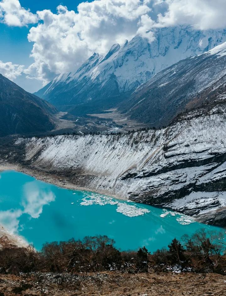
The Langtang Valley trek is an out-and-back route starting from Syabrubesi (1,462m), north of Kathmandu. The trail follows the Langtang Khola river upstream through dense forest, climbs through Tamang villages, and ends at Kyanjin Gompa (3,870m) in the upper valley. From Kyanjin, day hikes reach Kyanjin Ri (4,773m) or Tserko Ri (5,033m) for panoramic views.
Key numbers:
- Maximum altitude: 4,773m (Kyanjin Ri) or 5,033m (Tserko Ri, optional)
- Sleeping altitude: 3,870m (Kyanjin Gompa)
- Trailhead: Syabrubesi (1,462m)
- Total trekking days: 7 to 8 (within an 11-day itinerary)
- Daily walking: 5 to 7 hours
- Trail distance: 65 to 75km round trip
- Difficulty: Easy (moderate if adding Tserko Ri)
- Guided cost: From $775
The 11-day itinerary includes 2 driving days (Kathmandu to Syabrubesi and back), 4 ascending days, 1 to 2 exploration days at Kyanjin Gompa, and 2 descending days. The route retraces itself on the return, but the valley looks different heading downhill. Views that were behind you on the ascent (the forest canopy stretching below, distant snow peaks to the south) reveal themselves.
Day-by-Day Itinerary
Day 1: Arrival in Kathmandu (1,400m). Arrive at Tribhuvan International Airport. Transfer to hotel in Thamel. If you need trekking gear, Thamel's shops carry everything at local prices. No technical equipment needed for Langtang.
Day 2: Kathmandu to Syabrubesi (1,462m). Depart early (6:30 to 7:00 AM) from Machhapokhari Bus Park in Gongabu. The road follows the Trisuli River valley north through Dhunche (the district headquarters where you register your park permit). Syabrubesi is a small Tamang village at the confluence of the Langtang Khola and Bhote Koshi rivers, roughly 120km from Kathmandu. The road is paved until Dhunche, then rougher for the final section. 7 to 8 hours by shared jeep, 8 to 10 by bus. Afternoon free in Syabrubesi.
Day 3: Syabrubesi to Lama Hotel (2,324m). The trek begins with a climb through subtropical forest along the Langtang Khola. The trail crosses between the north and south banks on suspension bridges, passing through Bamboo (1,960m) and Rimche. The forest here is dense with oak, pine, and rhododendron. This is prime red panda habitat, though sightings require luck and early-morning timing. You may hear langur monkeys in the canopy. Lama Hotel is a cluster of teahouses in a forest clearing with no actual hotel or lama in sight. The name is historic. 5 to 6 hours walking, +862m elevation.
Day 4: Lama Hotel to Langtang Village (3,330m). The trail continues through forest, gradually transitioning from subtropical to temperate as you climb. Rhododendron becomes dominant above 2,500m. Around Ghoda Tabela (2,940m), a former Tibetan refugee settlement, the forest opens and the valley widens. You enter alpine grazing land with yaks. The new Langtang Village appears on a shelf above the valley floor, rebuilt after the 2015 earthquake. The old village site is visible below as a field of debris and memorial stones. 5 to 6 hours walking, +1,006m elevation.
Day 5: Langtang Village to Kyanjin Gompa (3,870m). A shorter day through the upper valley. The landscape is now fully alpine: yak pastures, glacial moraines, and scattered stone walls. The trail passes through Mundu and climbs gently to Kyanjin Gompa, a small settlement of teahouses, a Buddhist monastery, and the famous cheese factory. Langtang Lirung (7,227m) rises directly to the north, its icefall visible and audible from the gompa. The scale is compressed. Everything feels close. 3 to 4 hours walking, +540m elevation.
Day 6: Kyanjin Gompa exploration day. This is the payoff day. Two viewpoint options:
Option A: Kyanjin Ri (4,773m). A steep but short day hike. 2 to 3 hours up on a marked trail directly behind the gompa. The summit offers an intimate view down the entire Langtang Valley you walked through, plus a close-up of the Langtang Lirung icefall, Langtang Ri (7,205m), and Yala Peak (5,520m). On clear days, Shishapangma (8,027m) in Tibet is visible to the north. Total round trip: 4 to 5 hours.
Option B: Tserko Ri (5,033m). A full-day expedition. 4 to 5 hours up on a trail that becomes a ridgeline scramble in the upper section. The summit crosses 5,000m, which means altitude effects are real. The reward is a 360-degree panorama: the full Langtang Himal range, views into Tibet, the Yala Glacier spread below, Dorje Lakpa (6,990m), Langshisha Ri (6,370m), and Pemthang Karpo Ri (6,830m). Total round trip: 7 to 8 hours. Only attempt if well-acclimatized and weather is stable.
Most trekkers do Kyanjin Ri. It is accessible to everyone who made it to Kyanjin Gompa. Tserko Ri is a bonus for fit trekkers who want to cross the 5,000m threshold and earn a genuinely panoramic view.
Afternoon: visit the cheese factory, explore the gompa, watch yaks graze against the backdrop of 7,000m peaks.
Day 7: Kyanjin Gompa to Lama Hotel (2,324m). The long descent. From 3,870m back to 2,324m in a single day, retracing through Langtang Village, Ghoda Tabela, and down through the forest. The descent is fast but hard on the knees. Trekking poles earn their weight. The forest you walked through in shade on the way up is now lit differently, and the river sounds louder heading downstream. 6 to 7 hours walking.
Day 8: Lama Hotel to Syabrubesi (1,462m). Final trekking day. Continue descending through the forest and back to Syabrubesi. The subtropical heat at the bottom feels dramatic after 4 nights above 3,000m. 4 to 5 hours walking.
Day 9: Syabrubesi to Kathmandu. Jeep or bus back to Kathmandu. Same route in reverse. 7 to 8 hours.
Day 10: Buffer day in Kathmandu. Weather contingency or free day. Kathmandu Durbar Square, Swayambhunath (Monkey Temple), Boudhanath stupa, or Patan are all within reach.
Day 11: Departure. Transfer to Tribhuvan International Airport.
What You See: Mountains and Views
From Kyanjin Ri (4,773m)
Kyanjin Ri gives an intimate valley view rather than a distant panorama. You are inside the valley looking at the walls around you.
| Peak | Altitude | Position | Notes |
|---|---|---|---|
| Langtang Lirung | 7,227m | North | Dominates. Icefall visible and audible. |
| Langtang Ri | 7,205m | Northeast | Second highest in the range. |
| Shishapangma | 8,027m | North (Tibet) | 14th tallest on Earth. Visible on clear days. |
| Ganchenpo | 6,387m | East | Distinctive triangular shape. |
| Yala Peak | 5,520m | Southeast | The popular climbing peak. |
| Naya Khang | 5,844m | South | Across the valley. |
| Dorje Lakpa | 6,990m | Far east | Visible from higher viewpoints. |
| Kimshung | 6,781m | Northeast | Part of the Langtang Himal wall. |
From Tserko Ri (5,033m)
Tserko Ri adds the 360-degree dimension. You see everything Kyanjin Ri shows plus views into Tibet, the Yala Glacier below, and peaks to the south and east that are hidden from the lower viewpoint.
Additional peaks visible: Langshisha Ri (6,370m), Pemthang Karpo Ri (6,830m), Dorje Lakpa (6,990m) in full profile, and on exceptional days, the distant Ganesh Himal range to the west.
Kyanjin Ri vs Tserko Ri: Which One?
| Factor | Kyanjin Ri (4,773m) | Tserko Ri (5,033m) |
|---|---|---|
| Round trip time | 4-5 hours | 7-8 hours |
| Altitude gain from Kyanjin | 903m | 1,163m |
| Trail quality | Clear path, no scrambling | Ridgeline scramble in upper section |
| Altitude sickness risk | Low | Moderate (crosses 5,000m) |
| View character | Intimate valley panorama | 360-degree mountain panorama |
| Best for | Everyone, photography | Fit trekkers, summit hunters |
| Minimum fitness | Same as main trek | Above average, well-acclimatized |
If you only have one exploration day: Kyanjin Ri. It delivers the essential view without the altitude risk. If you have two days: Do Kyanjin Ri on day 1 (acclimatization), Tserko Ri on day 2 (already adjusted to altitude). If you are fit and acclimatized: Tserko Ri alone gives you the definitive Langtang view.
The 2015 Earthquake: What Happened and What You Will See
On 25 April 2015, a 7.8 magnitude earthquake triggered a massive avalanche and landslide from the slopes above Langtang Village. Ice, rock, and compressed air hit the village at estimated speeds over 200 km/h. The entire settlement was buried under debris 60 to 80 meters deep. 310 people were killed, including 175 residents and dozens of foreign trekkers and guides. It was the single deadliest event of the earthquake.
The village was not shaken to pieces like buildings in Kathmandu. It was buried by a wall of ice and rock from above. The mechanism matters because it explains why the trail is safe now: the landslide material that could fall has already fallen.
What Has Been Rebuilt
The new Langtang Village sits 100m higher and to the east of the original site, on terrain assessed as geologically stable. The rebuilding effort combined government funding, international NGOs, and Swiss technical support (the cheese factory was rebuilt with Swiss government assistance, commemorated by a plaque dated November 2018).
Current infrastructure (2026):
- 50+ teahouses and lodges
- WiFi and mobile charging at all stops
- Solar-powered hot showers
- Health post operational at Kyanjin Gompa
- Helipad at Kyanjin for emergency evacuation
- Clear trail markings and repaired suspension bridges
- Earthquake-resistant construction throughout
What You Will See on the Trail
Between Ghoda Tabela and the new village, the old Langtang Village site is visible below the trail. A field of grey debris, prayer flags, and memorial stones marks where the village stood. Trekkers pause here. Some leave flowers or stones. The memorial is maintained by the community.
This is not ruins in the sense of something crumbling. It is a flat grey field where a living village used to be. The scale is visceral. It is part of the trek, and it should be.
The community chose to return and rebuild. The cheese factory reopened. The teahouses serve dal bhat. Children attend school. Life continued. This is not a disaster tourism site. It is a village that survived something and decided to stay.
Difficulty and Physical Demands
The Langtang Valley trek is rated Easy, the same rating as the Poon Hill trek. The key difference is altitude: Langtang takes you to 3,870m (sleeping) and 4,773m (day hike), versus Poon Hill's 3,210m maximum.
Altitude Profile
The trail gains altitude gradually, which is ideal for acclimatization:
| Day | Start | End | Gain |
|---|---|---|---|
| Day 3 | 1,462m | 2,324m | +862m |
| Day 4 | 2,324m | 3,330m | +1,006m |
| Day 5 | 3,330m | 3,870m | +540m |
| Day 6 | 3,870m | 4,773m (day hike) | +903m |
The critical threshold is 3,500m, above which AMS becomes a possibility. You cross this threshold on Day 4 and sleep above it on Days 5 and 6. The gradual approach (3 days of walking before crossing 3,500m) gives your body time to adjust. Mild symptoms (headache, reduced appetite, disrupted sleep) are common above 3,500m and not dangerous. Stay hydrated, ascend no faster than the itinerary prescribes, and descend if symptoms worsen.
Diamox
Not required for most trekkers on this route. The altitude gain is gradual enough for natural acclimatization. Some trekkers take prophylactic Diamox (125mg twice daily starting the day before crossing 3,500m) as insurance. Discuss with your doctor before the trek. Diamox does not mask symptoms of serious AMS; it aids acclimatization by increasing breathing rate.
Physical Demands
The trail itself is not technical. No scrambling, no ropes, no glacier crossings (unless you attempt Tserko Ri, which involves a ridgeline scramble). The main demand is consecutive days of uphill walking through forest terrain with roots, rocks, and occasional muddy sections.
Fitness benchmark: If you can hike 6 hours on hilly terrain with an 8 to 10kg daypack on consecutive days, you can do this trek. A 4 to 6 week preparation period of regular cardio and hill walking is sufficient. The EBC difficulty guide has a training plan that is more than adequate for Langtang.
What It Costs: Full 2026 Breakdown
Option 1: Organized Trek (From $775)
The Mountain Hawk Trek Langtang package starts at $775 per person and includes guide, permits, all accommodation and meals on trek, Kathmandu-Syabrubesi transport, and airport transfers.
Option 2: Budget Independent (With Mandatory Guide)
| Expense | Daily Cost (USD) | 7-8 Trek Days | Notes |
|---|---|---|---|
| Teahouse room | $2-10 | $15-70 | Basic at lower stops, better at Kyanjin. |
| Meals (3x) | $8-15 | $60-120 | Dal bhat is best value. Prices rise above 3,000m. |
| Hot shower | $2-5 | $10-25 | Solar-powered. Available at most stops. |
| WiFi | $2-5 | $10-25 | Per day. Slow but functional. |
| Device charging | $1-3 | $7-20 | Per device per charge. |
| Guide fee | $25-35 | $175-280 | Licensed guide. Split between 2 halves cost. |
Subtotal (trek days): $280-540 per person for 7-8 days on trail.
| Fixed Cost | Amount (USD) |
|---|---|
| Langtang National Park entry | $25 (NPR 3,390) |
| TIMS card (individual) | $15 (NPR 2,000) / $8 agency |
| Kathmandu to Syabrubesi (shared jeep) | $15-19 each way |
| Guide tip (customary) | $25-50 total |
| Porter (optional) | $15-20/day |
Total budget estimate: $450 to $700 per person all-in.
Option 3: Mid-Range Independent
Private jeep both ways ($130-160 split with group), better lodges (attached bathroom), guide plus porter, extra exploration day.
Total mid-range estimate: $700 to $1,000 per person.
SAARC Nationals
National Park entry: NPR 1,695 ($13) instead of NPR 3,390 ($25). TIMS: NPR 1,000 ($8). Significant permit savings.
Permits and Regulations: 2026 Rules
What You Need
- Langtang National Park Entry Permit: NPR 3,390 (~$25) for foreigners, NPR 1,695 (~$13) for SAARC nationals. Required for entry into the park. Available at the park checkpoint in Dhunche (on the drive in) or in Kathmandu at the Nepal Tourism Board office.
- TIMS Card: NPR 2,000 (~$15) for individual trekkers (FIT), NPR 1,000 (~$8) for group/agency trekkers. Same offices as ACAP permits. If booking through an agency, your TIMS is arranged at the group rate.
- Travel insurance with helicopter evacuation coverage. Required since 2024 to obtain trekking permits. Must cover emergency rescue up to $30,000 minimum.
- Licensed guide. Mandatory since April 2023. Enforced at the national park checkpoint in Dhunche. Your guide carries their NATA or TAAN license.
Where to Get Permits
- In Kathmandu: Nepal Tourism Board in Bhrikuti Mandap. Open Sunday to Friday.
- In Dhunche: The national park checkpoint on the road to Syabrubesi. This is a backup option if you did not get permits in Kathmandu (most agencies handle everything in advance).
- Through your agency: All permits handled before you start.
Best Time to Trek: Month-by-Month Breakdown
| Month | Visibility | Temperature at Kyanjin (3,870m) | Crowds | Rhododendrons | Verdict |
|---|---|---|---|---|---|
| January | 85-90% clear | -5 to 5C day, -15 to -10C night | Very low | None | Crystal clear but brutally cold. Snow above 3,500m. |
| February | 80-85% clear | -3 to 7C day, -12 to -8C night | Very low | None | Cold but improving. Good for solitude. |
| March | 70-80% clear | 2 to 10C day, -8 to -3C night | Low-moderate | Starting in lower forest | Spring arriving. Warm enough for comfort. |
| April | 65-75% clear | 5 to 12C day, -5 to 0C night | Moderate | Full bloom 2,500-3,500m | The rhododendron month. Forest sections are spectacular. |
| May | 50-60% clear | 8 to 15C day, 0 to 5C night | Low | Fading | Warm but haze building. Last window before monsoon. |
| June-Aug | Under 20% | 10 to 17C day, 5 to 10C night | Very low | None | Monsoon. Heavy rain, leeches, landslide risk. Avoid. |
| September | 40-60% clear | 8 to 14C day, 0 to 5C night | Low | None | Monsoon ending. Trails muddy, clearing by late September. |
| October | 80-90% clear | 5 to 12C day, -5 to 0C night | Peak season | None | The best month. Stable, dry, clear. |
| November | 85-90% clear | 0 to 8C day, -8 to -3C night | Moderate-high | None | Excellent. Colder evenings, fewer trekkers than October. |
| December | 85-95% clear | -5 to 5C day, -12 to -8C night | Low | None | Clear but cold. Snow possible on upper trail. Some lodges close. |
Best overall: October, then November. Best for rhododendrons: April. Best for solitude: February or late November. Avoid: June through August.
For context on how Langtang compares to other regions seasonally, see our best time to trek in Nepal guide.
Where to Stay: Teahouse Guide
The Langtang Valley trail is fully teahouse-supported. The lodges were rebuilt after 2015 with improved construction and better facilities than the pre-earthquake era.
| Stop | Elevation | Lodge Quality | Room Price | Hot Shower | WiFi |
|---|---|---|---|---|---|
| Syabrubesi | 1,462m | Good (town) | $5-10 | Yes | Yes |
| Lama Hotel | 2,324m | Basic-Moderate | $3-7 | Sometimes | Spotty |
| Langtang Village | 3,330m | Good (new build) | $5-12 | Yes (solar) | Yes |
| Kyanjin Gompa | 3,870m | Good | $8-15 | Yes (solar) | Yes |
Key difference from Annapurna: Langtang teahouses are generally newer (rebuilt post-2015) and slightly more expensive at altitude. Solar hot showers are standard at Langtang Village and Kyanjin. The trade-off is that there are fewer lodge options per stop, so in peak October, rooms can fill. Your guide should book ahead.
Food: Same core menu as other Nepal treks: dal bhat, noodle soup, fried rice, momos, eggs, pancakes. Prices increase with altitude. Daily food budget: $15 to $25 at lower stops, $25 to $40 at Kyanjin. Dal bhat remains the best value everywhere.
The cheese factory at Kyanjin Gompa sells fresh yak cheese (actually a mix of yak and chauri milk). The cheese is made using Swiss alpine techniques introduced in 1952. It is dense, sharp, and unlike anything else you will eat on a trek. Buy a block. You earned it.
Tamang Culture and the Heritage Trail
The Langtang Valley is Tamang country. The Tamang are a Tibeto-Burman ethnic group with Tibetan Buddhist traditions, their own language, and a culture distinct from the Gurung and Sherpa communities on other trekking routes.
What you will encounter on the trail:
- Mani walls and prayer wheels at every village entrance. Walk to the left of mani walls (clockwise), as locals do.
- Chortens (stupas) dotting the trail between settlements.
- Kyanjin Gompa itself, a functioning Buddhist monastery where monks live and pray.
- Tamang architecture: wood-and-stone houses with intricate carved window frames.
- Yak herding culture in the upper valley. Kyanjin Gompa's economy still revolves around yak dairy.
- Lhosar festival (February/March), the Tamang New Year, celebrated with feasting and traditional dance.
The Tamang Heritage Trail Extension
For trekkers who want deeper cultural immersion before or after the main valley trek, the Tamang Heritage Trail runs through villages west of Syabrubesi: Gatlang, Tatopani, Thuman, Briddim. These are traditional Tamang settlements with homestay programs, a 100-year-old Buddhist monastery in Gatlang, hot springs at Tatopani, and a pace of village life that has not changed for centuries. Adding 3 to 4 days to your itinerary for this loop turns a nature trek into a cultural journey. Ask your agency about combining the two.
Red Panda Habitat
Langtang National Park holds 24.33% of Nepal's entire red panda population. The habitat zone is the mixed temperate forest between 2,500m and 4,000m, exactly the elevation band you walk through on Days 3 and 4 of the trek.
Red pandas are shy, solitary, and predominantly active at dawn and dusk. They live in the bamboo understory and are well-camouflaged against the forest canopy. Sightings on the standard trek are rare but not unheard of. The best chances are in the forest between Lama Hotel and Ghoda Tabela, particularly in early morning.
What you are more likely to see: langur monkeys, musk deer tracks, Himalayan pheasants, and a rich variety of birds (the park has 350+ species). But knowing you are walking through one of Asia's most important red panda corridors adds a layer to the forest that most trekkers miss.
What to Pack
Langtang's packing requirements sit between Poon Hill (3,210m max, minimal cold gear) and EBC (5,364m, serious insulation needed). You sleep at 3,870m and day-hike to 4,773m, so you need proper layering but not extreme altitude gear.
Essential Additions Beyond Poon Hill
- Warmer insulating layer: A proper down jacket (not just fleece) for mornings and evenings at Kyanjin. Temperatures at 3,870m drop to -5 to -15C at night depending on month.
- Thermal base layers: For sleeping and early morning starts.
- Warmer sleeping bag liner: Teahouse blankets at Kyanjin are adequate in October but insufficient in December.
- Sun protection at altitude: UV intensity at 4,773m is significantly higher than at lower elevations. SPF 50 lip balm and sunscreen are essential.
- Trekking poles: The descent from Kyanjin to Lama Hotel (1,546m drop in one day) is knee-intensive.
For the complete gear list with weights and buy-in-Kathmandu options, see our EBC packing list. Use the "moderate altitude" column rather than the extreme cold column.
Langtang vs Other Treks
Langtang vs Poon Hill
| Factor | Langtang Valley | Poon Hill |
|---|---|---|
| Duration | 7-8 trekking days (11-day trip) | 4-5 trekking days (10-day trip) |
| Max altitude | 4,773m (Kyanjin Ri) | 3,210m |
| Difficulty | Easy | Easy |
| Cost (guided) | From $775 | From $675 |
| Access from Kathmandu | Direct (7-8 hr drive north) | Via Pokhara (6-7 hr + 1.5 hr) |
| Crowds | Low | Moderate-High |
| View type | Glacial valley + icefall | Sunrise panorama |
| Culture | Tamang Buddhist | Gurung |
| Best for | Solitude, altitude experience, culture | Sunrise, short timeline, beginners |
Langtang is the natural progression from Poon Hill. Same difficulty rating but higher altitude, longer duration, and far fewer people.
Langtang vs Annapurna Base Camp
| Factor | Langtang Valley | Annapurna Base Camp |
|---|---|---|
| Duration | 7-8 trekking days (11 total) | 10-12 trekking days (16 total) |
| Max altitude | 4,773m / 5,033m | 4,130m |
| Difficulty | Easy (Moderate with Tserko Ri) | Moderate |
| Cost (guided) | From $775 | From $1,275 |
| Access | Direct from Kathmandu | Via Pokhara |
| Crowds | Low | Moderate-High |
| Flight required | No | Recommended (Ktm-Pokhara) |
| Trail type | Out-and-back valley | Out-and-back gorge/sanctuary |
| Highlight | Icefall + valley immersion | Amphitheater at base camp |
Langtang is shorter, cheaper, less crowded, and does not require a domestic flight. ABC has a more dramatic destination (the amphitheater) but takes 5 more days. For the full ABC guide, see our dedicated article.
Langtang vs Everest Base Camp
| Factor | Langtang Valley | Everest Base Camp |
|---|---|---|
| Duration | 11 days | 14 days |
| Max altitude | 4,773m (Kyanjin Ri) | 5,364m |
| Difficulty | Easy | Strenuous |
| Cost (guided) | From $775 | From $1,775 |
| Flight required | No | Yes (Lukla) |
| Crowds | Low | High |
| AMS risk | Low-Moderate | High |
If EBC is too long, too expensive, or too crowded for your first Himalayan trek, Langtang offers a genuine mountain valley experience at a lower commitment level. See our EBC complete guide for the full comparison.
Combining Langtang with Gosaikunda
For trekkers with 15 to 16 days, the Langtang-Gosaikunda combination is one of Nepal's finest circuit treks. After exploring Kyanjin Gompa, instead of descending back to Syabrubesi, you cross Laurebina La (4,610m) to reach Gosaikunda, a sacred high-altitude lake at 4,380m.
The combination gives you three distinct landscapes: the Langtang glacial valley, a high mountain pass crossing, and the sacred lake region. Same permits cover the entire route. The pass day is the hardest single day (long, above 4,500m for hours), making the combined trek moderate-to-strenuous rather than easy.
Getting There
Kathmandu to Syabrubesi:
- Shared jeep (Sumo): NPR 2,000-2,500 ($15-19). Departs Machhapokhari Bus Park (Gongabu), 6:30-8:30 AM. 7-8 hours.
- Local/deluxe bus: NPR 1,300-2,000 ($10-15). Same departure point. 8-10 hours.
- Private jeep: $130-160 (entire vehicle, seats 7-8, splittable). 6-7 hours.
Road condition (2026): Paved to Dhunche. Dhunche to Syabrubesi is rougher but manageable for all vehicle types. Landslides occasionally block the road in monsoon (June-August); jeeps reroute or wait for clearing crews. Outside monsoon, the road is reliable.
No airport required. This is the single biggest logistical advantage of Langtang over Annapurna and Everest treks. No flight booking, no weather cancellation risk, no airport queue. You leave Kathmandu in the morning and start trekking the next day.
Practical Tips
Phone and connectivity. NTC (Nepal Telecom) has signal at Syabrubesi, Langtang Village, and Kyanjin Gompa. Ncell coverage is spottier. WiFi is available at all stops ($2-5/day). Download offline maps before starting.
Money. No ATMs after Kathmandu. Bring enough Nepalese rupees for the full trek. Budget NPR 4,000 to 6,000 per day for food, lodging, and extras. Withdraw in Kathmandu before departure.
Water. Boiled water from teahouses (NPR 100-200 per liter) or purification tablets. Do not drink stream or tap water. Above 3,000m, the cold makes drinking enough water harder but more important.
The cheese factory. Open to visitors. You can watch the cheese-making process and buy fresh yak cheese. Bring a zip-lock bag. The cheese lasts a week unrefrigerated and pairs well with crackers and a rest day.
Earthquake sensitivity. The memorial site between Ghoda Tabela and Langtang Village is a place of respect. Do not climb on debris. Do not remove memorial stones. Photographs are acceptable but discretion matters. Many of the teahouse owners in the new village lost family members in 2015.
Why Langtang
Langtang does not have the name recognition of Everest or the sunrise fame of Poon Hill. It is not the shortest trek or the cheapest. What it has is a combination that no other valley offers:
The closest Himalayan valley to Kathmandu. No flight, no second city, no transfer day. You drive north and you are there.
Fewer people. In October, you share the trail with dozens of trekkers rather than hundreds. In November or March, sometimes fewer.
A real valley. Not a viewpoint, not a camp, not a pass. A living valley with villages, yaks, a monastery, a cheese factory, and a mountain wall that rises 3,300 meters above your teahouse roof.
And a story. The valley was destroyed and rebuilt. The people came back. The trail reopened. Walking through it feels different because of that. The valley earned its second life, and the people in it know it.
View the full Langtang Valley trek itinerary and pricing or get in touch to plan your trek.