- Route overview
- 15-day itinerary
- Larkya La Pass: what to expect on crossing day
- How difficult is the Manaslu Circuit Trek
- Best time for the Manaslu Circuit Trek
- Manaslu Circuit Trek cost 2026
- Permits and fees 2026
- Can you trek the Manaslu Circuit solo in 2026
- Teahouse or camping on the Manaslu Circuit
- Manaslu Circuit vs Annapurna Circuit
- What to pack for the Manaslu Circuit Trek
- Altitude sickness and safety on the Manaslu Circuit
- Tsum Valley: the cultural extension
- Next steps
In 2024/25, 12,512 foreign trekkers walked the Manaslu Circuit. In that same period, roughly 250,000 visited the Annapurna region and 50,000 went to Everest Base Camp.
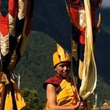
Those numbers explain why Manaslu exists in a different category. It is not a less popular version of Annapurna. It is a fundamentally different kind of trek. The trail follows the Budhi Gandaki river through a gorge so deep and narrow that the GPS signal drops out. The villages above Jagat (1,410m) belong to the Nubri people, a Tibetan Buddhist community that has occupied the upper valley for centuries. The prayer flags outnumber the trekkers. The pass, Larkya La at 5,215m, is a single-day event that starts in the dark and ends 1,625m lower on the other side.
Nepal opened the Manaslu region to foreigners in 1991. It remains a restricted area, meaning every trekker needs a special permit and a licensed guide. That restriction is the filter. It keeps the trail quiet, the teahouses small, and the experience closer to what Annapurna and Everest felt like 20 years ago.
This guide covers the full Manaslu Circuit Trek itinerary, day by day. Costs, permits (including the March 2026 solo rule change), Larkya La logistics, teahouse conditions, altitude sickness prevention, and a direct comparison with the Annapurna Circuit.
Route overview
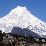
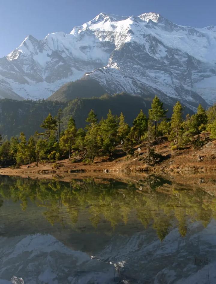
The Manaslu Circuit is a point-to-point trek that starts in the Budhi Gandaki gorge east of Gorkha and exits through the Marsyangdi valley on the Annapurna side. You never retrace your steps. The circuit wraps around Manaslu (8,163m), the eighth highest mountain on earth.
Key numbers:
| Fact | Value |
|---|---|
| Total distance | ~177 km |
| Duration | 15 days (13 trekking + 1 drive + 1 departure) |
| Maximum altitude | 5,215m (Larkya La Pass) |
| Highest sleeping altitude | 4,500m (Samdo and Dharamsala) |
| Trailhead | Soti Khola (710m) |
| Exit point | Chamje (1,725m) on the Marsyangdi River |
| Daily walking | 5 to 7 hours (7 to 10 on pass day) |
| Difficulty | Moderate to Strenuous |
| Guided cost (MHT) | From $1,675 per person |
| Trekkers per year | 12,512 (2024/25 record) |
The circuit format means every day brings new terrain. The lower gorge (Days 2 to 5) is subtropical, with waterfalls cutting through steep rock walls. The middle section (Days 6 to 8) opens into alpine meadows with yak herds and monastery settlements. The upper section (Days 9 to 11) is high altitude, glacial, and austere. After the pass, you descend rapidly into the Marsyangdi valley and drive back to Kathmandu.
15-day itinerary
| Day | Route | Altitude | Hours | Elevation change |
|---|---|---|---|---|
| 1 | Drive Kathmandu to Soti Khola | 710m | 6h drive | -- |
| 2 | Soti Khola to Machha Khola | 900m | 5.5h | +190m |
| 3 | Machha Khola to Jagat | 1,410m | 6h | +510m |
| 4 | Jagat to Ngyak | 1,950m | 6h | +540m |
| 5 | Ngyak to Ghap | 2,050m | 6h | +100m |
| 6 | Ghap to Lho | 3,200m | 6h | +1,150m |
| 7 | Lho to Samagaon | 3,500m | 6h | +300m |
| 8 | Samagaon to Samdo | 4,500m | 5h | +1,000m |
| 9 | Acclimatization day at Samdo | 4,500m | -- | -- |
| 10 | Samdo to Dharamsala (Larkya Phedi) | 4,500m | 5h | Undulating |
| 11 | Dharamsala to Bimthang via Larkya La | 3,590m | 7-10h | +715m / -1,625m |
| 12 | Bimthang to Tilje | 2,300m | 5h | -1,290m |
| 13 | Tilje to Chamje | 1,725m | 5h | -575m |
| 14 | Drive Chamje to Kathmandu | 1,345m | 7h drive | -- |
| 15 | Departure from Kathmandu | -- | -- | -- |
Day 1: Drive to Soti Khola (710m). A 6-hour drive from Kathmandu through Gorkha district. The last section of road is unpaved and rough. Soti Khola sits on the Budhi Gandaki River at the entrance to the gorge.
Days 2 to 5: The gorge section. The first four trekking days follow the Budhi Gandaki upstream through one of Nepal's deepest river gorges. The trail crosses suspension bridges, threads through waterfalls, and climbs stone staircases cut into cliff walls. This section is subtropical with dense forest, terraced farmland, and small Hindu villages. Jagat (1,410m) is the first restricted area checkpoint where permits and guide credentials are verified. After Jagat, the landscape transitions from Hindu lowlands to Tibetan Buddhist highlands.
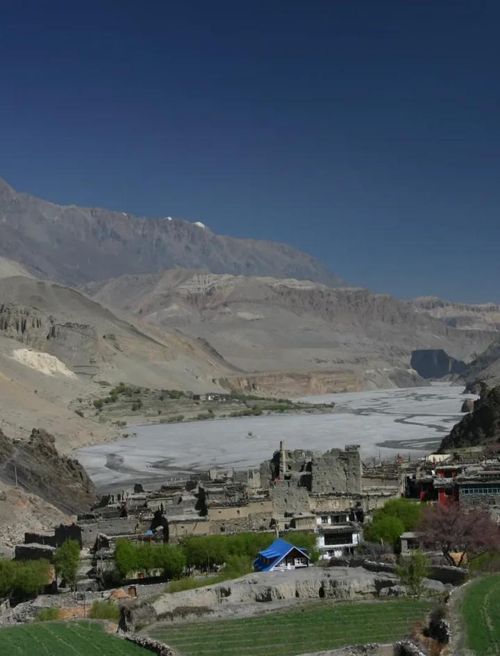
Days 6 to 7: Into the alpine zone. Above Ghap, the trail enters Nubri territory. Lho (3,200m) has a prominent monastery and the first clear view of Manaslu's 8,163m summit. Samagaon (3,500m) is the largest settlement on the circuit, a Tibetan Buddhist village with a gompa, a school, and 5 to 7 teahouses. This is the main resupply point and the gateway to Manaslu Base Camp for those extending their trek.
Days 8 to 9: High altitude and acclimatization. The climb from Samagaon to Samdo (4,500m) gains 1,000m in a single day through barren, wind-scoured terrain. Day 9 is a mandatory acclimatization day. Do not skip it. The jump from 3,500m to 4,500m is significant. Use the rest day for a short hike toward the Tibetan border (Samdo sits 3km from China) or visit the seasonal herding camps above the village.
Day 10: Samdo to Dharamsala (4,500m). A short trek across high-altitude terrain to the stone shelters at Dharamsala (also called Larkya Phedi, "the foot of the pass"). This is a basic stop. Limited beds, cold, and exposed. In peak October, beds fill by early afternoon. Arriving by noon is non-negotiable during peak season.
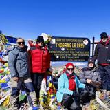
Day 11: Larkya La crossing (5,215m). The defining day of the trek. Wake at 3:00 to 3:30 AM. Depart by 4:00 AM with headlamps. The ascent from Dharamsala gains 715m over roughly 4 hours on a trail marked by cairns and prayer flags. The pass itself is broad and windswept, with views of Manaslu, Himlung Himal, Cheo Himal, and Annapurna II on a clear day. The descent to Bimthang drops 1,625m in 3 to 4 hours. The north-facing descent side holds snow and ice longer than the approach. Microspikes are recommended from October through May. Total time: 7 to 10 hours depending on conditions and fitness.
Days 12 to 13: The descent. After Bimthang (3,590m), the trail drops steeply through rhododendron forest into the Marsyangdi valley. You merge with the Annapurna Circuit trail briefly. The vegetation shifts back to subtropical. By Chamje (1,725m), you are in the lowlands.
Days 14 to 15: Return and departure. A 7-hour bus or jeep ride from Chamje back to Kathmandu. Day 15 is your departure day. If time allows, spend Day 14 evening in Thamel.
Larkya La Pass: what to expect on crossing day
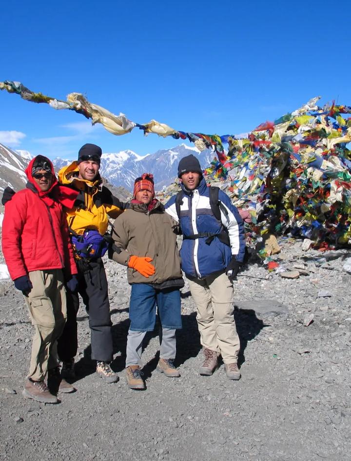
The pass is the crux of the entire trek. At 5,215m, it is the only point above 5,000m on the route, and you cross it in a single push.
The approach (Dharamsala to summit, ~4 hours). The trail leaves Dharamsala in darkness. The first hour follows a glacial moraine on a graded path. Above 4,800m, the path becomes rockier and steeper. The final 400m of ascent is the hardest stretch on the entire circuit: loose rock, thin air, and potentially icy footing if you are climbing before sunrise. The pass is marked by a large cairn wrapped in prayer flags.
The descent (summit to Bimthang, ~3 to 4 hours). The north-facing descent side is steeper than the approach. Snow lingers on this slope well into November and returns by March. The path drops through scree fields and snow patches before reaching the ablation valley above Bimthang. Trekking poles are essential. The final approach to Bimthang is through alpine meadow.
Weather window. Clear mornings are the rule in October and November. Cloud typically builds from the south by 11:00 AM. Starting before dawn ensures you cross the pass in clear conditions. In spring (March to May), morning cloud is less predictable and afternoon snow squalls are possible above 5,000m.
Success rate. The vast majority of trekkers who reach Dharamsala cross the pass successfully. Turnarounds happen due to weather (heavy snowfall blocking the route) or acute altitude sickness. The acclimatization day at Samdo (Day 9) is the primary insurance against altitude problems on pass day.
How difficult is the Manaslu Circuit Trek
The Manaslu Circuit is a Moderate to Strenuous trek. The difficulty comes from three factors: altitude, duration, and the Larkya La crossing.
Altitude is the primary challenge. You sleep at 4,500m for two consecutive nights (Samdo and Dharamsala) before crossing the 5,215m pass. Around 20 to 30 percent of trekkers develop some form of altitude sickness above 4,000m. Symptoms range from headache and nausea to the serious conditions HACE and HAPE. Proper acclimatization (the Day 9 rest day is critical) reduces risk substantially.
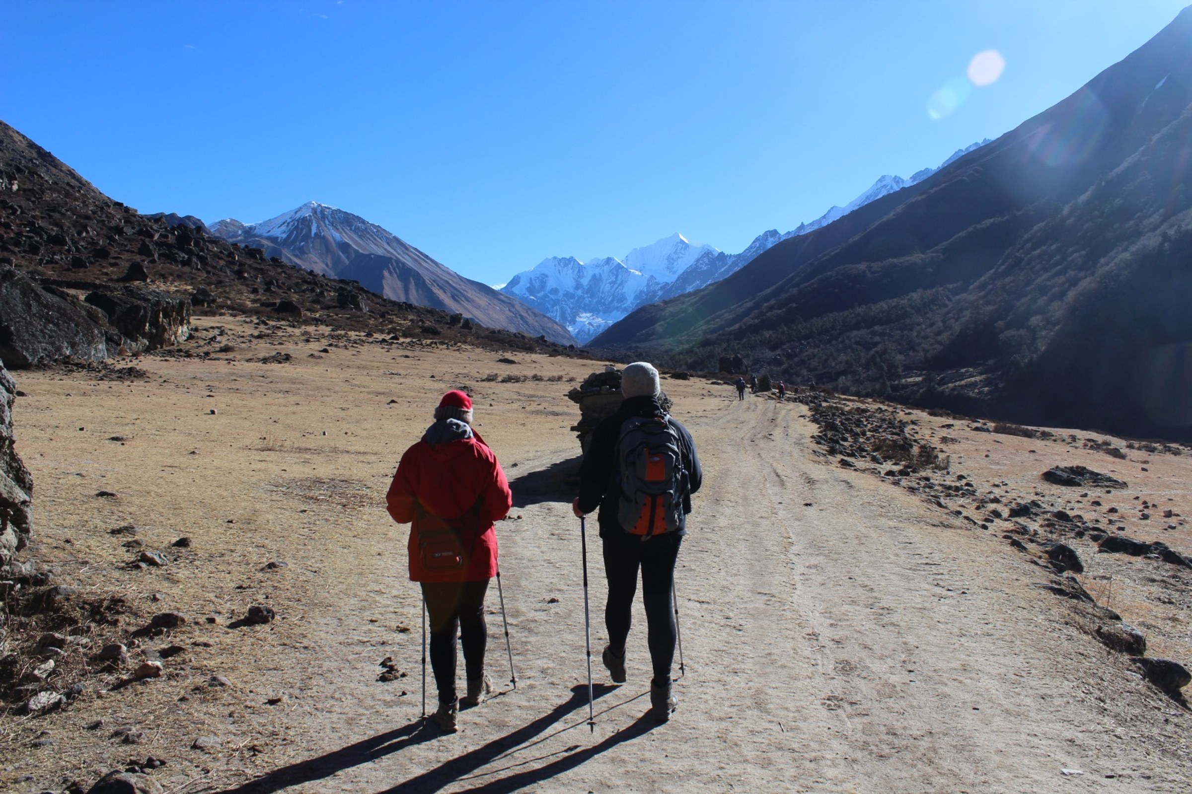
Duration wears you down. Fifteen days of walking is a long trek by any standard. The first week accumulates fatigue that compounds at altitude in the second week. By Day 10, you have already walked 8 to 9 consecutive days. The Larkya La crossing on Day 11 demands the most from you on the day you are most fatigued.
The gorge section is physically rougher than expected. Days 2 to 5 involve steep stone staircases, narrow cliff trails, and river crossings on suspension bridges. The trail is not as polished as the Annapurna or Everest routes. Expect uneven terrain.
Fitness benchmark. If you can hike 6 to 8 hours on consecutive days with a 5 to 8kg daypack on hilly terrain, you have the baseline fitness. Prior multi-day trekking experience (even a 3 to 4 day trek) is strongly recommended. The Manaslu Circuit is not a good first trek. Consider Poon Hill (10 days, Easy) or Langtang Valley (11 days, Easy) if you are new to trekking.
Best time for the Manaslu Circuit Trek
| Month | Conditions | Crowds | Verdict |
|---|---|---|---|
| January to February | Cold, snow possible on pass, clear skies | Very few trekkers | Experienced only |
| March | Warming, residual snow on Larkya La, spring haze | Low | Good for experienced trekkers |
| April to May | Rhododendron bloom below 3,500m, afternoon cloud | Moderate | Good spring window |
| June to August | Monsoon, heavy rain, landslide risk in gorge, leeches | Almost none | Not recommended |
| September | Late monsoon clearing, lush greenery, some rain risk | Building | Good from mid-September |
| October | Post-monsoon clarity, 100+ km visibility, mild temps | Peak | Best month |
| November | Clear, cold, excellent visibility, snow building on pass | Moderate | Excellent |
| December | Cold, pass may close late month, short days | Very few | Experienced only |
October is the best month for the Manaslu Circuit. Post-monsoon air is the cleanest of the year. Visibility regularly exceeds 100km. Daytime temperatures at Samagaon (3,500m) sit between 5 to 12C. Night temperatures at Dharamsala (4,500m) drop to -8 to -10C. The pass is typically snow-free on the approach side, with patches on the descent.
November is nearly as good but colder, especially at Dharamsala and on the pass. Late November brings increasing snow risk on Larkya La.
The spring window (March to May) offers warmer temperatures and fewer trekkers than autumn. April's rhododendron bloom brightens the lower forest sections. The tradeoff is reduced visibility from spring haze and less predictable weather on the pass.
Avoid June through August. The Budhi Gandaki gorge is a monsoon funnel. Landslides block the trail regularly. River crossings become dangerous. Leeches are relentless below 3,000m.
Manaslu Circuit Trek cost 2026
| Category | Budget (group) | Standard (guided) | MHT package |
|---|---|---|---|
| Trek package | $750 to $1,100 | $1,200 to $1,900 | $1,675 |
| Permits (peak season) | ~$150 | Included | Included |
| Guide and porters | Included | Included | Included |
| Meals on trek | Included | Included | Included (full board) |
| Sleeping bag / down jacket | Rent separately (~$30) | Varies | Included (provided) |
| Kathmandu hotel | Not included | Varies | Not included |
| Nepal visa (30 days) | $50 | $50 | $50 |
| Travel insurance | $50 to $150 | $50 to $150 | $50 to $150 |
| Tips (guide + porter) | $100 to $200 | $100 to $200 | $100 to $200 |
| Total estimate | $1,100 to $1,500 | $1,500 to $2,300 | $1,875 to $2,075 |
Mountain Hawk Trek's $1,675 package includes all permits (Restricted Area, MCAP, ACAP), a licensed English-speaking guide, porters, full board meals, teahouse accommodation, Kathmandu airport transfers, a sleeping bag, a down jacket, and a duffel bag. View the full inclusions list.
What is not included: Kathmandu meals and accommodation (estimate $15 to $30/day), Nepal visa ($50), travel insurance, personal gear, tips, and alcoholic or bottled drinks on the trail.
On-trail spending. Teahouse rooms cost $3 to $5 per night below 3,000m and $8 to $15 above. At Dharamsala during peak October, rooms run $15 to $25. Hot showers cost $2 to $5 where available. WiFi is $2 to $3 per day. Phone charging is $1 to $3 per charge above 3,000m. Budget $10 to $20 per day for on-trail extras if your package covers meals and rooms.
Permits and fees 2026
Every trekker on the Manaslu Circuit needs three permits. Your trekking agency handles the paperwork.
| Permit | Peak season (Sep to Nov) | Off-peak (Dec to Aug) |
|---|---|---|
| Restricted Area Permit (RAP) | $100/person (first 7 days), $15/extra day | $75/person (first 7 days), $10/extra day |
| Manaslu Conservation Area Permit (MCAP) | NPR 3,000 (~$23) | NPR 3,000 (~$23) |
| Annapurna Conservation Area Permit (ACAP) | NPR 3,000 (~$23) | NPR 3,000 (~$23) |
| Total (15-day trek, peak season) | ~$266 | ~$196 |
The ACAP permit is required because the circuit exits through the Annapurna Conservation Area via the Marsyangdi valley.
The March 2026 solo rule change. Until March 22, 2026, restricted area permits required a minimum of two trekkers applying together. Solo trekkers had to either find a second person or pay double. Nepal's Department of Immigration eliminated the two-person minimum in March 2026. Solo trekkers can now apply individually. The mandatory licensed guide requirement remains unchanged.
Checkpoint verification. Permits are checked at Jagat, Deng, and Samdo. Guides must carry their agency registration and TAAN license. Trekkers without proper documentation are turned back.
Can you trek the Manaslu Circuit solo in 2026
Yes. The March 2026 rule change removed the two-person minimum. You can now apply for a Restricted Area Permit as a single trekker.
What has not changed:
- A licensed trekking guide is mandatory. You cannot trek the Manaslu Circuit without one.
- The guide must be registered with a TAAN-licensed agency.
- The maximum guide-to-trekker ratio is 1:7.
"Solo" on the Manaslu Circuit means you are the only client in your group, not that you walk alone. Your guide handles checkpoint registration, teahouse bookings, and route decisions. On a trail with limited English signage and a pass crossing that starts in darkness, this is practical, not bureaucratic.
If you are booking through Mountain Hawk Trek, the guide is included in the $1,675 package. For independent trekkers arranging their own guide, expect $25 to $40 per day for guide wages.
Teahouse or camping on the Manaslu Circuit
The entire Manaslu Circuit is now teahouse-trekable. Camping is available but unnecessary for the standard circuit.
Teahouse conditions vary by section:
| Section | Teahouse quality | Notes |
|---|---|---|
| Soti Khola to Jagat (710m to 1,410m) | Basic | Simple rooms, shared toilets, limited menu |
| Jagat to Ghap (1,410m to 2,050m) | Basic to moderate | More options, some with hot showers |
| Ghap to Samagaon (2,050m to 3,500m) | Moderate | Samagaon has the best facilities on the circuit |
| Samagaon to Samdo (3,500m to 4,500m) | Basic | Smaller, colder, limited menu |
| Dharamsala (4,500m) | Very basic | Stone shelters, limited beds, fills early in peak season |
| Bimthang to Chamje (3,590m to 1,725m) | Moderate | Annapurna Circuit standard |
Dharamsala is the bottleneck. In peak October, the 15 to 20 available beds fill by early afternoon. Late arrivals may sleep in a dining room or common area. Pre-booking through your agency is strongly recommended for peak season.
Camping adds $40 to $80/day for cook, kitchen gear, and tents. It is mainly used by groups combining the Manaslu Circuit with a Tsum Valley extension (16 days, $1,775), where upper Tsum has limited teahouse infrastructure.
Manaslu Circuit vs Annapurna Circuit
Both are high-pass circuit treks through distinct cultural zones. The comparison matters because many trekkers choosing between them.
| Factor | Manaslu Circuit | Annapurna Circuit |
|---|---|---|
| Duration | 15 days | 12 to 21 days |
| Max altitude | 5,215m (Larkya La) | 5,416m (Thorong La) |
| Cost (MHT) | $1,675 | $1,825 |
| Restricted area permit | Yes ($100 peak) | No |
| Guide mandatory | Yes (always) | Yes (since 2023) |
| Trekkers per year | ~12,500 | ~35,000 to 50,000 |
| Teahouse quality | Basic to moderate | Moderate to good |
| Road encroachment | Lower gorge only | Significant (Besi Sahar to Chame) |
| Cultural zone | Tibetan Buddhist (Nubri) | Mixed Hindu and Buddhist |
| Scenery character | Deep gorge, glacial alpine, remote | Valley, high desert, Thorong La |
| Escape routes | Limited (helicopter only above Samdo) | Multiple (road access at several points) |
Choose Manaslu if you want fewer trekkers, a stronger sense of remoteness, and do not mind basic teahouses. The restricted area permit filters out casual visitors, which keeps the trail genuinely quiet.
Choose the Annapurna Circuit if this is your first high-altitude circuit, you prefer better teahouse infrastructure, or you want more flexibility with itinerary length. The Annapurna Circuit has road access at multiple points, allowing shorter variations.
The combined option: Mountain Hawk Trek offers a 23-day Manaslu and Annapurna Circuit Trek ($2,475) that crosses both Larkya La and Thorong La in a single journey.
What to pack for the Manaslu Circuit Trek
Mountain Hawk Trek provides a sleeping bag, down jacket, and duffel bag. Pack the following yourself:
Clothing: Waterproof jacket, hiking pants (2 pairs), thermal base layers (top and bottom), fleece midlayer, wool or synthetic socks (4 to 5 pairs), sun hat, warm beanie, waterproof gloves, insulated gloves for pass day.
Footwear: Waterproof trekking boots (broken in), camp sandals. Microspikes for Larkya La if trekking October through May.
Gear: Daypack (25 to 35L), trekking poles (essential for the 1,625m descent from Larkya La), headlamp with spare batteries, water bottle (1L minimum), water purification tablets or SteriPen, sunglasses (UV400, Category 3 or 4 for pass day).
Sun and health: Sunscreen SPF 50+, lip balm with SPF, basic first aid kit, personal medications, Diamox (consult your doctor before the trek, typical prophylactic dose is 125mg twice daily starting 24 hours before ascent above 3,500m), blister treatment, hand sanitizer.
Documents: Passport, 4 passport-size photos (for permits), travel insurance policy with helicopter evacuation coverage to 6,000m, printed copy of your insurance policy, cash in Nepali rupees (ATMs are not available on the trail).
Altitude sickness and safety on the Manaslu Circuit
The Manaslu Circuit takes you from 710m to 5,215m over 11 days. The most dangerous altitude zone is between Samagaon (3,500m) and the Larkya La crossing (5,215m), where you gain 1,715m in three trekking days.
Acclimatization strategy:
- Day 6 (Lho, 3,200m) is the first night above 3,000m. Symptoms like mild headache and disrupted sleep may appear.
- Day 9 (Samdo acclimatization day) is the most important day on the itinerary. Use it for a short hike above camp, then rest. Do not skip this day to "save time."
- Hydrate aggressively: 3 to 4 liters per day above 3,500m.
- Ascend slowly. The golden rule is sleep no more than 500m higher than the previous night above 3,000m.
Warning signs that require descent:
- Persistent severe headache not relieved by ibuprofen and hydration
- Vomiting
- Ataxia (inability to walk in a straight line)
- Confusion or disorientation
- Gurgling or crackling sounds when breathing (HAPE)
If any of these occur, descend immediately. Do not wait for morning. Your guide carries a pulse oximeter and is trained to recognize altitude emergencies.
Evacuation. Helicopter rescue is available from Samagaon (helipad) and Samdo (emergency landing zone). Cost ranges from $3,000 to $6,000. This is why travel insurance with helicopter evacuation coverage is mandatory, not optional. Mountain Hawk Trek requires proof of insurance before issuing permits.
Gamow bag availability is limited on the Manaslu Circuit. Samagaon's health post may have one. Do not rely on this. Descent is always the primary treatment.
Tsum Valley: the cultural extension
The Tsum Valley trek branches off the main Manaslu Circuit at Chumling (2,386m) and ascends into a high-altitude sacred valley that was closed to foreigners until 2008. Mu Gompa (3,700m), the valley's highest monastery, dates to the 15th century. The population is ethnically Tibetan, and the valley functions as a pilgrimage route.
Adding Tsum Valley extends the trek to 16 days ($1,775 with Mountain Hawk Trek) and requires an additional restricted area permit ($40 to $50). The upper Tsum Valley has limited teahouse infrastructure, and some sections require camping. This extension is for trekkers who specifically want cultural depth and are comfortable with basic conditions.
Next steps
The Manaslu Circuit Trek runs September through May, with October and November offering the best conditions. Mountain Hawk Trek handles all permits, logistics, and guide arrangements for the 15-day circuit at $1,675 per person.
For questions about the Manaslu Circuit or to discuss dates, contact us or view the full trek details.
If you are still deciding between treks, read Best Time to Trek in Nepal for a broader seasonal overview, or compare routes with our EBC vs Annapurna Base Camp guide.