
- Day-by-day difficulty breakdown
- The Larkya La Pass day, in detail
- What percentage of people don't make it across, honestly
- Fitness, training, and the self-test
- Altitude and acclimatization on this specific route
- Terrain, exposure, and what the trail actually feels like
- Who should not attempt this trek
- How Manaslu compares to EBC, the Annapurna Circuit, and Langtang
- Weather, seasonality, and what happens if the pass closes
- Mental preparation, and the real answer to how hard this trek is
Larkya La tops out at 5,106m. Thorong La, on the Annapurna Circuit, is 5,416m. Kala Patthar, near Everest Base Camp, is 5,545m. Every difficulty page you'll find lines those three numbers up and draws the same conclusion: Manaslu is the easy one of the three.
I think that's the wrong way to measure this trek, and it's worth saying why before we get into the day-by-day.
The Manaslu Circuit trek runs 15 days, 12 to 13 of them actual trekking days, climbing from Soti Khola at 700m to the pass at 5,106m. Daily walking is 5 to 7 hours. No ropes, no technical climbing, nothing that needs a mountaineering background. On altitude and terrain alone, it sits below both EBC and the Annapurna Circuit.
What the altitude comparison leaves out is what happens if something goes wrong. There's no Lukla-style airstrip to fly you home from. Past Samagaon you are two days' walk from the nearest road at the hardest point of the route, and the last stop before the pass, Dharamsala at 4,460m, has exactly two guesthouses. That's the entire infrastructure standing between you and an 8 to 10 hour crossing with no shelter and no easy way back. Difficulty on this trek is about what's around you when you actually need help, not the number printed on the pass sign. I'll come back to that at the end, because it's the thing that decides who struggles here and who doesn't.
For pricing, the Manaslu Circuit cost breakdown covers that separately, and the complete route guide has the full logistics. This article is about the physical and logistical reality of walking it.
Day-by-day difficulty breakdown
This is our standard 15-day itinerary. Days 1 and 13 to 15 cover road transport and buffer time; the trekking happens on days 2 through 12.
| Day | Route | Elevation | Gain/Loss | Hours | Difficulty |
|---|---|---|---|---|---|
| 1 | Arrival in Kathmandu | 1,345m | - | - | Rest day |
| 2 | Kathmandu to Soti Khola | 700m | drive | 7-8h drive | Easy |
| 3 | Soti Khola to Machha Khola | 930m | +230m | 5-6h | Easy |
| 4 | Machha Khola to Jagat | 1,340m | +410m | 6-7h | Moderate |
| 5 | Jagat to Deng | 1,860m | +520m | 6-7h | Moderate |
| 6 | Deng to Namrung | 2,630m | +770m | 5-6h | **Hard** |
| 7 | Namrung to Lho | 3,180m | +550m | 4-5h | Moderate |
| 8 | Lho to Samagaon | 3,530m | +350m | 3-4h | Easy to Moderate |
| 9 | Samagaon acclimatization day | 3,530m | optional +400m day hike | 3-5h | Moderate |
| 10 | Samagaon to Samdo | 3,875m | +345m | 4-5h | Moderate |
| 11 | Samdo to Dharamsala | 4,460m | +585m | 3-4h | Moderate |
| 12 | Dharamsala to Larkya La to Bimtang | 5,106m then 3,720m | +650m / -1,390m | 8-10h | **Hard** |
| 13 | Bimtang to Dharapani | 1,860m | -1,860m | 6-7h | Moderate (knees) |
The first week is easier than its reputation. From Soti Khola to Jagat you're following the Budhi Gandaki river through sal forest and terraced farmland, and the gain per day stays under 500m. Day 5, Deng to Namrung, is where the trail steps up, 770m gained in one push as the valley narrows and the Tibetan-influenced villages start to appear. Namrung still has a carved stone kani gate straddling the trail, one of the last you'll walk through before the architecture turns fully Tibetan for the rest of the route. From Namrung to Samagaon the walking gets shorter but the altitude starts doing more of the work than the terrain, and this is the first stretch where the trip genuinely starts to feel like Manaslu instead of a long river walk with mountains hovering in the distance.
Days 10 and 11 are short on paper, three to five hours each, but they're doing the job the altitude profile needs done: gaining height slowly enough that your body can keep up. Then day 12 happens, and everything before it was preparation for that one day.
Days 13 through 15 retrace out through Tilije and Dharapani to a road, then drive back to Kathmandu with a buffer day built in for weather. Nobody remembers those days when they talk about the trek afterward. Day 12 is the one people talk about.
The Larkya La Pass day, in detail
This is the day the whole trek is measured against, so it's worth walking through slowly.
You leave Dharamsala around 3 to 4am, headlamp on, temperature somewhere between minus 10 and minus 20 Celsius depending on the year and the wind. That start time isn't for drama. Wind builds on the pass through the morning and can turn dangerous by early afternoon, so the entire schedule exists to get you across and down before it does.
The climb from Dharamsala to the pass covers roughly 650m over rocky, uneven, sometimes icy ground, and it takes 4 to 5 hours at altitude-adjusted pace. You're not moving fast. Nobody is. At 5,106m the air holds roughly half the oxygen it does at sea level, and every step above 4,800m or so takes visibly more effort than the same step took an hour earlier.
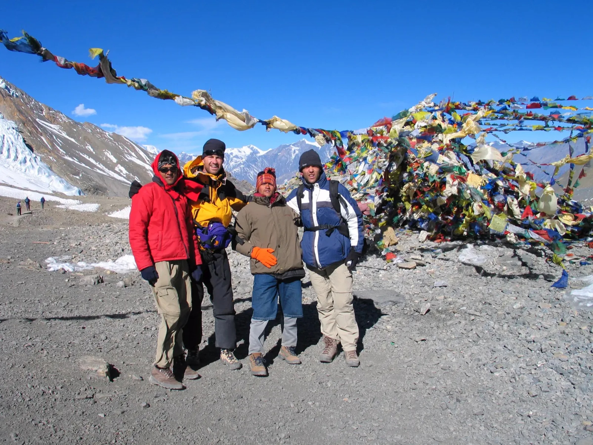
You don't linger at the top. Prayer flags, a few photos if your hands work well enough to operate a phone, and then down, because the descent to Bimtang at 3,720m drops almost 1,400m over loose scree and takes another 3 to 4 hours. This is the part that surprises people. The climb tests your lungs. The descent tests your knees, and by hour seven of an eight-to-ten-hour day, tired knees on loose scree is its own kind of hard.
There is no teahouse on this stretch. No shelter. No village halfway. Once you leave Dharamsala committed to the crossing, the only way forward is forward, and the only way back is the same 650m climb in reverse, which nobody wants to do once they've started down the other side. That's the no-bailout reality of this trek in its purest form, condensed into a single day.
Dharamsala itself is worth understanding before you get there. Two guesthouses, dorm-style rooms, one shared dining hall that everyone crowds into once the sun drops behind the ridge around 5pm. There's no village around it, just those two buildings sitting on a stretch of moraine below the pass. Whatever group size arrives that night, that's what the ridge has room for. It fills up in peak season, which is one more reason we book it well ahead and don't leave it to chance.
(You'll see Larkya La's elevation listed as 5,160m or 5,215m on some competitor sites. We hold to 5,106m, which is the figure GPS surveys and the Nepal government's own trail data support.)
What percentage of people don't make it across, honestly
Search this question and you'll find the same number recycled across a dozen agency blogs: success rates of 50 to 95 percent with proper acclimatization. Not one of those pages cites a source. I've looked. It reads like a number someone wrote once and everyone else copied, and I'm not going to add a new invented figure of my own to the pile.
What I can tell you is what's actually documented. In late October 2025, unseasonal heavy snowfall shut the entire high route for roughly a week, with trekkers held at Samagaon and Shyala until conditions cleared. That's not a rare fluke. Multi-day pass closures from snow happen most winters and occasionally in autumn too, and they're the single biggest reason a scheduled group doesn't cross on the day they planned to.
Beyond weather, the trekkers who turn back overwhelmingly cite altitude sickness, usually from a compressed itinerary that skipped acclimatization time, and less often, fitness that wasn't where it needed to be by day 12. The terrain itself isn't the obstacle. It needs no rope work, no climbing skill, nothing beyond steady legs and functioning lungs.
One more thing worth correcting directly, because it comes up in "is Manaslu dangerous" searches constantly. Several competitor pages quote fatality numbers for Mount Manaslu, the 8,163m peak, roughly 90 deaths across roughly 3,750 summit attempts. Those are mountaineering deaths on technical expeditions with fixed ropes, oxygen, and summit pushes above 7,000m. The Manaslu Circuit Trek is a teahouse walk that goes nowhere near the mountain itself. If you're researching whether you can handle a 5,106m pass crossing on foot, you don't need to know the fatality rate of people climbing an 8,163m Himalayan giant. Those are two different activities wearing the same place name.
Fitness, training, and the self-test
Give yourself 12 to 16 weeks if you're starting from a mostly sedentary base. Eight to ten weeks of focused work is enough if you already hike most weekends.
Build toward back-to-back long days on your feet, five to six hours, because Manaslu builds in one dedicated acclimatization day, at Samagaon, where a standard EBC itinerary gives you two. Train with a loaded 6 to 8kg daypack so your shoulders and hips already know what the real thing feels like. Don't skip squats and step-ups. The descent into Bimtang wrecks untrained knees faster than the climb to the pass wrecks lungs, and that's not an exaggeration, it's the exact order in which people's bodies fail on day 12.
A concrete test: can you hike 15km with 600m of elevation gain on hilly terrain without falling apart, and then get up the next morning and do something similar again without your legs refusing? If yes, you're in the range this trek needs. If you can do it once but the second day wrecks you, that's your training gap, and it's worth closing before you book, because day 13's descent comes straight after day 12's crossing with no rest between them.
Break in your boots properly. Cut your toenails short before you fly. Neither of those sounds like training advice, but blisters and black toenails have ended more trekking days on this route than weak cardio has.
Altitude and acclimatization on this specific route
The itinerary builds in two deliberate slow points: a full acclimatization day at Samagaon, 3,530m, and a gradual two-day climb through Samdo to Dharamsala at 4,460m. That structure exists because the alternative, rushing from 3,530m to 4,460m in a single day and then attempting a 5,106m crossing the morning after, is exactly how people get sick.
At Dharamsala, the night before the crossing, you're already sleeping at an altitude where available oxygen sits noticeably below sea-level concentration. By the top of the pass the next day, it's roughly half. That's basic physics of thin air, and the specific numbers for this particular route matter more than a general altitude rule of thumb ever could.
Current guidance from the Wilderness Medical Society, 2019 and reaffirmed in 2024, recommends acetazolamide (Diamox) at 125mg every 12 hours, started roughly 24 hours before ascending above 3,000m. That's the dose we use across our own itinerary planning. An older figure of 250mg twice daily still circulates on a few sites; it's outdated and shouldn't be followed. Consult a doctor before taking it either way.
For the general framework on AMS, HAPE, and HACE, symptoms, severity thresholds, and emergency descent protocol, our altitude sickness guide covers that in full. What's specific to Manaslu is the rescue geography: helicopters can land near Samagaon and Samdo, but above Dharamsala on crossing day, a rescue means getting a sick trekker back down to one of those points first, on foot or by yak if it comes to that, before a helicopter is any use at all.
Terrain, exposure, and what the trail actually feels like
Some sections genuinely are exposed, and it's worth saying so plainly. The lower Budhi Gandaki gorge between Jagat and Deng runs along ledges cut into the cliff face, a direct drop to the river on one side and no guardrails anywhere. This same stretch is also the most landslide-prone part of the route during and just after monsoon, June through September, which is one of the reasons we don't schedule departures in that window.
Most of the trail, though, is comfortably wide dirt and stone path, nothing that would trouble someone with ordinary trail experience. Trekkers with a mild unease around heights, not a diagnosed phobia, generally report the scary-looking sections pass in a few careful minutes and then it's over. If you have a real fear of heights, say so to your guide before you book. There's no way to reroute around every exposed stretch in the gorge on this particular trail, and pretending otherwise would waste your money and your week.
Who should not attempt this trek
Skip Manaslu, or at least talk to a doctor first, if any of this describes you. You've never hiked more than three hours in a single day and have no real time to train before your flight. You have unmanaged cardiac, respiratory, or blood pressure conditions, since altitude stresses all three regardless of how fit you otherwise are. You've had a prior severe altitude illness, HAPE or HACE, on another trek. Or this would be your first multi-day hike anywhere, with no lead-in preparation at all.
This isn't the trek to learn the basics on. It's also not the trek for anyone who needs rescue infrastructure close at hand no matter what. Helicopters land near Samagaon or Samdo and nowhere else on the high route, and bad weather can stretch what would normally be a two-hour rescue into something that takes 24 hours or more.
If any of that sounds like you right now, that's not a no forever. Everest Base Camp has a flight bailout at every stage, and the Annapurna Circuit now runs alongside a road for much of its length, so both are more forgiving starting points. So is Langtang Valley, a gentler introduction to teahouse trekking altogether. Manaslu makes more sense as a second or third Himalayan trek, once you've got one high-altitude route behind you and know how your body handles it.
A guide is mandatory on this route by law, one licensed guide per maximum seven trekkers, which matters here specifically because it's the reason self-navigating out of trouble solo isn't something you'll ever need to plan for. You'll never be making a call about the route or the weather alone.
How Manaslu compares to EBC, the Annapurna Circuit, and Langtang
| Trek | Max altitude | Bailout option | Main difficulty driver |
|---|---|---|---|
| Manaslu Circuit | 5,106m | None; nearest road two days' walk at the hardest point | Isolation, single committing pass day |
| Everest Base Camp | 5,545m (Kala Patthar) | Lukla flight | Cumulative altitude over multiple days |
| Annapurna Circuit | 5,416m (Thorong La) | Road access both ends now | Altitude, softened by road encroachment |
| Langtang Valley | 4,773m (Kyanjin Ri) | Road at Syabrubesi | Gradual, easiest of the four |
By altitude, Manaslu is the middle of this group, not the top. What changes the ranking is what's around you if the pass day goes wrong or the weather turns. EBC has an airstrip and a village with a real medical post at nearly every overnight stop. The Annapurna Circuit has jeep roads reaching deep into the route from both directions now, which softens what used to be a much harder trek. Langtang starts and ends by road with no restricted zone at all.
Manaslu has none of that. It has a single 8 to 10 hour crossing with no shelter on it, and two guesthouses at the last stop before that crossing begins. That's why most experienced guides, ours included, still rank it the hardest of Nepal's big three treks even though its summit number is the lowest of the three. Ask a guide which trek keeps them up the night before a client crosses, and it's this one, not because the mountain is taller, but because there's less room for anything to go sideways.
Trekker numbers back this up in an indirect way too. Around 12,512 people walked the Manaslu Circuit in the 2024/25 season, against roughly 250,000 on the Annapurna Circuit trails one valley over. A quieter trail photographs beautifully. It also means fewer guides passing the same stretch of ground week after week, fewer teahouse owners who've seen every version of a bad day at altitude, and a thinner safety net built from sheer repetition. None of that makes Manaslu unsafe. It's a genuinely well-run route with a mandatory guide on every group. But the margin is different, and it's worth knowing that going in.
Weather, seasonality, and what happens if the pass closes
October and April are the two windows where pass closures are least likely, stable high-pressure weather and clear mornings on the route. Winter departures, December through February, see closures far more often, sometimes for a week at a stretch when heavy snow moves in, the way it did in late October 2025.
If the pass is genuinely closed when you're at Dharamsala, there's no clever workaround. The topography leaves no alternate route around Larkya La. Your options are waiting it out at Samagaon, Samdo, or Dharamsala until conditions clear, or turning back the way you came. That's exactly why we build a buffer day into the itinerary and never schedule a flight home for the day right after the planned crossing.
In my own seasons guiding on this route, I'd put it at roughly one group in eight to one group in ten seeing the pass closed or seriously delayed by weather, enough to matter when you're planning flights home, not enough to plan around avoiding entirely. That's a guiding estimate from what I've seen on the trail, not a published statistic, and I'd rather tell you that plainly than dress it up as data it isn't.
Mental preparation, and the real answer to how hard this trek is
Feeling anxious in the days before the pass is normal. If you're feeling it right now reading this, take it as a sign you understand what you're about to do.
The physical demand of this trek is real but manageable for anyone who trains properly. What actually tests people is the isolation: knowing that for one long day, there's no teahouse, no easy retreat, and no shortcut, just the walk in front of you and the guide beside you. That isolation is exactly why people who complete Manaslu talk about it differently than they talk about other treks.
If you want to talk through your dates, your fitness, or whether this is the right trek for you right now versus in a year or two, get in touch and we'll give you a straight answer, not a sales pitch. For the route itself, see the Manaslu Circuit trek page, or if you want more days in the region, the Tsum Valley extension adds a quieter, older valley onto the same permit.