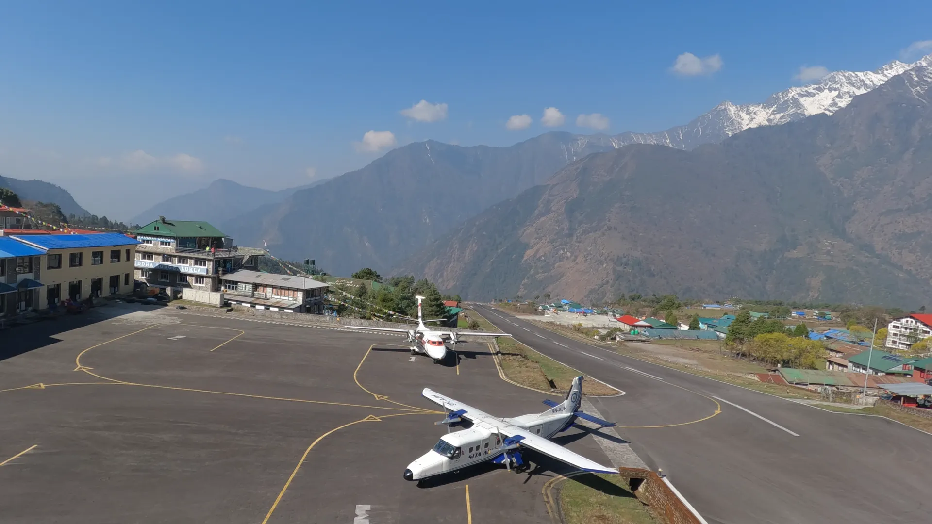

On day two you sleep in Pokhara at 865 metres. On day three you sleep in Kagbeni at 2,800. That is 1,935 metres of height in one day, and a vehicle does all of it. The walking starts from there.
Upper Mustang was closed to outsiders until 1992, and it is still a restricted area. It sits in a rain shadow, so the plateau gets almost no monsoon rain and there are no trees on it. The cliffs are red and ochre, the earth pillars are shaped by wind, and to my eye the whole place looks more like Tibet than Nepal.
The walk goes north to Lo Manthang, the walled capital of the former Kingdom of Lo, stays two nights inside the city, and comes back through villages you have not slept in yet, so that from day four to day twelve you sleep nine nights in a row above 3,000 metres and finish at Muktinath.
You need a restricted area permit and a licensed guide, and since March 2026 a solo trekker can apply for the permit alone. We arrange the permits either way. How the permit system works is set out in our permits guide.
Walking this one? See the Upper Mustang Trek package, dates and group sizes.
Down to Pokhara, Up to Kagbeni
Day one is arrival at Kathmandu airport, 1,345 metres, and a night in a hotel. Day two is a drive of about six hours to Pokhara, 865 metres. That is 480 metres lower than the capital, and you sleep in another hotel.
Day three is the drive to Kagbeni, 2,800 metres, and the first night in a teahouse. Kagbeni is the gateway to Upper Mustang. You have not taken a trekking step yet.
It is also the lowest teahouse of the trek. Every other teahouse night on the table is higher, and the lowest of those is Chele at 3,050.
- Day01Arrival in Kathmandu
- Day02Drive to Pokhara−480 m
- Day03Drive to Kagbeni+1,935 m
The First Three Walking Days
Day four is the first walk: about six hours from Kagbeni to Chele at 3,050 metres, 250 metres higher. Day five is about five hours to Syanbochen at 3,475, another 425. It is the shortest walking day on the table, and I like it for that.
Day six is about six hours to Ghami or Dhakmar at 3,520 metres. The net gain is 45. Whatever the trail does in between, you sleep almost level with the night before.
The country around you is the plateau seen from inside: painted earth cliffs, flat-roofed Tibetan-style villages, prayer wheels, barley fields. The cave monasteries between Kagbeni and Lo Manthang are carved into those cliffs, and some of them hold ancient manuscripts.
By the end of day six you have slept above 3,000 metres three times. Six more nights follow.
- Day04Trek to Chele+250 m
- Day05Trek to Syanbochen+425 m
- Day06Trek to Ghami or Dhakmar+45 m
Two Nights in Lo Manthang
Day seven takes you to Lo Manthang by way of Ghar Gompa. The city is the walled capital of the former Kingdom of Lo, with a royal palace at its centre and about 800 people living in flat-roofed Tibetan-style houses.
You sleep here twice. Day eight is the one day on the whole trek when you wake and sleep in the same place. Four major gompas stand in the city, and their Buddhist murals date to the 14th and 15th centuries. Some of the paintings have been restored by international conservation teams. Take your time in them.
The rest of the day goes to Chhosar, north of the city. The Chhosar caves have more than 3,000 years of human occupation behind them, and some hold manuscripts and murals. The table gives no walking hours for day eight.
- Day07Trek from Ghami to Ghar Gompa to Lo Manthang+280 m
- Day08Explore Lo Manthang and Chhosar Cave−100 m
The Longest Days Come Last
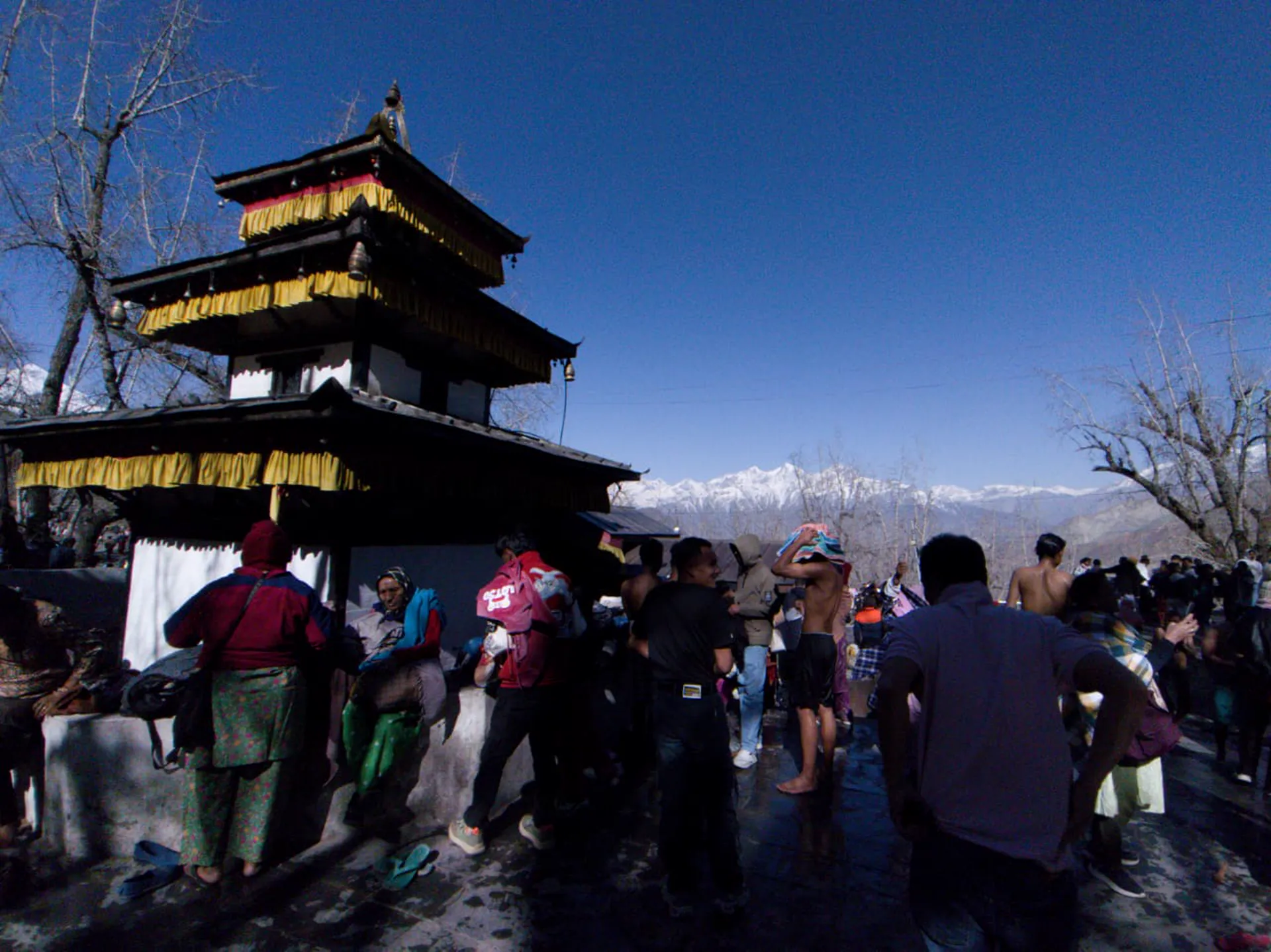
The way back does not retrace the way in. Day nine is about six hours to Yara at 3,607 metres. Day ten is about seven hours to Tengbe, 3,240, which is 367 metres lower. Day eleven is about nine hours to Tetang at 3,067, lower again by 173. Yara, Tengbe and Tetang are all new names.
Nine hours is the longest day on the table, longer than anything on the way in, and I would rather you read that here than meet it on the morning.
Day twelve is about eight hours to Muktinath at 3,800 metres. From Tetang that is 733 metres of climbing, straight after the longest day. Muktinath is higher than Yara, Tengbe or Tetang, and it is the last night on the trail.
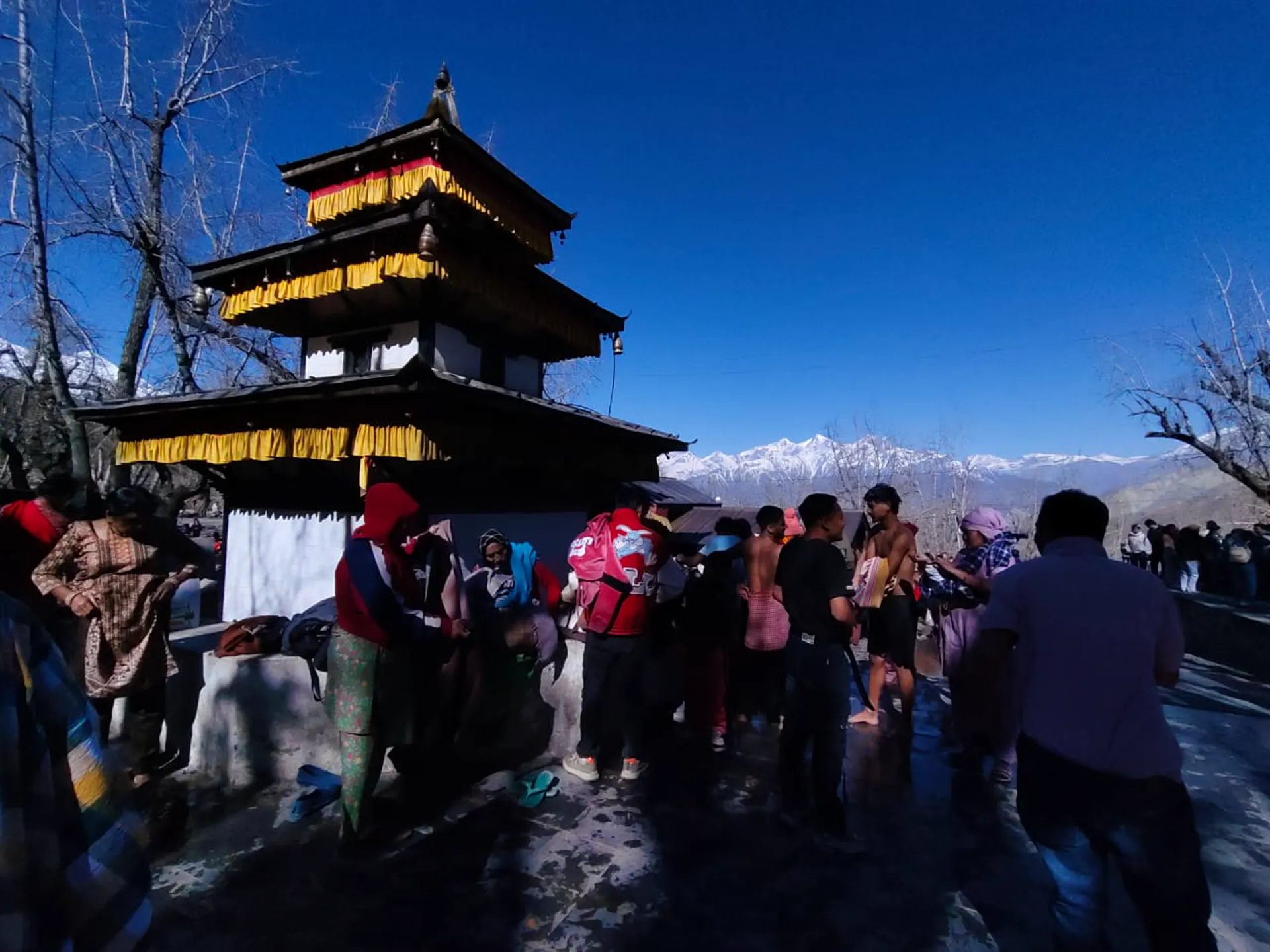
Muktinath is where the walking ends. The temple there is the photograph in this chapter: the pagoda, the pilgrims, the range behind them.
- Day09Trek to Yara−93 m
- Day10Trek to Tengbe−367 m
- Day11Trek to Tetang−173 m
- Day12Trek to Muktinath+733 m
Eight Hours Down to Pokhara
Day thirteen is a drive of about eight hours back to Pokhara, 865 metres. You lose 2,935 metres of height in one day, sitting down.
Day fourteen is the flight to Kathmandu, 1,345 metres, which is 480 above Pokhara, and a hotel. On day fifteen a transfer takes you to the international airport for your flight out.
- Day13Drive Back to Pokhara−2,935 m
- Day14Fly Back to Kathmandu+480 m
- Day15Departure
Your final night on foot is Muktinath, at 3,800 metres. The next night is in Pokhara at 865, 2,935 metres lower, and no other pair of consecutive nights on the table is as far apart.
Written by Prem Pandit, Founder