
- On the trail
- 16 days
- High point
- 5,416m
- Starts
- Kathmandu
- Nights
- Teahouse
- Best window
- September to June
- Effort
- Strenuous
Sixteen days is an odd length for a walk. It is too long to be a weekend test of nerve and too short to forget what a mattress feels like. The Annapurna Circuit is the one trek in Nepal that makes you feel both at once. You leave the terraces above Besisahar still smelling of rice paddies, and less than two weeks later you are standing under Thorong La with your eyelashes freezing together.
I like taking people on this walk because it does not ask you to believe in it on day one. The gorge convinces you first. Then the high villages do. Then the pass convinces you completely, in a way that leaves no room for argument. By the time your feet are in the hot pools at Tatopani, the version of you that worried about the whole trip already feels like someone you used to know.
What follows is the walk in the order your legs will actually experience it, day by day, told the way I see it happen out there rather than the way it reads on a route map. Some days are short and quiet. One day is neither. I will tell you which is which as we go.
Walking this one? See the Annapurna Circuit Trek package, dates and group sizes.
The Road Runs Out
Kathmandu on day one is mostly waiting. Gear gets checked, questions get asked twice, and everyone in the group is still a stranger to everyone else. That changes fast once the road starts.
Day two is a full day in a vehicle, first a drive to Besisahar, then a rougher jeep track climbing to Dharapani. Nine hours is a long time to sit down before you have walked a single step of your own trek, and I will not pretend otherwise. The road is dusty in the dry months and slow in the wet ones. What it buys you is real. The lower Marsyangdi valley has changed a great deal since I first walked it, and skipping straight to Dharapani means you meet the circuit at the point where it still feels like the circuit, not like traffic.
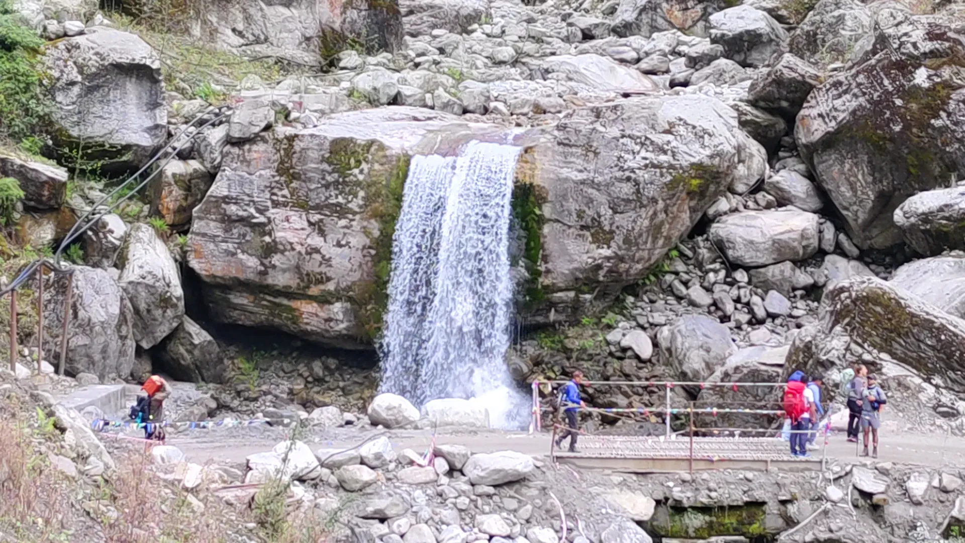
Chame is where the walking finally starts to feel like the reason you came. The trail from Dharapani follows the Marsyangdi upstream through pine forest, crossing the river on metal bridges strung with prayer flags, past at least one waterfall loud enough that conversation stops for a minute while you cross under the spray of it. Six hours is a fair day's work, and by the end of it your legs know they have done something.
I watch this transition happen on every group I take out. People arrive at the hotel in Kathmandu still checking their phones. By the time they reach Chame, most of them have stopped. The gorge does that. It is loud in a way that makes silence easier, not harder.
Chame itself sits low enough that the cold has not properly arrived yet. Enjoy that while it lasts.
| Day | Stage | Altitude | On foot | Night |
|---|---|---|---|---|
| 1 | Arrival in Kathmandu | 1,345 m | Hotel | |
| 2 | Drive to Besisahar, jeep to Dharapani | 1,860 m | 9 hr | Teahouse |
| 3 | Trek to Chame | 2,670 m | 6 hr | Teahouse |
The Valley Opens at Manang
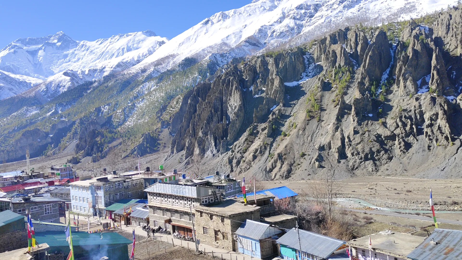
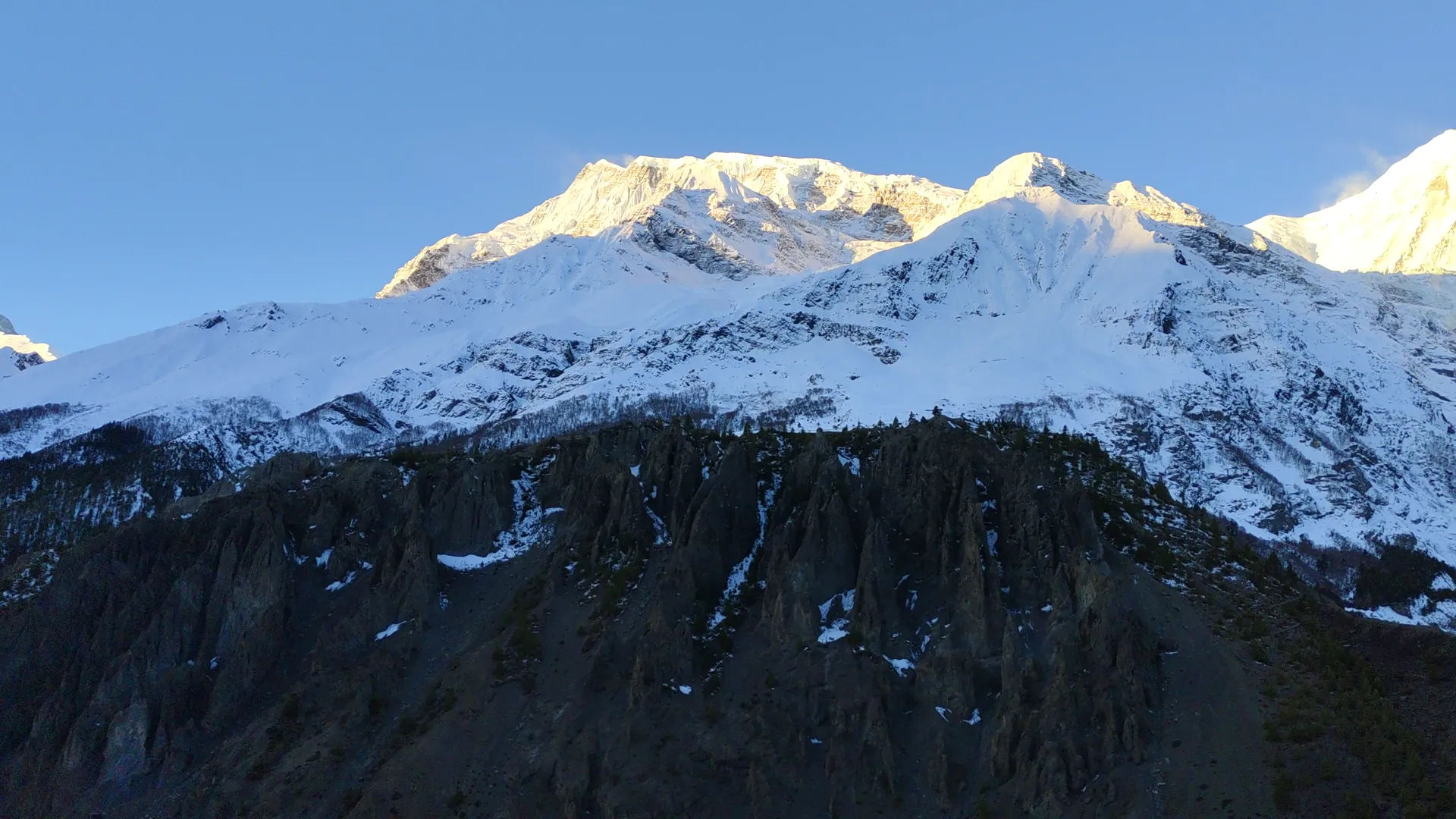
From Chame the trail climbs toward Upper Pisang, and this is where I always tell a group to take the high route rather than the valley floor path into Manang. It takes an extra hour of climbing through Ghyaru and Ngawal, stone villages with prayer wheels set right at their gates, and the whole north wall of Annapurna II, III and IV fills the sky above you the entire way. The valley floor route is shorter and flatter. I have never once regretted skipping it.
Manang itself is where the circuit is actually decided, more than at the pass. The acclimatization day here is not a day off. It is built around climbing high and sleeping low, which is the only trick that reliably works at this altitude. The ambitious option is the Ice Lake trail, a hard climb that gains well over a thousand metres before you turn around and come back down to sleep at the elevation you started from. The gentler afternoon is Braga's old gompa and Milarepa's cave, worth the visit even on the day your legs are voting for the gentler option.
Manang has a bakery that sells sea buckthorn juice and apple pie, and somewhere in the village there is a tiny cinema hall, which is a genuinely strange thing to find at 3,519 metres. I still find it funny every time I walk past it. Trekkers sit outside with a slice of pie watching cloud pour over the Gangapurna glacier, as if it were weather on a screen rather than something happening directly above their heads.
The acclimatization day is logged on the map at exactly the same altitude as the day before it. That is not a mistake. The whole point of the day is that you do not gain height. Your body needs the pause more than your itinerary wants to admit it does.
| Day | Stage | Altitude | On foot | Night |
|---|---|---|---|---|
| 4 | Trek to Upper Pisang | 3,300 m | 5 hr | Teahouse |
| 5 | Trek to Manang via Ghyaru and Ngawal | 3,519 m | 7 hr | Teahouse |
| 6 | Acclimatization day in Manang | 3,519 m | 4 hr | Teahouse |
The Line at 5,416 Metres
From Manang the days get shorter and simpler on purpose. Yak Kharka and Thorong Phedi are not exciting days on their own. Each is short, four hours, because above 3,500 metres how high you sleep matters more than how far you walk. Thorong Phedi is the last stop before the pass, and it is smaller than people expect. There are only two lodges up there, and in the busiest weeks of October you want your guide to have already secured your room before you arrive, because there genuinely is nowhere else to go.
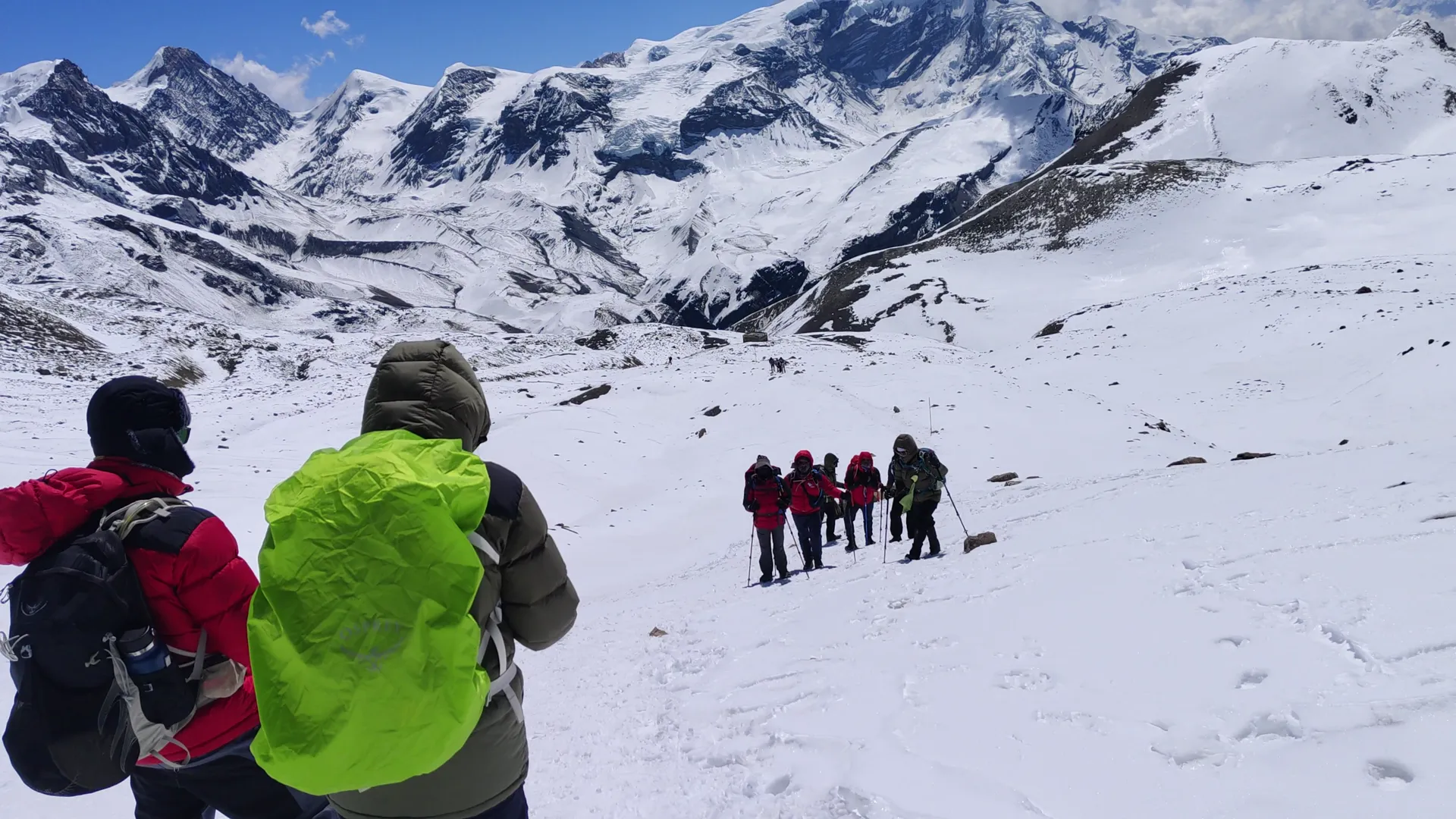
The pass day starts in the dark. You leave Thorong Phedi under headlamps, climbing switchbacks with your own breath the loudest sound around you. The shape of the day is what stays with people afterward, more than the number on the pass itself. You gain 966 metres to reach Thorong La at 5,416 metres, then drop 1,616 metres down the other side to Muktinath. Add that up and you finish the hardest day of the whole trek 650 metres lower than where you woke that morning.
The pass does not care how the rest of your trek went.
At the top there is a small shack that sells tea in season, and most groups do not stay long, under an hour, long enough for photos at the prayer flag cairn before the cold and wind push everyone back into motion. I have stood at that cairn more times than I want to count and it still catches me somewhere in the chest every time, not for the view exactly, but for what everyone around me looks like in that moment. Relief looks the same on every face at 5,416 metres.
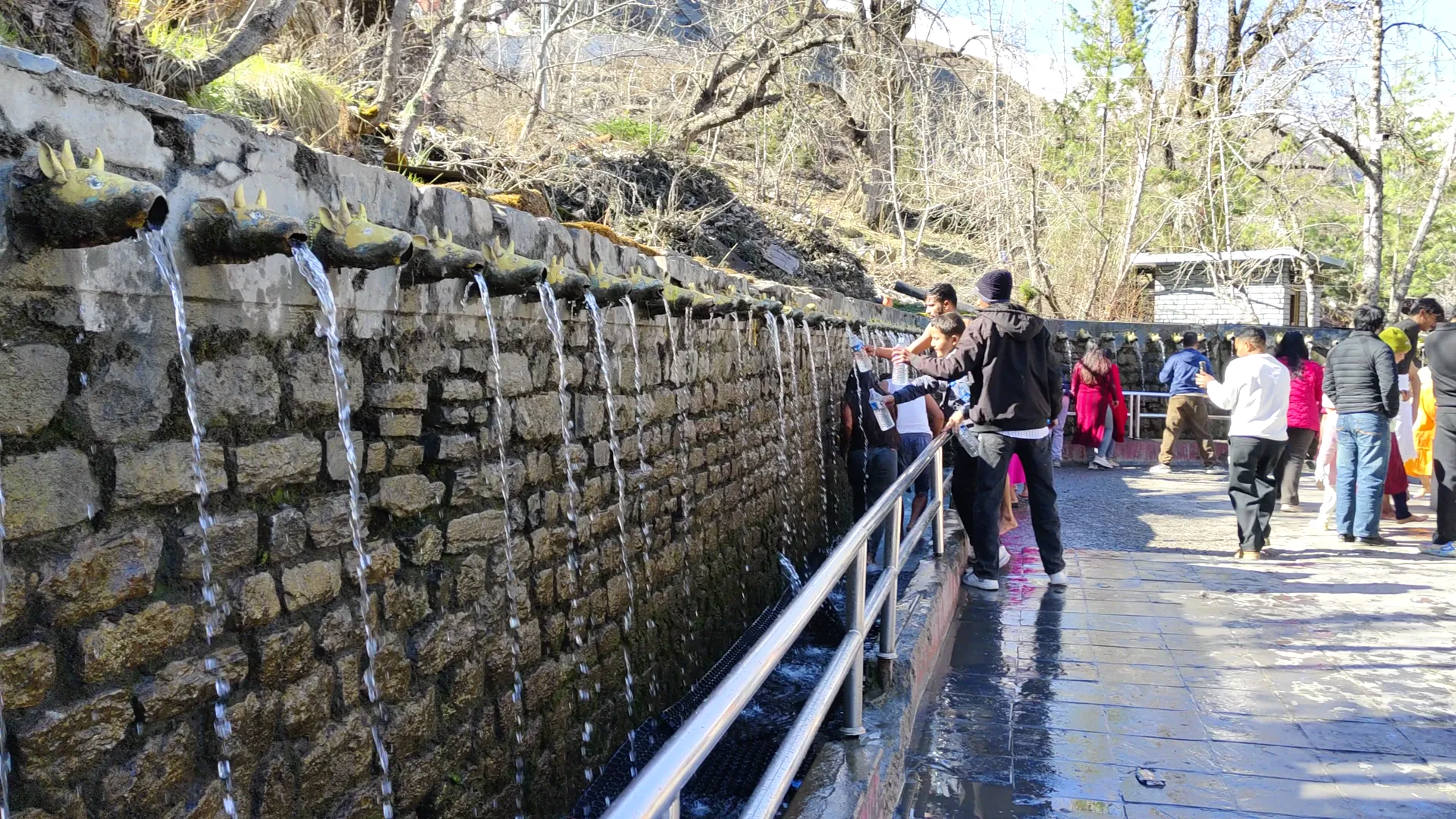
Muktinath waits at the bottom of the long descent, and it earns its reputation. It is one of the very few places on earth sacred to two religions at once. Hindu pilgrims bathe under its 108 water spouts, and inside the Jwala Mai temple, Buddhist nuns tend a flame that burns over a natural gas seep, fire and water from the same rock. Arriving there on foot, legs shaking, after crossing what you just crossed, means something a road trip to the same spot never could.
| Day | Stage | Altitude | On foot | Night |
|---|---|---|---|---|
| 7 | Trek to Yak Kharka | 4,050 m | 4 hr | Teahouse |
| 8 | Trek to Thorong Phedi | 4,450 m | 4 hr | Teahouse |
| 9 | Cross Thorong La Pass to Muktinath | 3,800 m | 9 hr | Teahouse |
Lower Than Kathmandu, Then Up Again
Leaving Muktinath, the trail drops into a different world entirely. Kagbeni sits right at the edge of Upper Mustang, and Jomsom is the administrative town where the wind starts to make itself known, funneling up the valley every midday hard enough to lean into. By the time you reach Marpha the wind has usually settled for the evening, which is a relief, because Marpha wants your full attention. It is a whitewashed Thakali village that grows some of the best apples in Nepal, and it distills them into a brandy that seems to leave with every trekker who passes through, whether they planned on buying any or not.
Below Marpha the trail runs three days through the Kali Gandaki, which measured rim to riverbed is the deepest gorge on earth. Dhaulagiri and Annapurna I face each other across it, both over 8,000 metres, standing barely 35 kilometres apart. The Thakali villages strung along this corridor grew wealthy centuries ago running the old salt trade through here, long before anyone walked it for the views.
Tatopani sits at the bottom of all this, at 1,190 metres, which if you do the maths is lower than Kathmandu itself. The name means hot water, and the springs are exactly what the name promises: stone pools right beside the river, in orange tree country that feels nothing like the frozen pass you crossed three days ago. Nobody skips the hot springs. I have never once seen anyone skip the hot springs.
Then the trail turns uphill again, and it does not go easy on you. Ghorepani sits at 2,850 metres, and the climb up from Tatopani is the last serious uphill day of the whole trek, arriving on legs that thought the climbing was finished. It is not finished. Not quite yet.
| Day | Stage | Altitude | On foot | Night |
|---|---|---|---|---|
| 10 | Trek to Marpha via Kagbeni and Jomsom | 2,670 m | 6 hr | Teahouse |
| 11 | Trek to Ghasa | 2,010 m | 6 hr | Teahouse |
| 12 | Trek to Tatopani | 1,190 m | 5 hr | Teahouse |
| 13 | Trek to Ghorepani | 2,850 m | 7 hr | Teahouse |
The Sunrise That Ends It
Ghorepani's dining room the night before is different from every other stop on the circuit. Everyone already knows what the next morning is for. Guides compare notes on cloud cover, people go to bed early without needing to be told twice, and there is a specific kind of quiet in a teahouse where forty strangers are all setting alarms for the same impossible hour.
Poon Hill is a pre-dawn walk from Ghorepani, about forty five minutes uphill in the dark with a headlamp, and I will not pretend the timing feels comfortable. Nobody wants to leave a warm sleeping bag before sunrise. Then the light starts moving across Dhaulagiri, then Annapurna South, then Machhapuchhre, gold arriving on each peak in turn at 3,210 metres, and every complaint about the early start goes quiet at once. I have watched that sunrise more times than I can count and it has never once repeated itself the same way twice.
From Poon Hill the trail drops all the way down to Nayapul, and a vehicle carries you on to Pokhara the same afternoon. It is a long day, the long kind that comes from a mountain instead of a road, and Pokhara at the end of it feels soft after two weeks of everything being hard edged and cold.
Day fifteen is the drive back to Kathmandu, which gives you time to notice how strange it is that a jeep covers in a few hours what took the better part of two weeks on foot. Day sixteen is departure, and most people leave quieter than they arrived, which I have come to think is the actual sign that a trek worked.
| Day | Stage | Altitude | On foot | Night |
|---|---|---|---|---|
| 14 | Poon Hill sunrise, trek to Nayapul, drive to Pokhara | 820 m | 7 hr | Hotel |
| 15 | Drive back to Kathmandu | 1,345 m | 7 hr | Hotel |
| 16 | Departure | 1,345 m | Transfer |
People ask me which day was the hardest, expecting me to say the pass, and they are right, it was the pass. They rarely ask which day changes you the most, and that one is harder to answer honestly. Something happens between the gorge at Chame and the tea shack at 5,416 metres that has nothing to do with fitness. You arrive expecting a mountain and you leave having also met several completely different versions of Nepal in one loop, subtropical to alpine to desert to river gorge, without ever backtracking over ground you already covered.
I still choose to walk this circuit myself when I can, because certain places do not wear out no matter how many times you see them. Manang's cinema hall is still ridiculous. Thorong La still empties my head of every thought except the next step. Tatopani's hot water still feels like it was invented specifically for tired legs.
If sixteen days around this mountain sounds like your kind of walk, I would rather talk you through it properly than let a page do all the convincing.
Written by Prem Pandit, Founder