
The name is older than the climb. In 1952 a British Cho Oyu team looked at the peak from Dingboche and called it Island Peak, because it rises out of the surrounding glaciers the way an island rises out of a sea. The local name, Imja Tse, ties it to the valley and the glacier it stands in. Both names are still in daily use, on permits and maps and in every teahouse in Chukhung. In 1953 Tenzing Norgay's team climbed it as training for Everest.
On the French Alpine scale the climb grades F to PD. That is harder than any trek in Nepal and easier than a true expedition peak. What earns the grade is one sustained crux, a steep face of snow and ice on fixed ropes, with a glacier crossing below it and an exposed ridge above it.
People weigh it against Mera Peak, which is 287 metres higher. Mera's trouble is thin air, and I have written that climb up in the Mera Peak itinerary. Island Peak's trouble sits somewhere else: a headwall on fixed ropes and an exposed summit ridge.
This itinerary walks the Everest Base Camp trail first and turns east into the Chukhung valley on day eleven. The Everest trail gets one chapter here. After the turn, the page slows down.
Walking this one? See the Island Peak Climbing package, dates and group sizes.
Boots Before Anything Else
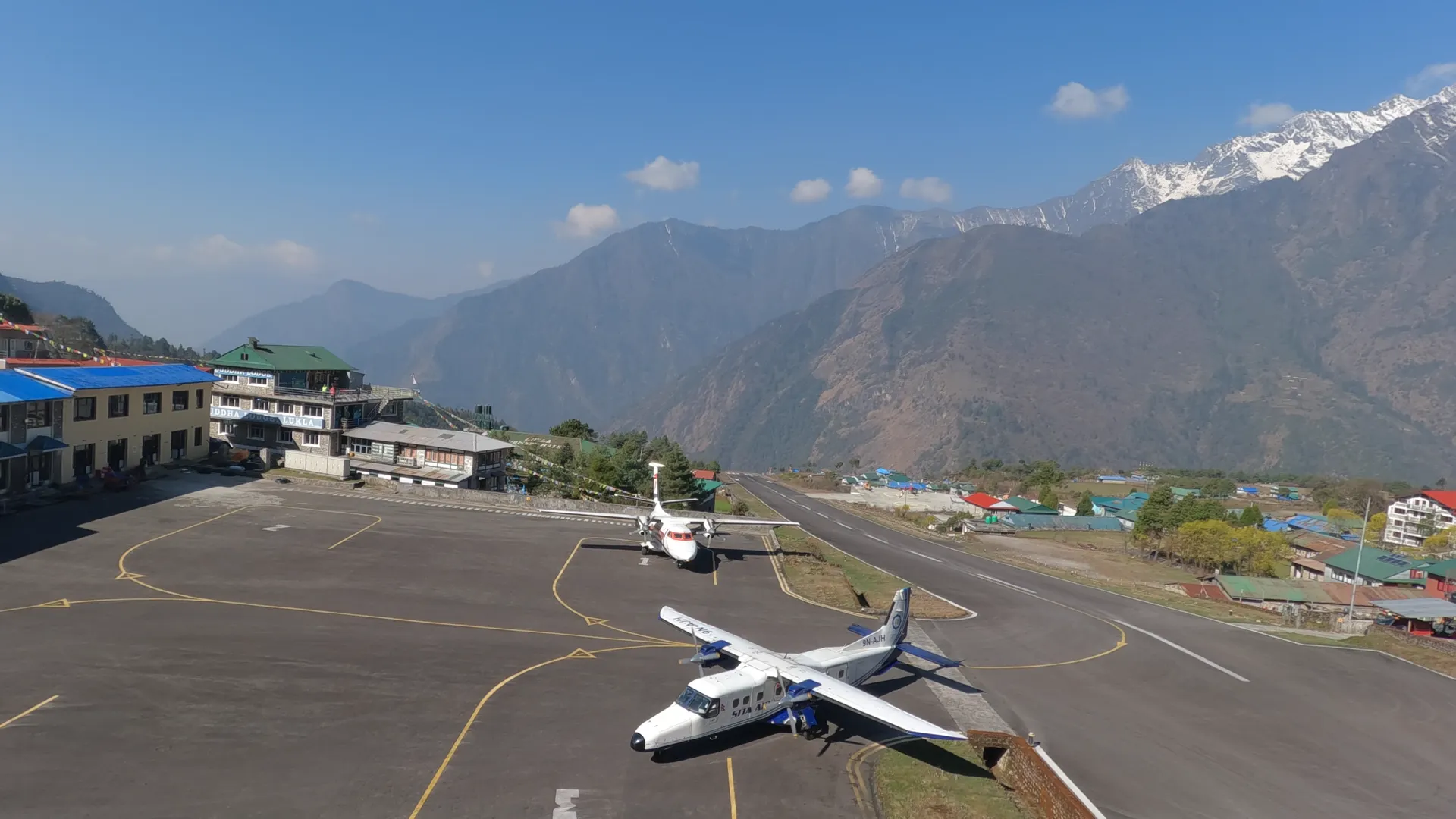
Day one is arrival at Tribhuvan International Airport, a private transfer to the hotel and an evening briefing. Day two is the pre-trip meeting: a route briefing, insurance and the paperwork for the NMA climbing permit, and a full gear check against the equipment list. The afternoon is sightseeing in the Kathmandu Valley, with time in Thamel to rent whatever you did not bring: double boots, crampons, ice axe, harness, helmet and jumar.
Start with the boots. You need insulated double mountaineering boots with a sole that takes crampons. Ordinary trekking boots are fine up to base camp. They do not hold crampons on steep ice, and your toes will not forgive the midnight start. Bring the trekking boots as well, because you climb in the doubles only on summit day. Crampons should be 12-point steel models, fitted to your boots before you leave Kathmandu. The rental shops check that fit and so does our team.
Insurance is the other paper that matters. A standard trekking policy stops at 6,000 metres and the summit is at 6,189. Some policies cover the altitude and still exclude ropes and crampons, which is exactly what this climb uses. Read the exclusions line by line.
One more number from this day. The Lukla flight allows 10 kilograms checked and 5 in hand luggage, and rented technical gear counts inside that limit. Whatever you do not need on the mountain stays in hotel storage in Kathmandu.
- Day01Arrival in Kathmandu
- Day02Pre-trip Meeting & Kathmandu Sightseeing
The Everest Trail First
Eight days of this itinerary are the walk to Everest Base Camp and back to Dingboche, and the Everest Base Camp itinerary tells that trail properly. I will not tell it twice. What matters here is what those days are for.
They are the acclimatization. The beds climb in steps: Phakding at 2,610 metres, Namche at 3,440, Tengboche at 3,860, Pheriche at 4,200, Lobuche at 4,920 and Gorak Shep at 5,164. Day five is a climb-high, sleep-low day above Namche. Day nine goes out to Everest Base Camp at 5,364 and back to Gorak Shep for the night. Day ten starts before dawn on Kala Patthar, at 5,545, for the sunrise on the south face of Everest, and ends at Dingboche, 4,410 metres.
Rushing to altitude is the main reason Island Peak attempts fail, more than any rope work. This stretch is the part of the plan that guards against it, and I would not shorten it.
Everest Base Camp looks different by season. In spring the tent city of the Everest climbing teams sprawls across the glacier. In autumn the site is stark and quiet.
Day ten ends at Dingboche, the village the island comparison was made from.
- Day03Fly to Lukla & Trek to Phakding+1,265 m
- Day04Trek to Namche Bazaar+830 m
- Day05Acclimatization Day in Namche Bazaar
- Day06Trek to Tengboche+420 m
- Day07Trek to Pheriche+340 m
- Day08Trek to Lobuche+720 m
- Day09Everest Base Camp & Gorak Shep+244 m
- Day10Kala Patthar & Trek to Dingboche−754 m
The Turn East
Day eleven is a short stage east into the Chukhung valley, to 4,730 metres. It leaves the Everest crowds behind. One day off that main trail and the valley is yaks and moraine, with the Imja Glacier grinding somewhere under its rubble.
The afternoon is for rest and water. It is also the first long look at Island Peak, standing in its ring of ice. Final gear top-ups are possible here, because Chukhung has a smaller rental pool that is useful for a last-minute swap. If a strap is wrong or a size is off, this is the last village where it gets put right.
- Day11Trek to Chukhung+320 m
Two Nights in Tents
Day twelve walks the moraine valley beneath the Lhotse wall to Island Peak Base Camp at Pareshaya Gyab, 5,087 metres. From here the nights are in tents: sleeping tents, a dining tent, a kitchen crew and hot meals. You carry a daypack, and porters and the camp team move everything else.
The afternoon belongs to the skills session. Your climbing Sherpa rigs a practice line and runs you through crampon technique, jumar ascent on the fixed rope, figure-8 descent and rope-team travel for the glacier. You repeat each one until it is dull.
I want these moves boring by the end of the afternoon. On the headwall, boring is what safe looks like.
In April and October, when several teams share the site, the practice line runs in shifts.
Day thirteen is a short, steep carry to High Camp, at around 5,600 metres. It is the highest bed of the whole trip, and nobody sleeps well there. Its job is position: it sets you up for a shorter summit morning. Dinner is early, the alarm is set for midnight, and the water bottles go into your sleeping bag or they freeze. You have already slept at 5,164 metres at Gorak Shep, so the altitude is familiar even though the tent floor is not.
- Day12Trek to Island Peak Base Camp & Skills Session+357 m
- Day13Move to High Camp+513 m
Midnight to Chukhung
The alarm is at midnight, and you are moving between midnight and 2 AM. The first stretch is not ice. It is two to three hours of scrambling up rock ridges by headlamp to reach the glacier, in air that runs around minus 15 to minus 20 on summit morning, colder with wind.
At the glacier you rope up as a team and cross the crevasse zones of the Imja Glacier, another two to three hours. The crevasses shift every season. In some years the guides place aluminium ladders over the widest gaps, and in others the route winds around them. A ladder crossing in crampons is a two-minute exercise on a fixed safety line, and it looks worse in photographs than it is.
Then comes the headwall, the crux of the climb. It is a steep face of snow and ice that your climbing Sherpa has fixed with rope before you arrive. You clip in with a jumar, an ascender that slides up the rope and locks under load, and climb on the front points of your crampons while the rope holds every slip. It takes about two hours.
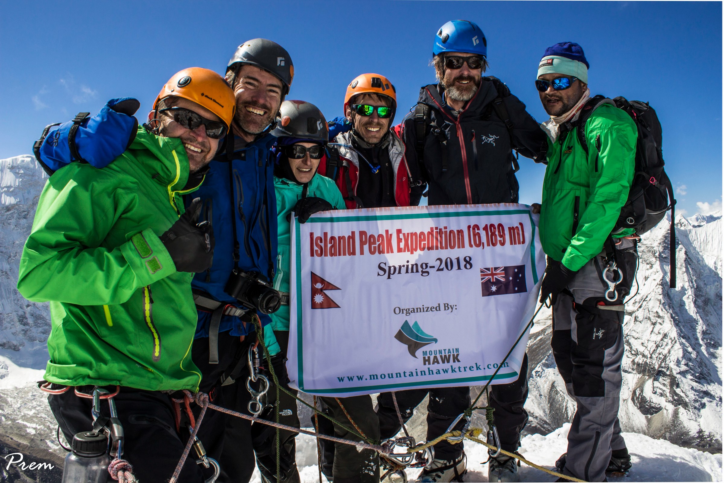
Above it the summit ridge runs about 300 metres to the top on a fixed line, narrow and corniced. The south face of Lhotse fills the northern sky, and Ama Dablam, Makalu and Baruntse stand around the horizon. You are on top by mid-morning.
The climbing Sherpa sets a hard turnaround time, typically around 10 to 11 AM depending on conditions, and it is not negotiable. Afternoon brings wind, softening snow on the headwall and the risk of coming down tired in the dark. Whether you go up or turn round is the Sherpa's read of the mountain that morning.
The descent reverses the route. You abseil the headwall with a figure-8, retrace the glacier and carry on down to a teahouse bed in Chukhung. From alarm to bed it is the longest day on the itinerary.
- Day14Summit Island Peak (6,189m) & Descend to Chukhung−870 m
Down the Khumbu
Day fifteen is the first day of the walk out: down the Chukhung valley, past Dingboche and Pangboche, and along the high trail to Namche at 3,440 metres, about seven hours. Pangboche has the oldest gompa in the Khumbu. Every hour of descent puts oxygen back in the air.
Day sixteen retraces the Dudh Koshi valley through Monjo and Phakding to Lukla, six to seven hours. That evening is the traditional thank-you dinner with the guide, the climbing Sherpa and the porter team. I would not skip it.
- Day15Trek to Namche Bazaar−1,290 m
- Day16Trek to Lukla−580 m
The Buffer Day
Day seventeen is the morning flight from Lukla to Kathmandu or Ramechhap and a transfer to your hotel. The afternoon is yours: sleep, shop, or eat everything Thamel offers.
Day eighteen is a planned buffer. Lukla flights depend on weather in both directions, and this day absorbs a delay without endangering your international connection. If the schedule ran clean, it becomes a free day for Bhaktapur, Patan or nothing at all.
The buffer protects the flight. It does not protect the summit, because this itinerary has no spare summit day. The shorter Island Peak trip we run, which skips the Everest trail, holds two climbing days in reserve for exactly that. Day nineteen is the transfer to the airport.
- Day17Fly to Kathmandu−1,515 m
- Day18Buffer Day in Kathmandu
- Day19Departure
The rope on the headwall is fixed before you arrive, by the Sherpa who climbs beside you. Everything you do on it, you did two days earlier at Pareshaya Gyab, in daylight, until it bored you. The Everest trail before it exists so that you reach that line with your breathing already used to the height.
Summit day finishes in Chukhung. Your boots come off, the tea arrives, and the peak you stood on that morning is framed in the teahouse window.
Written by Prem Pandit, Founder