
For the first four days, anyone walking to Gokyo is on the Everest Base Camp trail. You fly into Lukla with the Base Camp groups, sleep where they sleep at Phakding and Namche, and take the same acclimatization day above Namche's rooftops. Nothing on those days tells you which trek you booked.
Day five does. Above Namche, at Sanasa, the trail forks, and the Gokyo side turns northwest up the Dudh Koshi. Within an hour the crowds thin. By our own estimate this valley sees perhaps a tenth to a fifth of the people on the Base Camp side, and in the shoulder months you can have a teahouse above Dole nearly to yourself.
What follows the fork is easy to hold in your head. There are three days up the valley to the lakes, then two nights at Gokyo with the climb up Gokyo Ri in between, then three days back down the same valley to Lukla and a flight out. The route crosses no pass and never puts you on the glacier, and there is nothing technical anywhere on it.
The grade is Moderate, and the altitude is what earns it. Five nights of this trek are spent above 4,000 metres, two of them at Gokyo itself, 4,770 metres, and the hill above the village tops out at 5,360.
The shared days get their due quickly here, because the part of this trek nobody else walks begins at Sanasa.
Walking this one? See the Gokyo Valley Trek package, dates and group sizes.
The Everest Trail First
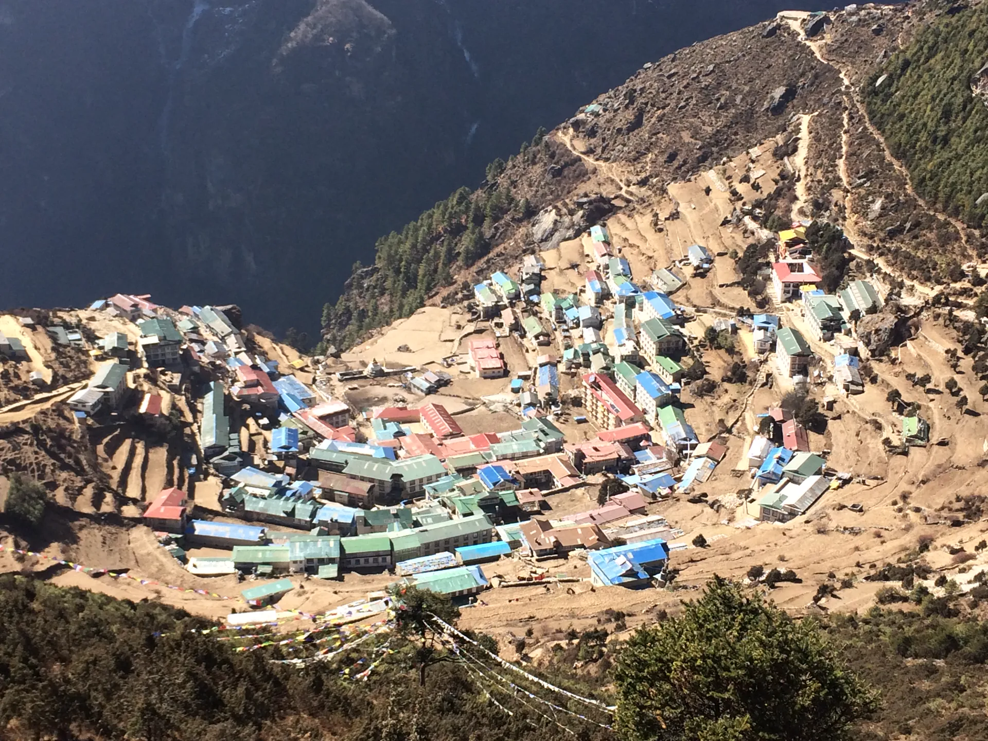
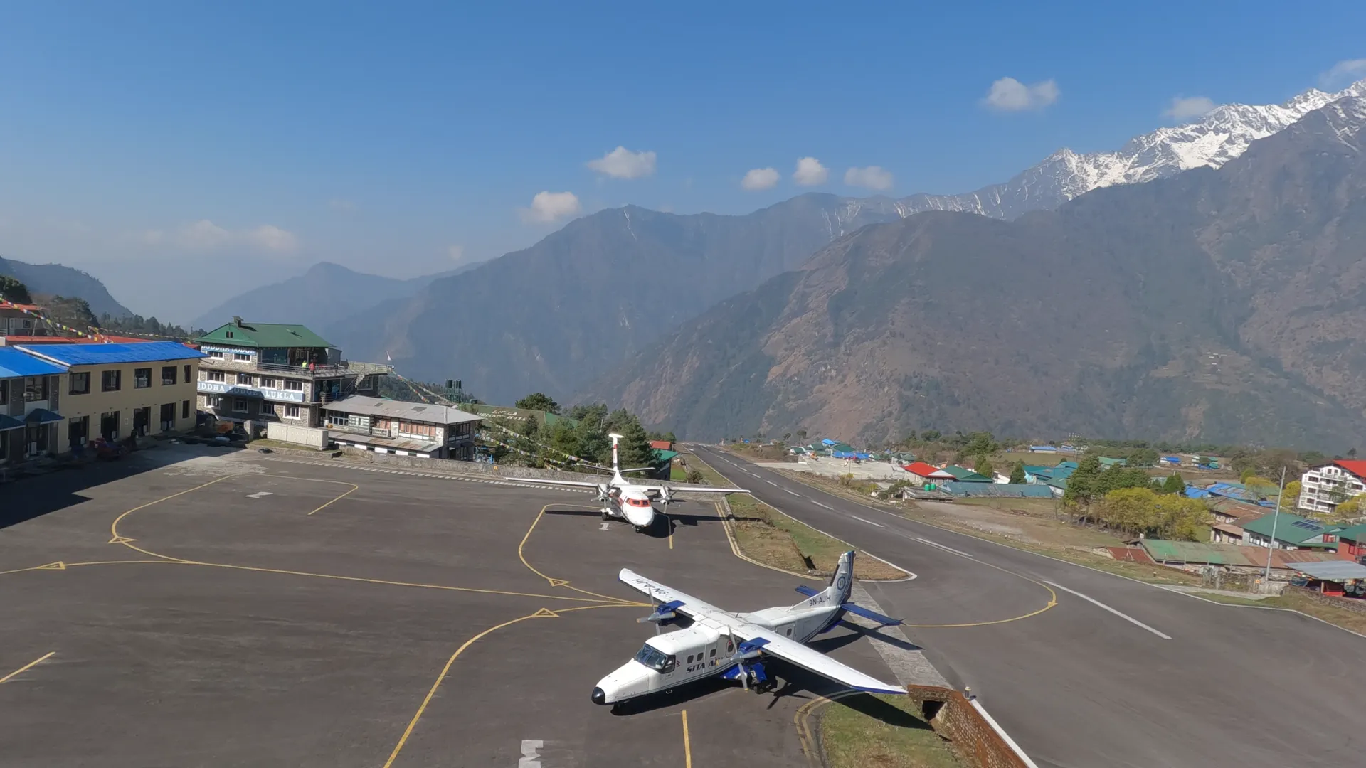
Day one is Kathmandu at 1,345 metres and a hotel bed. Day two is the flight to Tenzing-Hillary Airport at Lukla, 2,795 metres, then about three hours on foot to Phakding. Phakding sits at 2,610 metres, so your first afternoon of walking finishes 185 metres below the runway you landed on. I like a trek that starts by going down.
Day three is the one to respect. It is about seven hours from Phakding to Namche Bazaar at 3,480 metres, and the steep part begins after the Hillary Bridge. That day gains 870 metres, the largest single climb on the whole trek. Gokyo Ri, for all its reputation, gains less.
Namche has the best rooms you will sleep in until you come back through it on day ten. Enjoy them.
Day four is the acclimatization day, and you spend it climbing. The usual walk goes up to the Everest View Hotel above the town and back down to sleep at the same 3,480 metres. It is the only acclimatization day on this itinerary. Do the walk even if you feel fine that morning, because feeling fine at Namche tells you very little about how you will feel at Gokyo.
- Day01Arrival in Kathmandu
- Day02Fly to Lukla & Trek to Phakding+1,265 m
- Day03Trek to Namche Bazaar+870 m
- Day04Acclimatization Day in Namche Bazaar
Northwest at Sanasa
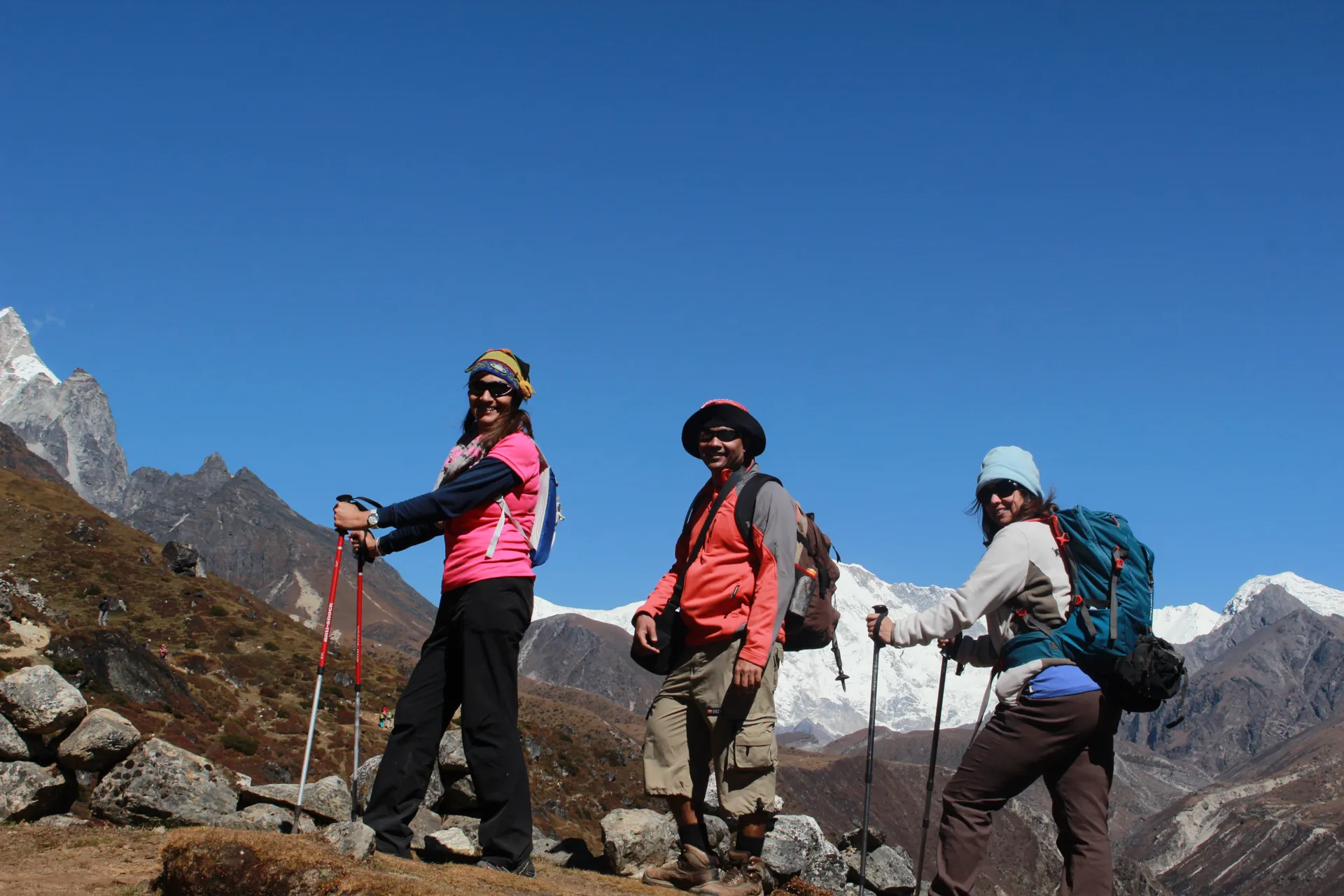
Day five is about five hours from Namche to Dole at 4,130 metres, a gain of 650 metres. Sanasa is where the trek changes hands. Before the fork, you share the trail with people walking toward Base Camp. After it, you share it with a few other groups and a lot of yaks.
Dole is your first night above 4,000 metres. You sleep there twice, once going up and once coming down, and the same village feels different from each direction. Going up, it is the highest bed you have slept in. Coming down from Gokyo, it is the place where the air starts to thicken again.
Above Dole the valley opens out. The ground turns to yak pasture divided by stone walls, with a few teahouses spaced out between the glacial moraines. The walking is steady and never steep, and that suits the height.
On day six the trail climbs to Machhermo at 4,470 metres, and it gains only 340 metres in about five hours. Five hours for 340 metres looks slow on paper. At this height it is the right speed.
Machhermo has a Himalayan Rescue Association post, which is a good building to have in a village at 4,470 metres. It also has a bakery, and the cinnamon roll there is decent. Most trekkers remember that roll more clearly than anything the trail did that day, and I do not blame them.
If you walk this in December or January, expect the dining rooms above Dole to be cold at breakfast, cold enough that down jackets stay on through the meal. The stove is lit in the evening, and by morning it has given up.
Look around Machhermo properly, because you only sleep there once. On the way down, the trail walks straight through it.
- Day05Trek to Dole+650 m
- Day06Trek to Machhermo+340 m
The Lakes Come in Order
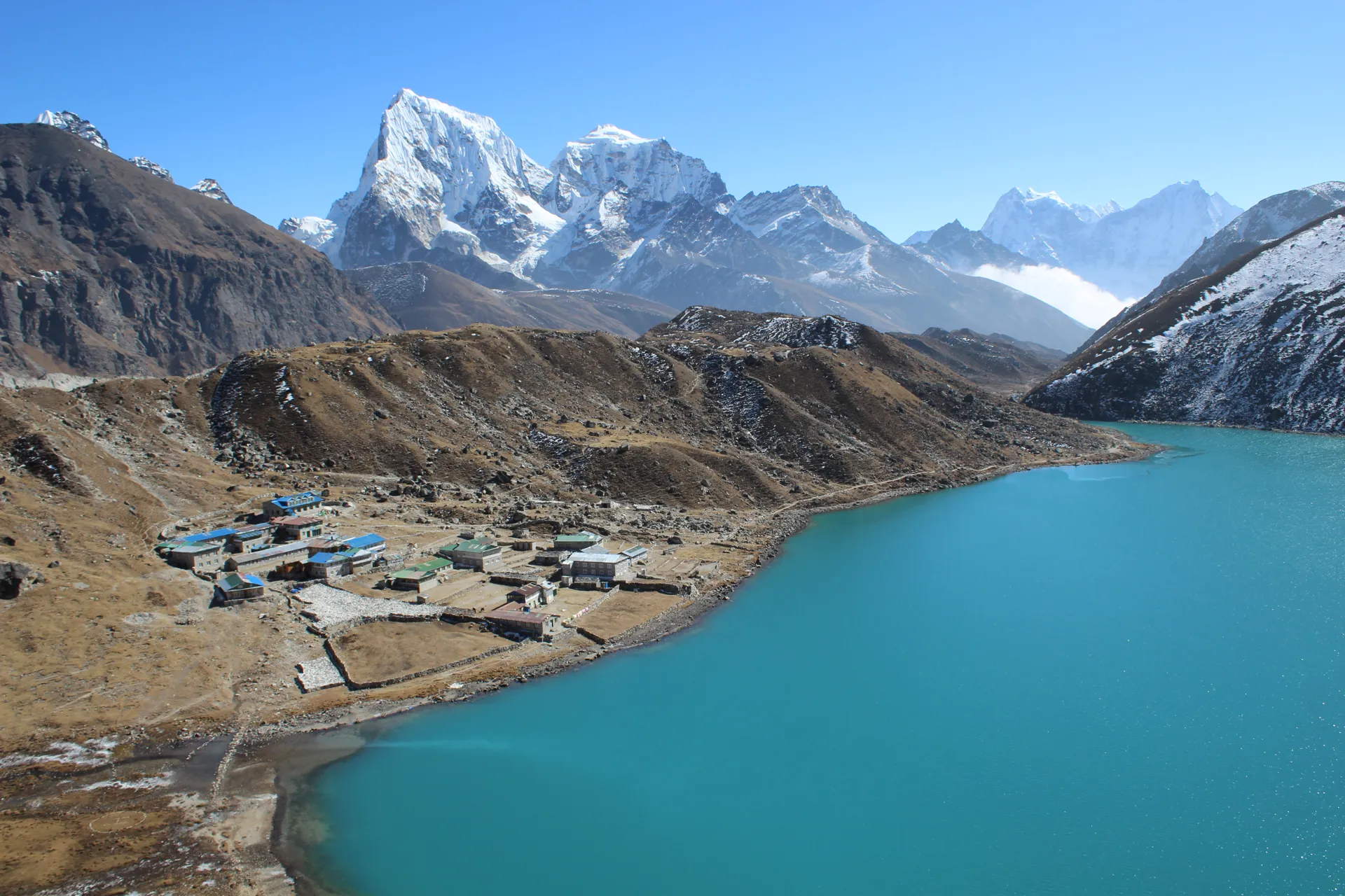
Day seven is about five hours from Machhermo to Gokyo, 300 metres higher. It is the day the lakes arrive, and they arrive one at a time. The trail passes the first lake, Longponga Tsho, then the second, Taboche Tsho, and then comes out on the shore of the third, Dudh Pokhari, the largest of the chain at nearly a kilometre long.
No two of them are quite the same colour. The turquoise comes from glacial flour, rock ground so fine by the Ngozumpa Glacier that it hangs in the water, and the shade moves with the angle of the sun. On the far side of the lakes the Ngozumpa itself runs south, a long grey back of moraine. The trail keeps beside it and never crosses it.
Gokyo is a handful of teahouses clustered on the eastern shore of Dudh Pokhari, at 4,770 metres. Cho Oyu stands about 3,400 metres above the village, straight behind it, and on a still morning the whole mountain lies upside down in the lake. That reflection is the photograph a lot of people came for. Get up before the wind does and it is yours.
These lakes are sacred to Hindus and to the Buddhist Sherpa families of the Khumbu. At Janai Purnima, the full moon festival in August, Hindu pilgrims walk up through the monsoon to bathe in Dudh Pokhari, and the Sherpa communities have long kept a ban on fishing here. Nobody on an October trek sees the pilgrims, but it is worth knowing whose water you are standing beside.
From December to mid-February the lakes can freeze solid. The village is still there and the hill is still there, but the turquoise is gone, and I would rather you knew that before you booked a January departure for the colour.
This is your first night at 4,770 metres, and a dull headache on it is common. It is not automatically a warning. A headache that gets worse instead of settling is a different matter, and your guide will want to hear about it the moment it starts.
- Day07Trek to Gokyo+300 m
Up Gokyo Ri in the Dark
Most guides leave Gokyo for the hill somewhere between 4:00 and 4:45 in the morning. The exact time gets set the night before, counted backward from sunrise, and sunrise moves with the month, so a group leaving at quarter past four in October might leave half an hour later in December.
The trail starts at the north end of the village and goes straight up. The first stretch is packed dirt, a good place for legs that are still half asleep. Then it turns into a rocky ridge marked by scattered cairns. The last 200 metres or so of height is loose rock and small ledges, where poles help less and foot placement matters more. There are false summits on this stretch, rises that look like the top from below and are not. Prayer flags mark the real one, strung between the cairns.
We plan the climb at about 90 minutes. It gains 590 metres, from 4,770 to 5,360. When the upper section carries ice in winter or early spring, add half an hour or more.
Dress for standing still at the top. The climb keeps you warm, and standing still at 5,360 metres before the sun arrives does not, so keep the down jacket in your pack until you stop. A spare pair of dry liner gloves is worth its weight here. Once the sun reaches you, the temperature can climb 15 to 20 degrees within the hour.
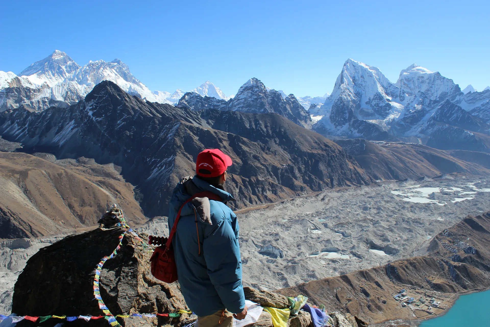
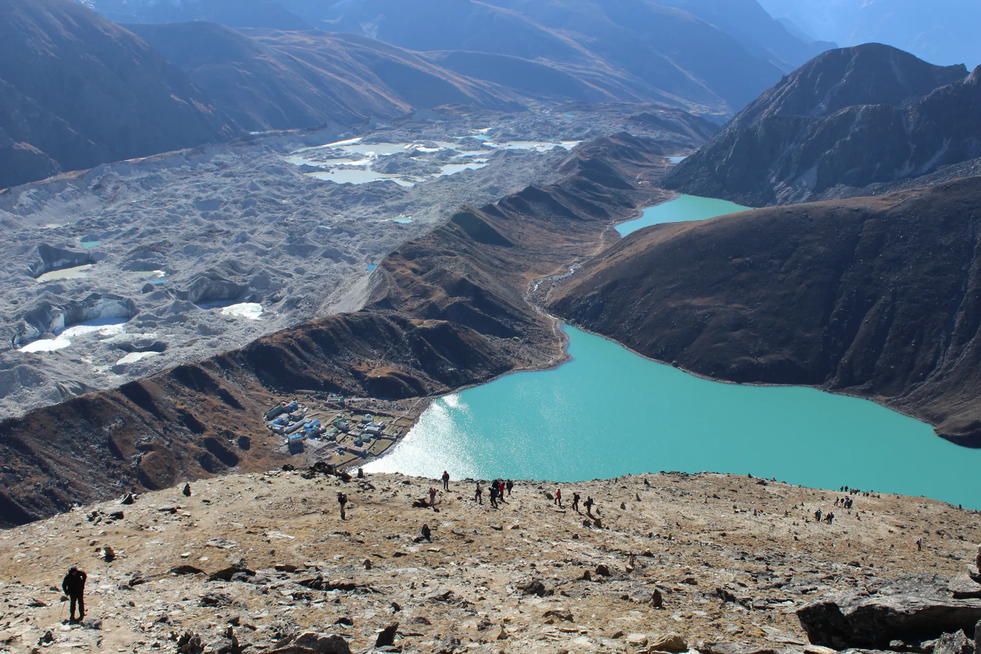
The light comes in a set order. Everest's west face takes it first, while everything below stays blue and grey. Then it moves across to Lhotse, and down onto the glacier and the lakes. From this one hill you are looking at Everest, Lhotse, Makalu and Cho Oyu, and on a clear morning Kangchenjunga as well, five of the six highest mountains on Earth. Below them the lakes turn turquoise against the grey moraine, and the village you left in the dark sits on the shore of the third one, small enough to cover with a thumb.
Of everything on this trek, that view is the one I would walk the other eight days for.
The best light lasts thirty to forty minutes before the mountains go flat and white. Do not hurry off, but do not linger for hours either, because the wind on the summit ridge tends to pick up after about nine.
Back in Gokyo, breakfast is waiting. The whole outing is about five hours, and the rest of the day is yours beside the lake. You sleep a second night at 4,770 metres, and you sleep it with the hill behind you.
- Day08Gokyo Ri & Return to Gokyo
Down the Same Valley
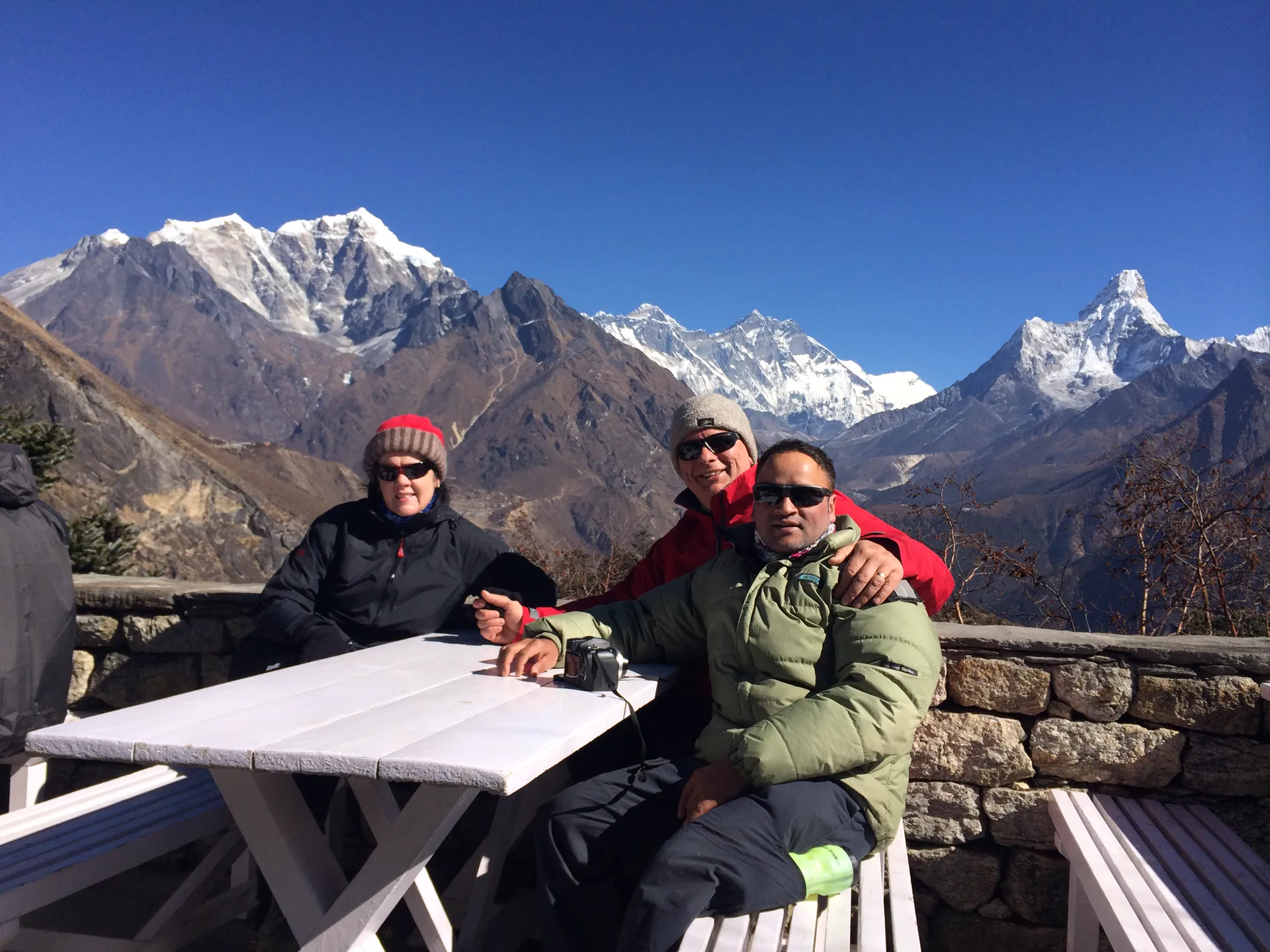
Day nine is about six hours from Gokyo back to Dole, 640 metres lower. It folds two days of the climb into one. You walk through Machhermo without stopping for the night, and Dole, which felt high on day five, now feels low.
On day ten another six hours or so take you 650 metres down to Namche. Somewhere on this stretch you rejoin the main trail at the fork, and the Base Camp traffic is back around you. After five days on the quiet side, the noise takes a little getting used to.
Day eleven is the long one, about seven hours from Namche down to Lukla, 685 metres lower. After three straight days of downhill, the knees are doing most of the complaining. Trekking poles earn their place on these descents more than anywhere else on the trip, and this is the day you will be glad you carried them.
Day twelve is the morning flight from Lukla to Kathmandu, and a hotel. Day thirteen is a leisure day there. Lukla flights are cancelled often for cloud, wind or poor visibility, and when one slips, this is the day that absorbs it, so a late flight out of the mountains never reaches your international connection. If everything runs on time, it is a free day in the city. Day fourteen is the transfer to the international airport.
- Day09Trek Back to Dole−640 m
- Day10Trek to Namche Bazaar−650 m
- Day11Trek to Lukla−685 m
- Day12Flight from Lukla to Kathmandu−1,450 m
- Day13Leisure Day in Kathmandu
- Day14Departure
An out-and-back trek means walking most of your ground twice, and on this one I count that in its favour. Going up, every day ends somewhere new. Coming down, the same trail faces the other way, the valley opens out below you, and the villages you passed as a stranger are ones you already know. Machhermo gets one night. Gokyo you keep for two.
I send people to Gokyo for the lakes. The part I expect them to talk about afterwards is the hill: an hour and a half in the dark on loose rock, and then the west face of Everest turning gold while the lake you slept beside turns blue below you.
Written by Prem Pandit, Founder