
- What time to leave, and why guides disagree
- The trail underfoot
- Ice and microspikes in winter and early spring
- How long it actually takes, and why estimates vary
- Sunrise timing and the light window
- Cold and wind at the summit
- The view, briefly
- Who should skip the climb, and what they do instead
- The alternative: fourth lake, fifth lake and Scoundrel's Viewpoint
- Fitness for summit day
- Frequently Asked Questions
The headlamp beam is the only light on the trail out of Gokyo village, long before four in the morning. No moon glow off snow tonight, no lights from below, just the black shape of the ridge against a sky thick enough with stars that it looks lit from behind. Somewhere up that ridge is Gokyo Ri, and in a few hours the sun is going to clear it.
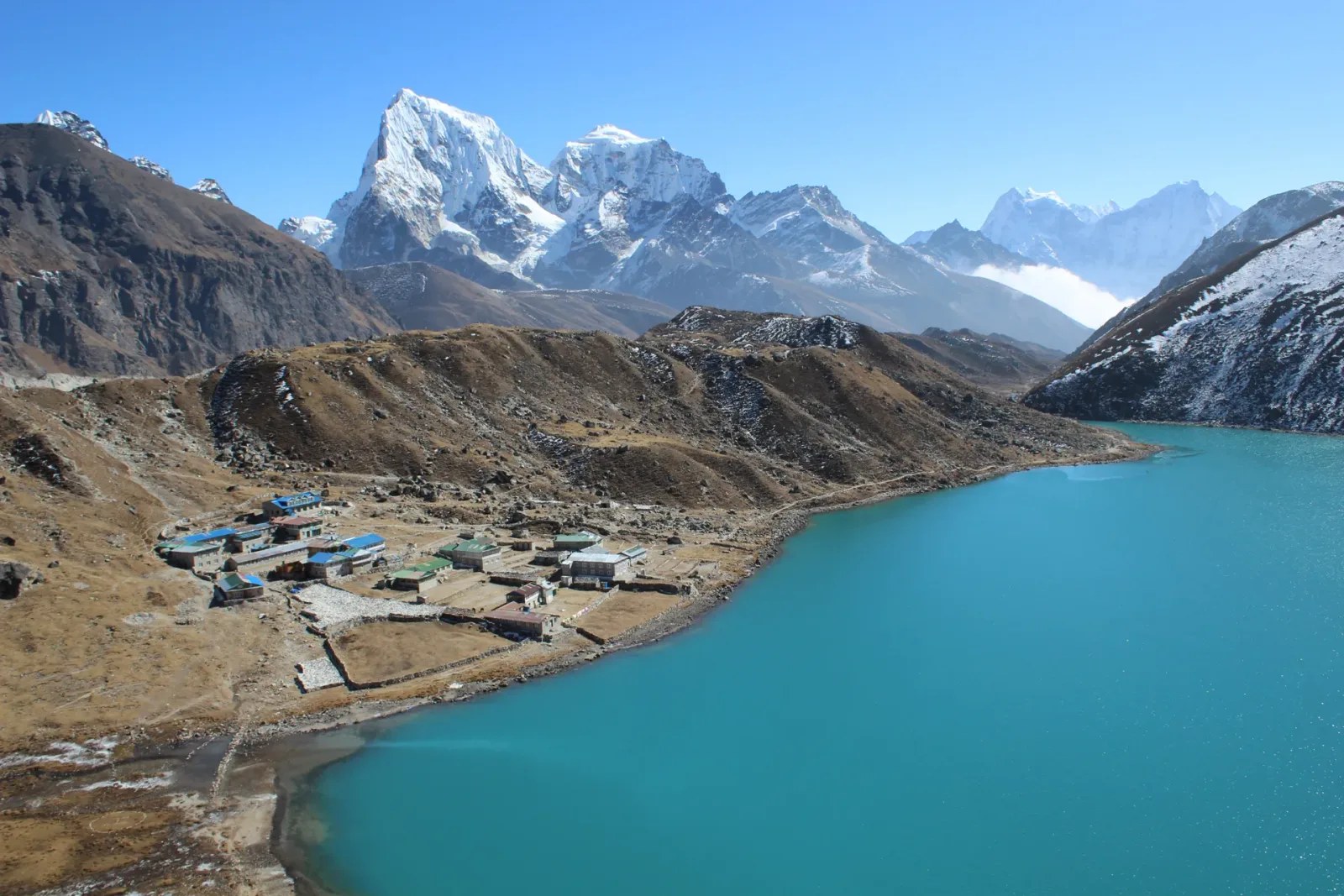
Gokyo Ri, also called Gokyo Peak, is why most people spend eight days walking to a village at 4,790m in the first place. It rises directly above Gokyo, non-technical the entire way, at 5,357m. The climb is short by Himalayan standards. Short does not mean easy in the cold, before dawn, at that altitude. What follows is the climb itself: when to leave, what the trail does underfoot, how long it takes and why nobody agrees on that number, and what to do if you decide not to go. For the wider trek, the lakes and the full itinerary, see our Gokyo Valley Trek guide.
What time to leave, and why guides disagree
Most guides leave Gokyo between 4:00 and 4:45am. That forty-five minute window is not guesswork. It's guides building in a buffer for three variables they can't control the night before: how fast the group moves once they're on the rock, whether the upper trail has ice, and what time the sun is going to break the ridgeline that particular week.
Sunrise at Gokyo shifts through the trekking season. In October the sun clears the horizon a little after six. By late December it is closer to seven. On the summit the useful light arrives later than either of those times, because the Everest massif sits directly east and the sun has to climb over it before it reaches you. Guides who know the current month count backward from that. If the summit is a 2.5-hour climb, and the group needs 20 minutes on top before the light gets good, the math sets the departure time. It's arithmetic, not superstition, and it's why a guide who says 4:15 in October might say 4:45 in December.
The other variable is you. A fast-moving group can leave later and still make it. A group with mixed fitness, or trekkers still working through the last of a mild headache from altitude, needs the padding. We build extra time into the schedule on purpose. Standing at 5,357m for sunrise is worth almost nothing if half the group is still 200m below when the light turns.
The trail underfoot
The trail leaves from the north end of Gokyo, right at the edge of the village, with no approach walk required. For the first stretch it's a packed dirt path, switchback-free, climbing steadily without demanding much technique. This part is where legs still half asleep at 4am wake up.
After that the ground changes. The path gives way to a rockier ridge, marked by scattered stone cairns rather than one obvious line, and the gradient steepens. There's no scrambling yet, just steady, lung-testing climbing on uneven footing.
The final push is the part that earns Gokyo Ri its reputation. Roughly the last 200m of elevation gain is loose rock and small ledges, not a scramble that needs hands on rock constantly, but enough that trekking poles become less useful and foot placement matters more. It's also where the false-summit problem shows up: several rises along this stretch look like the top from below and aren't. Trekkers who don't know to expect this sometimes think they've arrived, only to see another ridge still above them.
Ice and microspikes in winter and early spring
In October and November the trail is dry, and most trekkers do the whole thing in sturdy boots with nothing extra. From December through February, and again in early March before the trail dries out, the upper section can carry a layer of ice, especially where the trail crosses shaded rock the sun hasn't reached yet. Microspikes aren't part of the standard packing list for the autumn window, but they earn their weight in winter. A trekking pole helps more on the descent than the ascent, where loose rock underfoot on tired legs is the bigger risk.
How long it actually takes, and why estimates vary
Ask five different sources how long the climb to Gokyo Ri takes and you'll get five different numbers. Guidebooks and other operators put it anywhere from two to three hours, some as tight as two hours for a fast group, others stretching past three. None of them explain why the range is that wide, so here's why.
Altitude gain from Gokyo village to the summit is roughly 570m, covered in about two kilometers of trail. That's steep by trekking standards, and how your body handles it on this particular morning depends heavily on how acclimatization went over the previous eight days. A trekker who slept well at Machhermo and handled the altitude cleanly moves differently than one still shaking off a mild headache from two days before.
Trail conditions move the number too. Dry rock in October lets groups move at a steady, unbroken pace. Ice on the upper section in winter slows everyone down, sometimes by 30 minutes or more, because careful foot placement replaces momentum. Group size matters in a way that's easy to underestimate: the final loose-rock stretch narrows to single file in places, so a group of eight bunches up behind its slowest member in a way a pair of trekkers never does.
Then there's the false-summit problem from the section above. Trekkers who mistake an early rise for the top sometimes stop, take photos, and start back down, not realizing the actual summit sits another ten or fifteen minutes higher. That shortens some reported times for reasons that have nothing to do with fitness.
Two to three hours up is a reasonable planning figure. The descent is faster, usually an hour to an hour and a half, though loose rock on tired legs after a summit push is its own kind of slow.
Sunrise timing and the light window
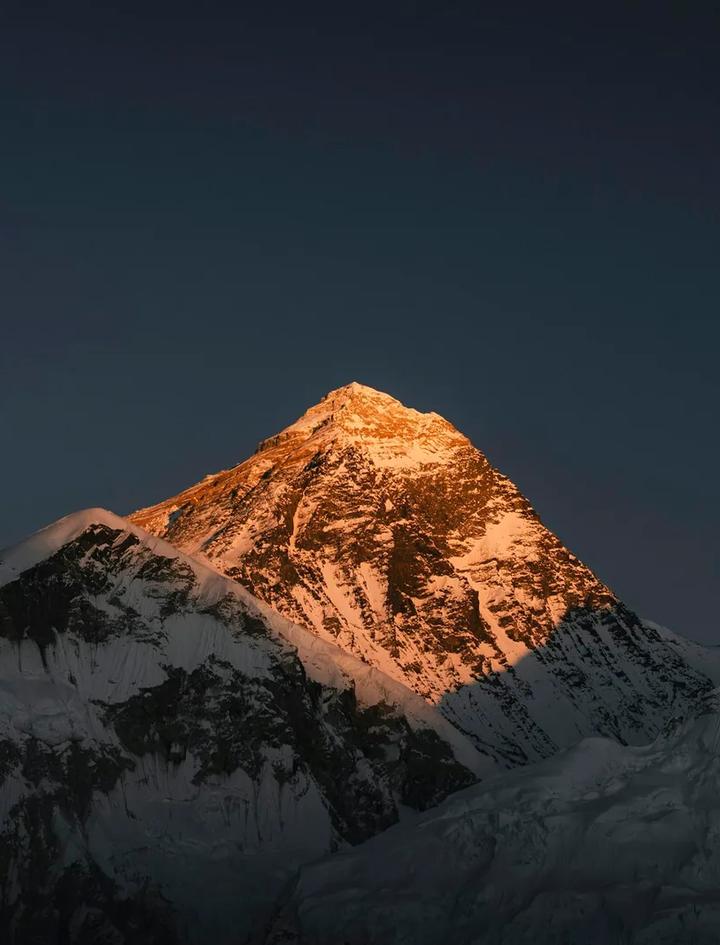
The light doesn't arrive all at once. First the sky pales behind the eastern ridge, then a thin band of gold appears along the highest points, Everest's west face catching it before anything else around it. For a few minutes only the very top of the mountain is lit while everything below stays blue-grey. Then the light drops down the mountain, reaching Lhotse, sweeping across the glacier, and finally hitting the lakes far below.
That good window, the ten or fifteen minutes when the mountains are gold and the shadows are long, doesn't last. Within thirty to forty minutes the light has flattened into ordinary daylight, and the photographs stop looking like anything special. Trekkers who arrive at the summit even ten minutes late for this window still get a clear view. They just don't get the photograph everyone else got.
Wind tends to pick up as the light changes, which is worth knowing before you plan to linger. Arriving with ten minutes to spare beats sprinting the last stretch to beat sunrise exactly.
Cold and wind at the summit
Gokyo Ri in the dark, before the sun clears the ridge, is cold in a way the rest of the day's trekking isn't. Temperatures at the summit before dawn commonly sit well below freezing, and the open, exposed top has nothing to block wind coming off the glacier. Once the sun hits, the temperature climbs fast, sometimes 15 to 20 degrees within the hour, which catches people out in both directions: too many layers for the climb up, too few for the twenty minutes of standing still at the top waiting for the light.
The climb itself generates heat. Standing still at 5,357m before sunrise does not. A down jacket, warm hat, and gloves you can still take photographs in are not optional extras here. They're the difference between watching sunrise and thinking about nothing but your hands. A buff or neck gaiter over the face cuts the windchill on the exposed final stretch.
Layer for the temperature swing, not for the climb alone. Most trekkers overheat on the way up in a down jacket they only needed for the summit itself. A warm base layer and a light shell work better for the ascent, with the down jacket staying in the pack until you stop moving. Fingers and toes go numb faster than the rest of the body at this altitude, so a spare pair of dry liner gloves for the summit itself is worth the extra weight in your daypack. For a full rundown of cold-weather gear for the whole trek, our high-altitude packing list covers what to bring beyond this one morning.
The view, briefly
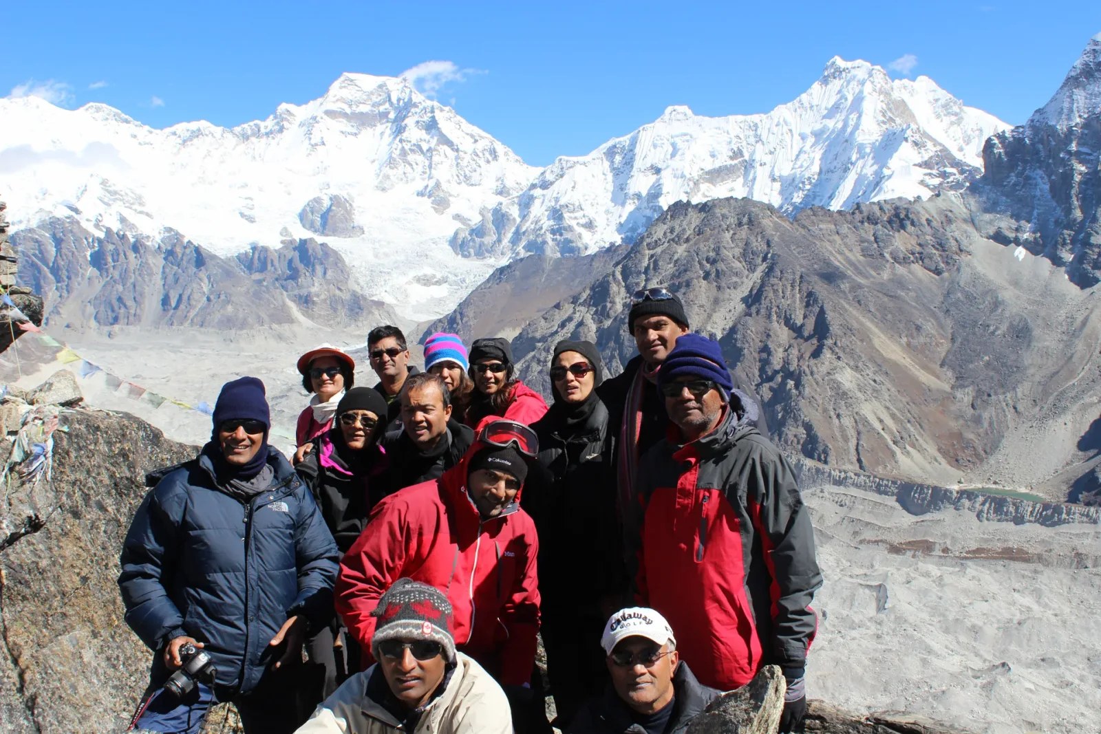
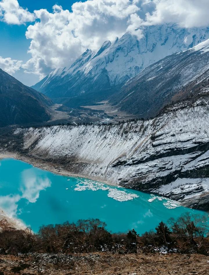
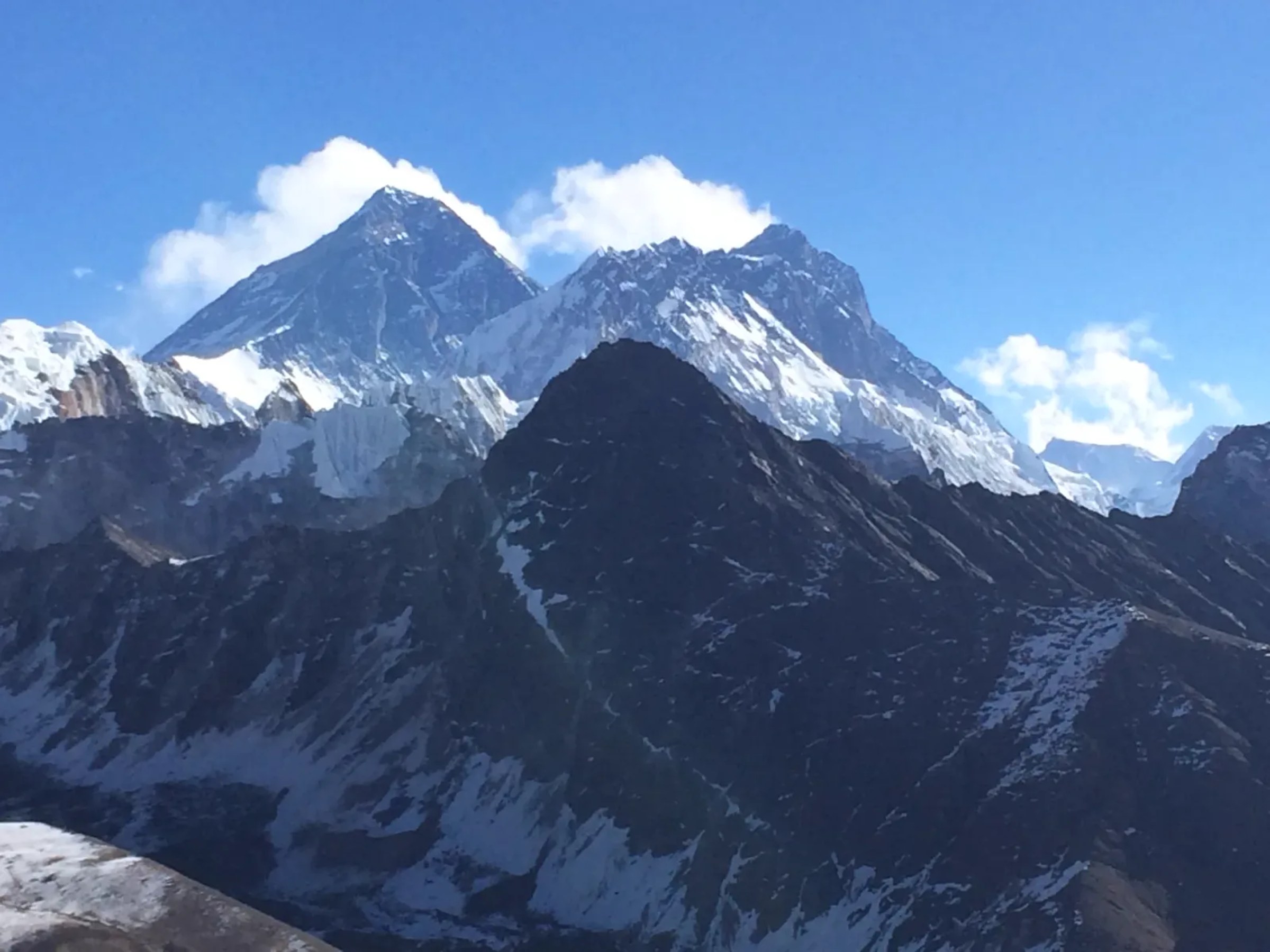
The reason for all of this: four peaks over 8,000m are visible from one non-technical summit, Everest among them, along with the Ngozumpa Glacier and the turquoise lakes below. We've covered the full breakdown of which peaks, from which direction, and how Gokyo Ri compares to Kala Patthar in our Gokyo Valley Trek guide. This article is about getting there, not what you see once you're standing on top.
One thing worth saying here: prayer flags mark the true summit, strung between the cairns, and they're usually the first thing that comes into focus once there's enough light to see color again.
Who should skip the climb, and what they do instead
Not everyone should do this climb, and saying so plainly is more useful than pretending otherwise. Trekkers with active altitude sickness symptoms, even mild ones like a persistent headache or poor sleep the night before, are better off resting. Gokyo Ri adds real strain right at the point in the trek when your body is working hardest to adjust, and pushing through symptoms here is exactly the wrong moment to test your limits.
Exhaustion is a legitimate reason too, separate from illness. Eight days of trekking before a 4am start is a lot, and some trekkers simply arrive at Gokyo running on empty. There's also a smaller, less discussed reason: some people just don't want a 4am start, cold hands, and a summit crowded with headlamps. That's a fine reason on its own.
Your guide is the person best placed to make this call with you, not for you. Tell them honestly how you slept, whether your appetite has held up, and whether yesterday's walk into Gokyo felt harder than it should have. A guide who has watched you for eight days can usually tell the difference between normal fatigue and something worth taking seriously, and a good one will say so before you're standing at the trailhead in the dark deciding on your own.
None of this means missing out on Gokyo entirely.
The alternative: fourth lake, fifth lake and Scoundrel's Viewpoint
From Gokyo, a trail runs north along the edge of the Ngozumpa Glacier to the fourth lake, Thonak Tsho, and beyond it to the fifth, Ngozumpa Tsho. It's a full-day walk on relatively gentle ground compared to the summit scramble, with no pre-dawn start required and no loose-rock final push. You can leave after breakfast.
The fourth and fifth lakes sit higher and further from the crowds than the first three, and the walk between them runs alongside the glacier instead of above it, which gives a different kind of view: ice and moraine at eye level instead of a panorama from 570m up. Trekkers who make it to the fifth lake are rewarded with some of the quietest scenery on the entire route, and the walk itself, four to five hours out and back at a relaxed pace, is a full day without ever feeling rushed.
Scoundrel's Viewpoint, a lower rise near the fifth lake, offers a wide panorama of Cho Oyu and the upper glacier without the elevation gain or technical footing Gokyo Ri demands. It's a legitimate alternative for trekkers managing altitude symptoms, recovering from a rough night, or simply choosing a gentler day. The mountains don't disappear because you didn't wake up at four in the morning for them.
This day trip adds time to the standard itinerary. Discuss it with your guide before you leave Kathmandu so it's built into your schedule from the start, instead of squeezed in at the last minute once you're already at Gokyo.
Fitness for summit day
The wider Gokyo Valley trek is rated moderate, and we've written separately about what that difficulty involves across the full 14-day itinerary. Summit day itself is narrower and more specific: one steep push, gaining roughly 570m in two to three hours, at the highest altitude of the entire trek, before the body has had breakfast or full daylight to work with.
Cardiovascular fitness built before the trip matters more here than raw hiking experience. If you can climb steadily uphill for two to three hours without stopping every few minutes, carrying only a light daypack, you're prepared for the physical demand. What training can't fully prepare you for is the altitude itself, which is why the two acclimatization days earlier in the itinerary matter as much as any gym session at home.
Breathing rate is the honest measure of how your body is coping, more than leg fatigue. On the lower stretch of the trail, most trekkers can hold a conversation. By the final loose-rock section, most can't, and that's normal at 5,357m, not a sign anything is wrong. Slowing your pace to keep breathing steady, instead of pushing to match a faster hiker ahead of you, is the single most useful thing you can do on the way up.
Trekkers continuing on to cross Cho La Pass afterward sometimes treat Gokyo Ri as a rehearsal for a bigger day ahead. Our Gokyo Cho La Pass guide covers what that extension adds to the trip.
By the time you're back down at Gokyo, the rest of the village is just waking up. Breakfast is waiting, and so is a full day of walking still ahead. The climb that felt enormous in the dark an hour earlier is already becoming one of those mornings you describe to people back home in far fewer words than it deserves.
We run the Gokyo Valley Trek as a 14-day guided itinerary with two built-in acclimatization days ahead of the Gokyo Ri push. For what the trip costs beyond the summit morning, see our Gokyo trek cost breakdown.
Frequently Asked Questions
How long does it take to climb Gokyo Ri?
Two to three hours up from Gokyo village, with the descent taking about an hour to an hour and a half. The range depends on trail conditions, group size, and how the previous days of acclimatization went. Ice on the upper section in winter can add 30 minutes or more.
What time should you start the climb to Gokyo Ri?
Most guides leave Gokyo between 4:00 and 4:45am, timed backward from sunrise so the group reaches the summit with a few minutes to spare before the light turns. Sunrise shifts through the season, arriving earlier in October and later into December, so the exact departure time changes month to month.
How cold is it on top of Gokyo Ri?
Well below freezing before dawn, with wind exposure on the open summit adding to the chill. Temperatures climb quickly once the sun clears the ridge, sometimes 15 to 20 degrees within the hour, so the cold at the top is sharper and shorter-lived than it feels while you're standing in it.
What can you do instead of climbing Gokyo Ri?
Walk north from Gokyo along the Ngozumpa Glacier to the fourth and fifth lakes, and on to Scoundrel's Viewpoint. It's a full-day walk on gentler ground, with no pre-dawn start and no loose-rock scramble, and it still delivers a genuine high-altitude panorama.
Is Gokyo Ri or Gokyo Peak the correct name?
Both refer to the same 5,357m summit above Gokyo village. Gokyo Ri is the more commonly used name on maps and in most guiding literature, and Gokyo Peak shows up often enough in casual use and search that either name gets you to the same place.