Manaslu Circuit Trek
Mountain Hawk Trek
Manaslu RegionStrenuous

Manaslu CircuitTrek

15-day Manaslu Circuit Trek crossing Larkya La Pass at 5,106m through Nepal's restricted Gorkha district. From $1,675 all-inclusive.

View Itinerary
Trusted by 500+ trekkers on these trails
Trip Highlights

The moments that matter most

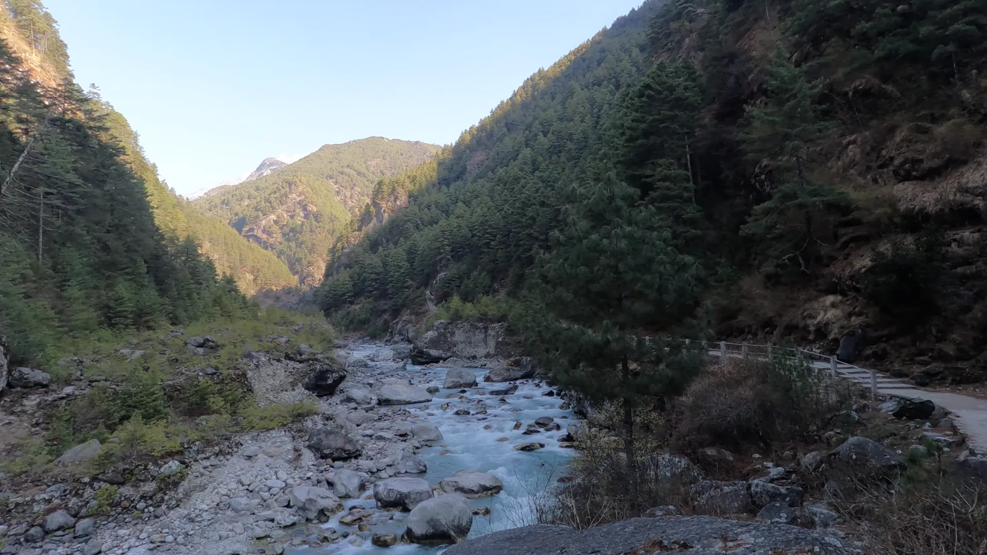
The first three days of the Manaslu Circuit follow the Budhi Gandaki river through one of the deepest gorges in Nepal. The trail begins at Soti Khola (700m) and climbs to Jagat (1,340m). The trail is narrow, carved into cliff faces in places, and crosses the river on suspension bridges that swing 30 to 50 meters above the water. Bamboo and sal forest close in from both sides. Waterfalls drop directly onto the path after rain. At Machha Khola (870m), teahouse owners cook dinner on wood-fired stoves while the river drowns out conversation. The gorge section feels nothing like the open valleys that come later. It is subtropical, humid, and green, a different planet from Larkya La at 5,106m twelve days later.

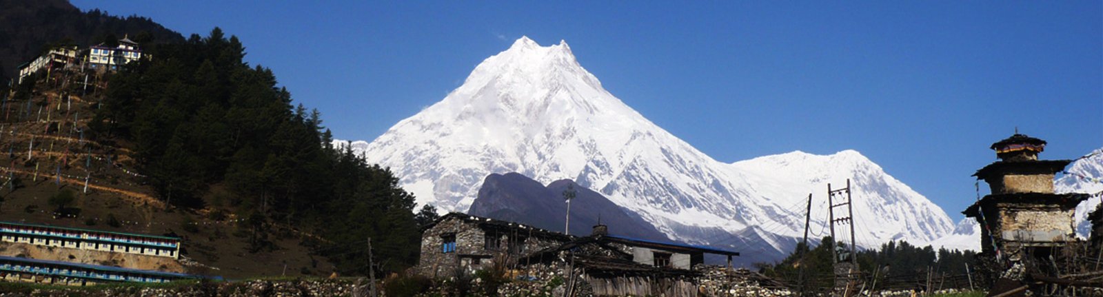
Above the Jagat checkpoint (1,340m), the Budhi Gandaki valley opens and the culture shifts from Hindu lowlands to Tibetan Buddhist highlands. Mani walls, some 50 meters long, line the trail between Deng (1,860m) and Namrung (2,630m). Prayer flags stretch between rooftops. At Lho (3,180m), a monastery sits on a ridge directly opposite Manaslu's north face, close enough that the glacier above Samagaon is visible in detail from the courtyard. Samagaon (3,530m) is the largest village on the circuit, with roughly 400 residents, a small school, and a gompa whose monks still conduct daily puja. Samdo (3,860m), two days further, sees yak caravans headed for the Larkya Bazaar trading post near the Tibet border. No bakeries, no gear shops, no wifi that works past sunset.

Larkya La Pass at 5,106m is the high point of the Manaslu Circuit and the reason the trek is rated moderate to strenuous rather than moderate. The climb from Dharamsala (4,460m) gains 650m over frozen rock, and the first two hours are walked in total darkness with headlamps. At the pass, the view opens west to Himlung Himal (7,126m), Cheo Himal (6,820m), and Kang Guru (6,981m), with Annapurna II rising beyond. The descent to Bimtang (3,720m) drops 1,400m on loose scree, taking three to four hours. Oxygen at the summit sits near 50% of sea level. Trekkers who have crossed both Larkya La and Thorong La consistently rank this day as the harder one, despite Larkya La sitting 310m lower than the Annapurna Circuit pass.

Samagaon's acclimatization day is not a rest day in the lazy sense. Most groups hike to Birendra Lake at 3,691m, a glacial pool fed by meltwater off the Manaslu Glacier, roughly 3km from the village and 120m higher. The water is still enough in the early morning to reflect Manaslu's summit before wind picks up. Stronger walkers head toward Pungyen Gompa at approximately 4,000m, a 15km round trip through yak pastures alongside the glacier, with some of the best close-range views of Manaslu's north face on the circuit. Both options follow the climb-high-sleep-low principle: gain altitude during the day, descend to sleep at 3,530m. This day prevents altitude sickness. Skip it and the pass gets harder.

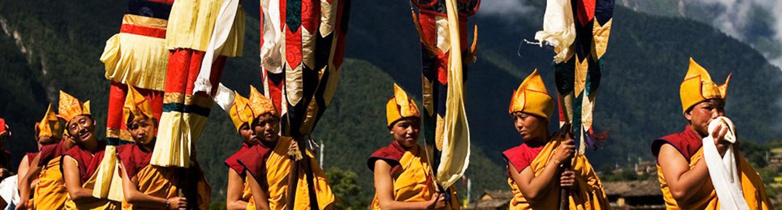
The Manaslu region above Jagat belongs culturally to Tibet, not to the Nepali lowlands. Villagers at Lho, Samagaon, and Samdo speak a Tibetan dialect, raise yaks, and maintain gompas that predate the arrival of trekkers. Samagaon's monastery holds multi-day festivals during Losar (Tibetan New Year, usually February), and village life at Samdo still revolves around seasonal yak migration rather than trekking season. The mani walls between Deng and Namrung are among the longest on any Nepal trek, with carved stones piled for generations. Above 3,000m, the architecture shifts from stone and slate to flat-roofed Tibetan-style houses with firewood stacked on the roof. These are working communities that happen to sit on a trekking route.

The Manaslu Circuit ends at Dharapani (1,860m), where the trail meets the Annapurna Circuit in the Marsyangdi river valley. From Dharapani, a jeep road runs to Besisahar and then to Kathmandu, roughly 10 to 12 hours by vehicle. Trekkers with time and permits can continue west on the Annapurna trail toward Chame, Manang, and Thorong La, turning the Manaslu Circuit into a combined 22 to 25 day route. The Dharapani junction also makes it possible to end in Pokhara instead of Kathmandu, three hours closer by road. The descent from Bimtang (3,720m) to Dharapani passes through Gho and Tilje, small villages where the Tibetan highland feel fades back into Hindu valley culture over the course of a single afternoon.

Trip Overview

A closer look

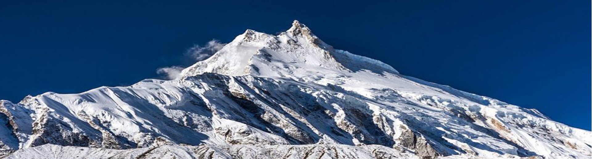
The Manaslu Circuit Trek is a 15-day teahouse trek that circles Mount Manaslu (8,163m), the world's eighth highest peak, through the Gorkha district of western Nepal. The route follows the Budhi Gandaki river upstream from Soti Khola at 700m, climbs through Tibetan Buddhist villages, and crosses Larkya La Pass at 5,106m before dropping to Dharapani at 1,860m. Manaslu sits inside a restricted area. Only 12,512 foreign trekkers completed the circuit in the 2024/25 season, a fraction of the traffic on the Everest Base Camp trek or the Annapurna Circuit. For a full breakdown of the route, culture, and logistics, read the Manaslu Circuit Trek complete guide.

The trail starts at Soti Khola (700m), where the Budhi Gandaki river cuts through a subtropical gorge thick with sal and bamboo. Over the first four days, trekkers pass through Machha Khola (870m) and Jagat (1,340m), where a checkpoint marks the entrance to the restricted zone and the cultural border shifts. Above Jagat, the valley opens into Tibetan Buddhist territory. Mani walls line the trail between Deng (1,860m) and Namrung (2,630m). Gompas dot the hillsides at Lho (3,180m), where a monastery faces Manaslu's north face across a narrow valley. Samagaon (3,530m), the largest village on the circuit, sits below Birendra Lake, a glacial pool 3km from town that most groups visit on their acclimatization day. All trekkers entering the Manaslu Conservation Area need three permits, processed through a registered agency.

Larkya La at 5,106m is the single hardest day on the circuit and one of the most demanding pass crossings in Nepal. Trekkers leave Dharamsala (4,460m) between 3am and 4am, walking the first two hours in the dark on frozen ground. The climb gains roughly 650m over rocky terrain that can hold packed snow or ice depending on the season. The descent to Bimtang (3,720m) drops nearly 1,400m on loose scree and moraine, harder on the knees than the ascent was on the lungs. Total day length runs 8 to 10 hours with no teahouse or shelter between Dharamsala and Bimtang. Temperatures at the summit drop to minus 10 to minus 20 Celsius in October. Two acclimatization stops, at Samagaon (3,530m) and Samdo (3,860m), build the altitude tolerance needed for this crossing. Read the full altitude sickness guide before booking.

Three permits are required for the Manaslu Circuit in 2026. The Manaslu Restricted Area Permit (RAP) costs $100 per person for the first seven days in peak season (September to November), then $15 per additional day. Off-season rates drop to $75 for the first week and $10 per extra day. The Manaslu Conservation Area Permit (MCAP) and the Annapurna Conservation Area Permit (ACAP, needed because the trail exits through Dharapani into ACAP territory) each cost NPR 3,000, roughly $22. A licensed guide from a registered trekking agency is mandatory by law. Since March 2026, solo trekkers can apply individually for the RAP, ending the old two-person minimum rule. Only TAAN-registered agencies can file the paperwork. Full permit details, costs, and required documents are on the trekking permits page.

October is the best month for the Manaslu Circuit. The monsoon clears by mid-September, and stable high pressure over Gorkha district holds through November. Daytime temperatures at Samagaon (3,530m) sit around 12 to 15 Celsius in the sun, and Larkya La pass-day success rates are highest from early to mid-October. April is the second pick: rhododendrons bloom between Soti Khola and Deng, spring crowds thin out, and permit fees drop to off-season rates. Monsoon months (June to August) bring genuine risk. The Budhi Gandaki gorge between Machha Khola and Jagat has narrow, landslide-prone sections, and leeches populate the forest below 1,900m. Winter crossings (December to February) are possible but Larkya La can hold enough snow to require crampons or force a turn-back. Teahouses at Dharamsala sometimes close entirely in January and February.

Mountain Hawk Trek's Manaslu Circuit package starts at $1,675 per person, all-inclusive: licensed guide, porter, all three permits (RAP, MCAP, ACAP), teahouse accommodation, three meals a day on the trail, and private jeep transfers from Kathmandu to Soti Khola and from Dharapani back. Budget an extra $15 to $30 per day for wifi ($3 to $8 per night), hot showers ($2 to $6), device charging ($2 to $4), and boiled water ($1 to $3 per liter, rising with altitude). Tips for the guide and porter typically add $200 to $300 total. Compared to the Everest Base Camp trek, which runs $1,500 to $2,500 largely because of the $340+ Lukla flight, Manaslu lands roughly 30% cheaper once you account for that missing flight cost, even with the restricted area permit tacked on. The Annapurna Circuit costs $1,000 to $1,500 with cheaper permits but road traffic on up to 75% of its original route.

Trekkers with three or more weeks can extend the Manaslu Circuit in two directions. The Tsum Valley add-on branches off the main trail near Lokpa, adding 5 to 7 days through a sacred beyul valley with active monasteries at Rachen and Mu Gompa. Tsum requires its own restricted area permit on top of the standard three. For trekkers who want to keep walking after Larkya La, the trail meets the Annapurna Circuit at Dharapani (1,860m), making a combined Manaslu and Annapurna Circuit trek possible over 22 to 25 days. That combo crosses both Larkya La (5,106m) and Thorong La (5,416m) in a single trip. On the starting end, some groups now drive to Machha Khola (870m) instead of Soti Khola (700m). That cuts a full day of lower valley walking. The jeep road has pushed further each year, though the last stretch to Machha Khola is still rough.

Manaslu is what the Annapurna Circuit was 20 years ago, before roads reached 75% of its original route from both the Besisahar and Jomsom sides. Above Jagat, no road exists on the Manaslu trail. Everything, food, gas cylinders, building materials, still arrives by porter or mule train. The restricted area permit caps the number of trekkers: 12,512 in the 2024/25 season versus roughly 250,000 across the Annapurna Circuit network and 50,000 on the Everest Base Camp route. Villages like Lho, Samagaon, and Samdo remain primarily yak-herding and farming communities, not tourism economies with bakery strips and gear shops. For trekkers who have already done EBC or Annapurna and want a route that feels genuinely remote, the Manaslu Circuit is the most authentic multi-day circuit trek left in Nepal. The Langtang Valley is a shorter alternative at 7 to 10 days, but it does not cross a high pass and reaches only 3,870m at Kyanjin Gompa.

Route & Elevation

The trail, mapped

Elevation ProfileDay-by-day altitude
TrailPeak
5,106m4,005m2,903m1,802m700mKathmanduSoti KholaMachha KholaJagatDengNamrungLhoSamagaonSamdoDharamsalaLarkya La PassBimtangDharapaniKathmandu5,106m
Itinerary

Day by day, on the trail

15 days from Kathmandu arrival to departure. Hover any day for full details.

Day01

Arrival in Kathmandu

Kathmandu

Arrive at Tribhuvan International Airport. Mountain Hawk Trek transfers you to your hotel in Thamel by private vehicle. Use the afternoon for a trek briefing at the office, final gear checks, and permit processing. The agency needs your passport with visa sticker to file the Manaslu Restricted Area Permit, which takes a minimum of two working days. Exchange currency and withdraw enough Nepali rupees for the trek, as there are no ATMs past Kathmandu on this route. Thamel rental shops stock sleeping bags, down jackets, and trekking poles at $1 to $3 per day.

1,345mHotel
Day02

Drive Kathmandu to Soti Khola

Soti Khola

Early morning departure by private jeep heading west through Dhading and Gorkha to the Budhi Gandaki river valley. The road is paved to Arughat, then turns rough and unsealed for the final stretch to Soti Khola, roughly 141km total. The drive takes 7 to 8 hours by jeep, 9 to 10 by local bus. Soti Khola sits at 700m on the riverbank, the lowest point of the trek. A handful of teahouses serve dal bhat and noodle soup. The sound of the Budhi Gandaki rapids carries through every room.

700m8h trekTeahouse645m
Day03

Soti Khola to Machha Khola

Machha Khola

The first trekking day follows the Budhi Gandaki upstream through a narrow gorge. The trail crosses the river on suspension bridges, climbs over rocky outcrops, and passes through stands of sal forest. Waterfalls drop across the path in a few spots, especially after recent rain. The route gains only 170m over the full day, but the terrain is rough and uneven, with sections carved into cliff faces that keep the pace honest. Machha Khola is a small settlement on the riverbank. Teahouses here are simple, two or three lodges with wood-fire kitchens. Walking distance: approximately 15 to 18km.

870m6h trekTeahouse170m
Day04

Machha Khola to Jagat

Jagat

The trail continues through the gorge with more elevation gain, climbing 470m from Machha Khola to Jagat. The path passes through Khorlabesi (970m) where natural hot springs sit beside the river, worth a 15-minute soak if time allows. Above Tatopani, the gorge narrows and the trail switches between forested hillside and exposed rock. Jagat (1,340m) marks the entrance to the Manaslu Conservation Area. The checkpoint here verifies your RAP, MCAP, and ACAP permits, and your guide's license. This is the cultural border: Hindu lowlands below, Tibetan Buddhist highlands above. Walking distance: approximately 16 to 20km.

1,340m7h trekTeahouse470m
Day05

Jagat to Deng

Deng

Above Jagat the valley opens and the first mani walls appear along the trail. The route passes through Salleri and Philim (1,590m), a larger village with a second permit checkpoint. The trail descends briefly to a riverside section before climbing to Deng at 1,860m, a village of fewer than a dozen buildings in a narrow side valley. The transition from Hindu to Tibetan architecture is visible here: flat roofs, firewood stacked in rows, prayer flags strung between structures. Above Deng the gorge deepens again with cliff-side trail sections. Walking distance: approximately 14 to 17km. Elevation gain: 520m.

1,860m6h trekTeahouse520m
Day06

Deng to Namrung

Namrung

One of the harder days in the first week. The trail climbs 770m from Deng to Namrung through a series of forest switchbacks and river crossings. Ghap (2,160m) is the mid-day stop, a small village with a gompa and a waterfall visible from the teahouse patio. Above Ghap, rhododendron and birch forest thickens and the air begins to feel noticeably different. Namrung (2,630m) is a farming village with stone houses, barley fields, and views of Peak 29 (Ngadi Chuli, 7,871m) to the east. The altitude jump on this day catches some trekkers off guard, especially those who skimped on hydration in the gorge. Walking distance: approximately 12 to 15km.

2,630m7h trekTeahouse770m
Day07

Namrung to Lho

Lho

A shorter day, deliberate in its pacing as altitude gains start to add up. The trail climbs through Lihi (2,920m) and Sho (2,950m) before reaching Lho at 3,180m. Lho is one of the most scenic stops on the circuit: a monastery sits on a ridge with Manaslu's north face directly across the valley, close enough that you can watch avalanches calve off the glacier on a warm afternoon. The gompa is active and open to visitors. Lho has two or three teahouses, small and basic. From this point onward, expect limited menus (dal bhat, thukpa, noodle soup, porridge) and colder rooms. Walking distance: approximately 8 to 10km. Elevation gain: 550m.

3,180m5h trekTeahouse550m
Day08

Lho to Samagaon

Samagaon

A relatively short day to keep altitude gains moderate before the acclimatization stop. The trail passes through Shyala (3,500m), a small Tibetan hamlet with a few lodges, before arriving at Samagaon (also spelled Sama, 3,530m). Samagaon is the largest settlement on the circuit, with roughly 400 residents, a school, a gompa, and four or five teahouses. The village sits below the Manaslu Glacier with Birendra Lake visible 3km up the valley. This is the last village with anything resembling reliable wifi. Charge all devices here. Walking distance: approximately 7 to 9km. Elevation gain: 350m.

3,530m5h trekTeahouse350m
Day09

Samagaon acclimatization day

Samagaon

A rest day that is not a rest day. The standard morning hike goes to Birendra Lake at 3,691m, a glacial pool fed by the Manaslu Glacier, roughly an hour each way at a relaxed pace with 120m of elevation gain. The lake surface reflects Manaslu's summit in the early morning before wind picks up. For stronger walkers, the alternative is Pungyen Gompa at approximately 4,000m, a 15 to 16km round trip (5 to 6 hours) through yak pastures with close-up views of Manaslu's north face. Both options follow climb-high-sleep-low: gain altitude during the day, return to sleep at 3,530m. The guide checks pulse oximeter readings in the evening and assesses readiness to continue.

3,530m4h trekTeahouse
Day10

Samagaon to Samdo

Samdo

A deliberately short day. The trail from Samagaon climbs gradually along the valley past a few scattered stone shelters and yak pastures. Samdo (3,860m) sits near the Tibet border, a two-street village of flat-roofed stone houses where yak caravans still arrive from the Larkya Bazaar trading post. The village has two teahouses. Wifi does not reach here. Phone signal is gone. Nights at Samdo drop to minus 8 to minus 12 Celsius in October. This is the last settlement with a real kitchen before Dharamsala, where the menu shrinks to a handful of items cooked on a single kerosene stove. Walking distance: approximately 6 to 8km. Elevation gain: 330m.

3,860m4h trekTeahouse330m
Day11

Samdo to Dharamsala (Larkya Base Camp)

Dharamsala

The trail climbs steadily from Samdo through open, treeless terrain, gaining 600m to reach Dharamsala, also called Larke Phedi or Larkya Base Camp. Dharamsala has only two guesthouses (Jambala Lodge and the community-run Larke Phedi lodge) and both run dorm-style rooms when 20 to 30 trekkers arrive on the same evening in peak season. Toilets are outside, squat-style. There is no shower. Charging is limited to a few hours of solar power. The guide holds a group briefing for the pass crossing: 3 to 4am wake-up, headlamp, layering system, water supply, and pace expectations for the 8 to 10 hour day ahead. Walking distance: approximately 8 to 10km. Elevation gain: 600m.

4,460m5h trekTeahouse600m
Day12

Dharamsala to Bimtang via Larkya La Pass (5,106m)

Bimtang

The defining day of the Manaslu Circuit. Depart Dharamsala between 3am and 4am in the dark, wearing full cold-weather layers and headlamp. The climb to Larkya La (5,106m) takes 4 to 5 hours over rocky, sometimes icy terrain. Temperatures at the pass run minus 10 to minus 20 Celsius before sunrise. At the top, the view opens west to Himlung Himal (7,126m), Cheo Himal (6,820m), Kang Guru (6,981m), and Annapurna II beyond. The descent to Bimtang (3,720m) drops 1,386m on loose scree and moraine over 3 to 4 hours. The knees take more punishment on the way down than the lungs did on the way up. Bimtang is a high meadow with two teahouses, surrounded by 6,000m and 7,000m peaks. Walking distance: approximately 15 to 24km. Total elevation change: +646m, -1,386m.

3,720m10h trekTeahouse740m
Day13

Bimtang to Dharapani

Dharapani

A long descent day, dropping nearly 1,860m from Bimtang to Dharapani. The trail passes through Gho (2,560m) and Tilje (2,300m), small villages where the Tibetan highland feel gives way to Hindu valley culture. Rhododendron and pine forest returns. The path meets a rough jeep road near Dharapani, where the Manaslu Circuit joins the Annapurna Circuit route in the Marsyangdi river valley. At Dharapani the air is warm, thick with oxygen, and the effort of breathing at altitude is suddenly gone. Teahouses here have better menus, warmer rooms, and hot showers. Walking distance: approximately 18 to 22km.

1,860m8h trekTeahouse1,860m
Day14

Drive Dharapani to Kathmandu

Kathmandu

Morning departure by private jeep from Dharapani through Besisahar to Kathmandu, roughly 10 to 12 hours on a mostly unsealed road. The drive follows the Marsyangdi river downstream before joining the highway. Some trekkers prefer to break the drive at Besisahar or Pokhara. Arrive in Kathmandu in the late evening. Transfer to your hotel. The city feels loud, crowded, and wonderful after two weeks above 2,000m.

1,345m12h trekHotel515m
Day15

Departure

Kathmandu

Transfer to Tribhuvan International Airport by private vehicle for your departure flight. The drive from Thamel to the airport takes 20 to 40 minutes depending on traffic. If your flight departs in the afternoon, there is time for Boudhanath Stupa (a 20-minute drive), Swayambhunath (Monkey Temple), or a final walk through Thamel. End of trek services.

1,345mTransfer
Good to Know

Before you commit

Trek Cost

TierPrice
Per Person
USD 1,675
Package Details

What's in, what's out

What's Included

10

Airport pickup and drop-off by private vehicle in Kathmandu

2 nights hotel accommodation in Kathmandu with breakfast

Private jeep transfer from Kathmandu to Soti Khola (or Machha Khola) and Dharapani to Kathmandu

All three permits: Manaslu Restricted Area Permit (RAP), Manaslu Conservation Area Permit (MCAP), and Annapurna Conservation Area Permit (ACAP)

Licensed English-speaking trekking guide (government-certified, TAAN-registered)

One porter per two trekkers (carries up to 15kg per person)

Teahouse accommodation for all nights on the trek

Full board meals on trek: breakfast, lunch, and dinner daily

First aid kit carried by guide including pulse oximeter

All applicable government taxes and service charges

Not Included

8

International airfare to and from Kathmandu

Nepal tourist visa fee ($50 for 30 days on arrival)

Travel insurance with helicopter evacuation coverage to 5,500m (mandatory)

Personal trekking gear (sleeping bag, down jacket, boots, trekking poles; rentable in Thamel)

Wifi, hot showers, device charging, and boiled/bottled water on the trail ($15-30/day)

Alcoholic and soft drinks

Tips for guide ($10-15/day) and porter ($8-10/day)

Personal expenses, souvenirs, and any costs arising from itinerary changes due to weather, natural disaster, or other factors beyond the agency's control

Add-on

Extra Nights in Kathmandu

Single Room$60per night · breakfast included
Twin Sharing$35per person / night · breakfast included

Dear guest, should you require additional accommodation in Kathmandu, we are pleased to offer the following rates: US$60 per person per night for a single room and US$35 per person per night for a double (twin sharing) room, both inclusive of breakfast.

The Reward

Why you'll love it

Three reasons this trek stays with you long after the plane home.

Scenery

Mountain Hawk Trek processes all three Manaslu permits (RAP, MCAP, ACAP) through its Kathmandu office, typically within two working days of receiving the trekker's passport. The agency is registered with the Nepal Tourism Board and a member of TAAN, one of the requirements for filing a Manaslu Restricted Area Permit. Since March 2026, solo trekkers can apply individually, and Mountain Hawk Trek handles the updated paperwork under the new rules.

Thrill

Every Manaslu departure includes a licensed guide who has walked this specific route before, not a general-purpose city guide reassigned from Kathmandu. The guide carries a pulse oximeter and checks SpO2 readings twice daily from Samagaon (3,530m) onward. On Larkya La pass day, the guide wakes the group at 3am, manages the pace across the 5,106m crossing, and makes the call on whether to proceed or wait if weather deteriorates at Dharamsala. Porters carry up to 15kg per trekker in a duffel, leaving the trekker with a 5 to 8kg daypack.

Connection

The 15-day itinerary builds in two acclimatization days, not one. The first rest day at Samagaon (3,530m) includes a side hike to Birendra Lake at 3,691m or toward Pungyen Gompa at 4,000m, following the climb-high-sleep-low principle. The second comes at Samdo (3,860m) with a shorter walk toward the Tibet border. Trekkers who skip rest days or compress the schedule to 12 or 13 days run significantly higher altitude sickness risk. Mountain Hawk Trek does not offer shortened itineraries that cut both acclimatization stops.

Honest Check

Is this trek for you?

A few things worth knowing before you commit. No sugar-coating, no surprises on day one.

Expectations

Before you book

7

The Manaslu Circuit involves 5 to 7 hours of walking per day for 12 trekking days, with one day stretching to 8 to 10 hours for the Larkya La crossing at 5,106m. Prior multi-day trekking experience above 3,000m is recommended, though fit beginners who train for 12 to 16 weeks can complete the route. A training base of consecutive 5 to 6 hour hikes with a 6 to 8kg pack is a reliable readiness indicator.

The highest sleeping altitude is 4,460m at Dharamsala (Larkya Base Camp), and the pass itself reaches 5,106m. Roughly 25 to 50% of trekkers on comparable passes experience mild AMS symptoms. Altitude sickness risk depends on acclimatization, hydration, and pace, not fitness level alone.

Temperatures at Dharamsala drop to minus 15 to minus 20 Celsius on clear October nights. Larkya La summit temperatures hit minus 10 to minus 20 Celsius before sunrise. A sleeping bag rated to at least minus 15 Celsius (minus 20 preferred) and a down jacket rated to minus 15 Celsius are not optional. Most gear can be rented in Kathmandu's Thamel district for $1 to $3 per day per item.

Teahouses above Samagaon (3,530m) are basic: shared rooms, squat toilets, limited electricity, no showers at Dharamsala. Wifi works intermittently up to Samagaon and drops out entirely past Samdo. Phone signal disappears for 3 to 4 days around the pass.

A licensed guide from a TAAN-registered agency is legally required. This is enforced at checkpoints in Jagat, Deng, and beyond. Trekkers cannot apply for the Manaslu Restricted Area Permit independently. Since March 2026, solo trekkers can get the permit through a registered agency without needing a second trekker on the application.

Travel insurance covering helicopter evacuation to at least 5,500m altitude is mandatory. Agencies will not file the RAP without proof of coverage. A rescue from the Samagaon or Samdo area costs $4,000 to $7,000 without insurance. Expect to pay $80 to $200 for a policy covering a 15 to 22 day Nepal trek.

There is no hard age limit. Mountain Hawk Trek sets 12 as the practical minimum for the full circuit due to the long pass day. Trekkers over 60 can complete the route with proper training and a doctor's clearance for cardiac and blood pressure history. Past 65, a slower-pace itinerary with an extra acclimatization day is recommended.

Gear Up

What to pack

The full kit that's built from years on the trail. Skip it at your own risk, bring it and you'll never think about it again.

Equipment

Packing checklist

31 items

Duffel or Rucksack bag (This should be nice with good zipper

Daypack

Down Jacket (Company also nice and clean down jacket provide)

Sleeping bag 4 season ( also provide )

Hiking pants

Waterproof jacket

Full, sleeves shirt

Jumper or pile jacket

T, shirts

Trekking boots (Water proof)

Camp shoes/Sandal

Polypropylene/wool socks

Light cotton socks for under wool socks( take quite several pairs of these too. Better to carry some extra weight rather than spend the whole time washing socks)

Woollen socks to wear with boots

Sun hat

Beanie

Gloves

Sun block for lips

Sun lotion

Goggles or sunglasses ( with spare)

Thermal Long underwear (take quite a few pairs. Although the weather may be cold one tends to sweat a lot)

Insulated pants

Nylon windbreaker

Nylon wind pants

Water bottle

Sewing kit

Medical & first aid kit

Flash light ( with spare batteries)

Walking stick. (company also provide or you can buy in Kathmandu)

Camera ( do not forget to buy the spare film and batteries to go with it before you leave.)

Book ( buy them before you leave or in Kathmandu)

Notepad (writing a diary in the evening by the fireside is a favorite past time of trekkers) Multipurpose knife or Swiss army knife Personal towel Personal toiletries and medication which should be labelled Please. Note: Tight fitting, figure-hugging clothing, such as those made with Lycra can often be offensive to locals, especially on women. If you find these items comfortable as a base layer then please pack something to wear over the top of them.

Good to Know

Frequently asked questions

Still have questions? Tap through the answers below or reach out directly. We reply within the hour.

FAQs

The most asked

53
Trail Stories

What trekkers say

Reviews from trekkers who have walked this exact route.

Be the first to review this trekShare your experience and help other trekkers decide.

Nepal trekking reviews
from trekkers worldwide

Verified reviews from Everest, Annapurna, Manaslu, and Langtang treks.