
- The mountain and the circuit
- Why so few people walk it
- The route as our day table runs it
- Camping and teahouse nights
- The glacier and moraine days
- French Pass, Hidden Valley and Dhampus Pass
- Acclimatization: where the rest days sit
- How hard it is, and who it suits
- Remote means slow help
- Permits
- When to go
- What it costs
- The Dhaulagiri, Annapurna and Manaslu circuits side by side
- Who should book it
- Frequently Asked Questions
- Is the Dhaulagiri Circuit harder than the Annapurna Circuit?
- How many walking days are there?
- Are there teahouses at Dhaulagiri Base Camp?
- What is Hidden Valley?
- Can I trek the Dhaulagiri Circuit in spring?
- Do the permits cost extra?
Dhaulagiri I is 8,167m high, the seventh highest mountain on Earth. A trek around it crosses two high passes, camps beside a glacier and spends a night in a valley that French climbers named in 1950. Fewer people walk it than walk the Annapurna or Manaslu circuits, and the pages written about it rarely agree on the numbers.
This guide follows our 18 day Dhaulagiri Circuit trek with our own day table as the only source for places, heights and walking times. After the route come the camps, the glacier days, the passes, the rest days, the difficulty, what remote means when something goes wrong, permits, season, price and a comparison with two other circuits.
The mountain and the circuit
Dhaulagiri was first climbed on 13 May 1960 by a Swiss, Austrian and Nepali party, by the northeast ridge. Ten years earlier a French expedition under Maurice Herzog had come to look at it. Their map, drawn in the 1920s, turned out to be badly wrong. In the north they found an unmapped valley with no view of the mountain and called it the Hidden Valley. Two of the party reached a pass beyond it, decided the north face could not be climbed, and the pass has been called French Pass ever since.
The French gave up on Dhaulagiri a few weeks later. Herzog stood on top of Annapurna on 3 June 1950.
The mountain has not got easier to climb with time. The first winter ascent came on 21 January 1985, by Jerzy Kukuczka and Andrzej Czok. A Department of Tourism count, cited in a May 2026 news report from Myagdi, puts the total number of summits at 733 in 66 years, and one history of the peak lists 86 climbers who have died on it. Walking around it is a different job from climbing it, and an easier one, but you spend your days under the same walls.
On the 1960 expedition a prototype aircraft crashed in Hidden Valley on takeoff and was left there. Our trek sleeps in the same valley on day 13.
Why so few people walk it
Most of the answer is on the map. That same report, published by Ratopati (its own note says it was translated automatically), quotes a ward chairman saying that the road from Beni to Dovan shortened the trek to base camp "from nine-day journey to two days." The report says Mudi, Naura and Bagar have been left largely empty. A man who ran the Dhaulagiri Community Homestay in Mudi closed it and took up goat farming, because "tourists have started going directly to the base camp by helicopter." Five homestays in Mudi, about 50 beds between them, lost the business.
That is the part nobody advertises. A circuit that fewer people walk is a loss for Mudi before it is a gain for you.
The rest of the answer is on our tour page. Above Italian Base Camp there is no settlement at all, and on most days there are no other trekkers. The nights between days 10 and 14 are in tents, so the trek needs a crew, kitchen gear and porters that a teahouse trek does not. If you want another remote trek to compare, our Kanchenjunga Base Camp guide covers the far east.
The route as our day table runs it
Days 1 to 3, Kathmandu to Darbang. You land at 1,345m. Day 2 is the pre-trip meeting and sightseeing in the Kathmandu Valley. Day 3 is a long day on the road, about 10 hours on our day table, to Darbang at 1,180m. The trek starts 165m lower than the city you left, in a tea house.
Days 4 to 7, the forest and the valley. The trail follows the Myagdi Khola through subtropical forest. Day 4 is about 5 hours to Muri at 1,850m. Day 5 is about 6 hours to Boghara at 2,080m, which is only 230m of height for a full morning and afternoon. Day 6 is about 5 hours to Dobang at 2,520m, and day 7 is about 5 hours to Choriban Khola at 3,110m. Every one of these nights is in a tea house.
Days 8 and 9, Italian Base Camp. Day 8 is the longest of the lower days, about 7 hours, to Italian Base Camp at 3,660m. Our tour notes put the first views of the north face of Dhaulagiri here. Day 9 is a rest day, and you sleep in the tea house again.
Days 10 and 11, the glacier. Day 10 is about 6 hours to Glacier Camp at 4,210m, the first night in a tent. Day 11 is about 7 hours to Dhaulagiri Base Camp at 4,740m. The next section covers both days.
Day 12, rest. A second rest day at Dhaulagiri Base Camp.
Days 13 and 14, the two passes. Day 13 crosses French Pass and ends at Hidden Valley, 5,200m, about 6 hours. Day 14 crosses Dhampus Pass and drops to Yak Kharka at 3,680m, about 6 hours. Both nights are in tents.
Days 15 to 18, out. Day 15 is about 5 hours to Marpha at 2,610m, back in a tea house. Then a jeep from Marpha to Pokhara and the road to Kathmandu. Day 18 is departure. The last stretch is mostly sitting down, and after 58 hours of walking you will not mind.
Add the hours and the walking comes to about 58, across 10 walking days. Twelve days are on the trail, counting the two rest days.
Camping and teahouse nights
The split is plain on the day table. Tea house on days 3 to 9, so every night up to and including Italian Base Camp. Tents on days 10 to 14, five nights, from Glacier Camp to Yak Kharka. Tea house again at Marpha on day 15.
The tents come with a crew. Our price includes two-person waterproof tents, a dining tent, kitchen gear, a table and chairs, a toilet tent and a shower tent, plus a cook, a licensed English-speaking guide and the porters the trek needs, with their food, pay, insurance and equipment. Drinking water is boiled and purified. We lend a down jacket and a sleeping bag, and they go back after the trek. The duffel is yours to keep.
The equipment list has one line I like. It asks for several pairs of light cotton socks to wear under the wool ones, because it is better to carry the extra weight than to spend the whole time washing socks. Our packing list covers the rest of the kit.
The glacier and moraine days
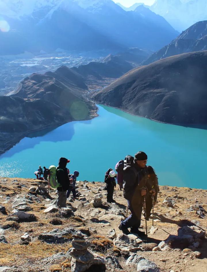
Days 10 and 11 are the first days that feel like a mountain. The forest is gone and so are the villages. Glacier Camp sits at 4,210m after about 6 hours. Dhaulagiri Base Camp is another 530m up, at 4,740m, about 7 hours further.
Other pages describe this stretch as walking on and beside the Chhonbardan glacier, a name spelled several ways, over loose moraine and boulders. One operator's page calls the day to Glacier Camp prone to stonefall. Two things follow. These are the days to keep your pace slow and your poles out. And you will not find a lodge at the end of either day, so the tent crew matters here more than anywhere else on the route.
French Pass, Hidden Valley and Dhampus Pass
French Pass is 5,360m, the highest point of the trek. On day 13 you climb 620m from Dhaulagiri Base Camp to the pass, then drop 160m to Hidden Valley at 5,200m. That makes Hidden Valley the highest bed on the whole table, and you are in a tent.
The valley is the one the French named in 1950. From inside it the mountain cannot be seen, which was the whole surprise for them. Our tour notes describe a flat glacial basin with no permanent structures, surrounded by unnamed peaks.
Day 14 is the long way down. From Hidden Valley you cross Dhampus Pass and descend to Yak Kharka at 3,680m, a drop of 1,520m in about 6 hours, the largest single-day drop on our table. Published heights for Dhampus Pass run from 5,200m to 5,280m depending on the map. The tour notes also mention yak pastures and rhododendron forest on the way, and apple orchards by the time you reach Marpha.
Acclimatization: where the rest days sit
Here is every sleeping height on the table, and what it rises by.
| Night | Place | Height | Rise from the night before |
|---|---|---|---|
| 6 | Dobang | 2,520m | 440m |
| 7 | Choriban Khola | 3,110m | 590m |
| 8 | Italian Base Camp | 3,660m | 550m |
| 9 | Italian Base Camp (rest) | 3,660m | 0m |
| 10 | Glacier Camp | 4,210m | 550m |
| 11 | Dhaulagiri Base Camp | 4,740m | 530m |
| 12 | Dhaulagiri Base Camp (rest) | 4,740m | 0m |
| 13 | Hidden Valley | 5,200m | 460m |
The Wilderness Medical Society guideline, as the US Centers for Disease Control quotes it in its Yellow Book (page dated 23 April 2025), is that sleeping altitude should rise by no more than 500m a night once above 3,000m, with an extra night for every 1,000m gained. The same page adds that these recommendations "can still be too fast for some travelers and too slow for others."
Four of our nights rise by more than 500m: 590m, 550m, 550m and 530m. The two rest nights sit at Italian Base Camp and Dhaulagiri Base Camp. From 3,000m to 5,200m the sleeping gain is 2,200m, and an extra night for every 1,000m comes to two, which is what the table has. Glacier Camp has no rest day after it. One operator's page says large steps are unavoidable because campsites are limited. That is the reason I would not send anyone here as a first high trek: the table asks your body to be already familiar with how it behaves above 4,000m. For how altitude sickness develops, see our altitude sickness guide for the Everest trek, which applies in Myagdi as well.
How hard it is, and who it suits
We grade it Challenging. The tour notes call it very demanding, and they ask for prior experience above 5,000m. The numbers behind that: 10 walking days of 5 to 7 hours, about 58 hours in all, two passes, five nights in tents, and the highest bed at 5,200m.
French Pass is 56m lower than Thorong La on the Annapurna Circuit. The hard part is staying high for days with no settlement to retreat to. Four nights in a row, from day 10 to day 13, are spent above 4,000m. Our Manaslu Circuit difficulty guide makes the same argument for a different valley, that isolation matters more than the number on the pass sign, and it holds here with tents added.
If you have never trekked above 4,000m, start smaller. Our guide to Nepal trekking for beginners lists the shorter treks that build the base this one assumes.
Remote means slow help
Our FAQ on this trek is blunt. Above Italian Base Camp there are no settlements and no teahouses. A helicopter evacuation is possible, and it takes longer to arrange than in the Annapurna or Everest regions.
The May 2026 Myagdi report says helicopters are used to reach base camp, so the machines do fly there. A 2017 post by an evacuation company describes a climber on Dhaulagiri hit by rockfall who was lifted from a lower camp after a satellite message, and says another climber caught in the same rockfall waited three days for pickup. That is mountaineering, a different activity from the trek. It shows how long a rescue on this mountain can take.
What you must arrange is insurance. Travel insurance is compulsory on our trek and it is not in the price. One operator's page advises cover to at least 5,500m that includes helicopter evacuation, which is a sensible test to apply to any policy.
Permits
The permits the trek needs are included in our price. The Annapurna Conservation Area permit is NPR 3,000 for foreigners, according to the National Trust for Nature Conservation permit page. Our Nepal trekking permits guide keeps the wider fee schedule.
When to go
October and November bring stable weather and clear passes. April and May are the secondary window. Our tour notes say the passes can close under snow in winter and are risky in the monsoon. One independent guide, published in September 2026, rates April and May excellent and October and November peak, tells readers to avoid December to February because of snow and blocked passes, and says July and August are monsoon. It adds that wind chill at base camps and passes can sit 15 to 20 degrees below the air temperature.
Our spring 2027 departure runs from 26 April to 13 May. For the wider picture across Nepal, see our guide to the best time to trek in Nepal.
What it costs
Our price is USD 2,475 per person. It covers airport transfers, three nights in a two or three star Kathmandu hotel with breakfast, full board on the trek, the tents and crew described above, the permits, the surface transfers and all government taxes and service charge. It leaves out lunch and dinner in Kathmandu and Pokhara, travel insurance, the Nepal visa, tips for the staff and driver, personal items such as drinks and laundry, and personal equipment.
On the pages I read, group packages for 15 to 17 day versions of this trek run from about USD 2,000 to about USD 3,500, and the same pages disagree on how many nights are in tents. Days, crew, hotel nights and group size move the number. Ask each quote how many nights it covers.
You pay nothing to reserve a place. A 30 percent deposit confirms it, and the refund is up to 100 percent if you cancel 45 or more days before departure, under our booking terms.
The Dhaulagiri, Annapurna and Manaslu circuits side by side
| Trek | Days | Highest point | Nights |
|---|---|---|---|
| Dhaulagiri Circuit | 18 | 5,360m | Tea house to Italian Base Camp, five nights in tents, tea house at Marpha |
| Annapurna Circuit | 16 | 5,416m | Tea houses on the trail |
| Manaslu Circuit | 15 | 5,106m | Tea houses on the trail |
Our Annapurna Circuit is USD 1,325, and our Annapurna Circuit cost breakdown prices it line by line. Our Manaslu Circuit is USD 1,675. The Dhaulagiri Circuit is USD 2,475, and that is the camping crew showing up in the price.
The Annapurna Circuit guide covers a trek with teahouses and villages throughout. The Manaslu Circuit guide covers the nearest match in spirit, a quiet circuit with one big pass. Dhaulagiri is the only one of the three with tents. Our own reading is that it is rougher and more isolated than the Annapurna Circuit or the Everest Three Passes trek, and our Three Passes guide shows what the busier side of that comparison looks like.
Who should book it
This trek suits you if you have been above 5,000m before, you are comfortable sleeping in a tent for five nights, and you can walk 5 to 7 hours a day for ten days. It does not suit a first-time trekker or anyone who wants a village at the end of every day.
If that sounds like you, the next step is the 18 day Dhaulagiri Circuit page, where you can see the dates and ask us about the route.
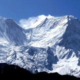
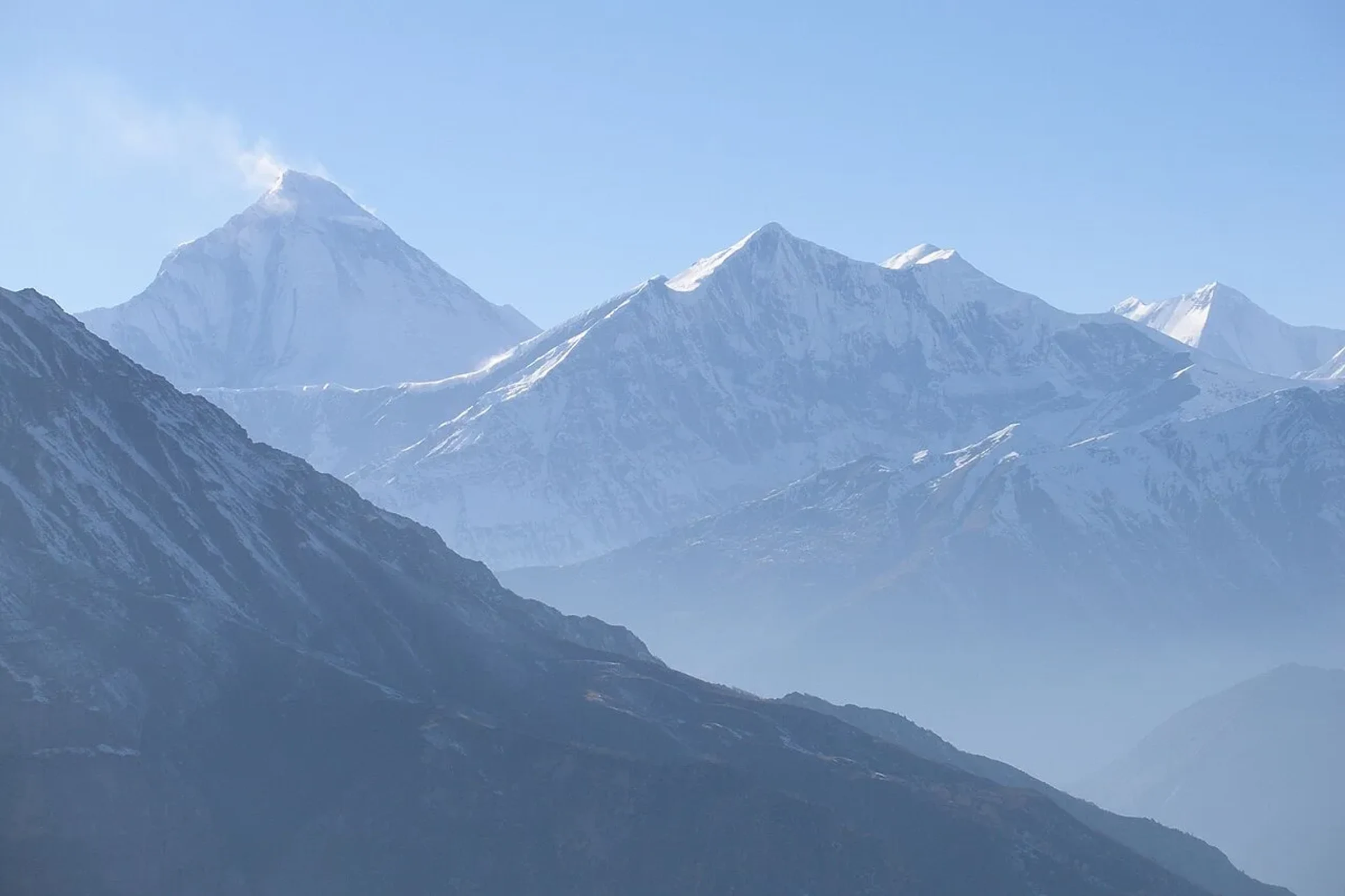
Cover photograph: Dhaulagiri I, Tukuche Peak and Dhaulagiri II seen from the Kali Gandaki side, by Vyacheslav Argenberg on Wikimedia Commons, licensed CC BY 2.0. It was not taken on the high route.
Frequently Asked Questions
Is the Dhaulagiri Circuit harder than the Annapurna Circuit?
Yes. Our tour notes call it rougher and more isolated. It has five nights in tents and two passes, against teahouses throughout on the Annapurna Circuit.
How many walking days are there?
Ten walking days of 5 to 7 hours, plus two rest days, inside an 18 day trip from Kathmandu to Kathmandu.
Are there teahouses at Dhaulagiri Base Camp?
No. The teahouse nights end at Italian Base Camp on days 8 and 9. Glacier Camp, Dhaulagiri Base Camp, Hidden Valley and Yak Kharka are tent nights, and the next tea house is Marpha on day 15.
What is Hidden Valley?
It is the highest bed on our table, at 5,200m, the night of day 13. French climbers named it in 1950, and the mountain cannot be seen from inside it.
Can I trek the Dhaulagiri Circuit in spring?
Yes. April and May are the secondary window after October and November, and we run a fixed departure in that window.
Do the permits cost extra?
No. They are included in the price. The Annapurna Conservation Area permit is NPR 3,000 for foreigners on the NTNC permit page.